Download
Preview
Add to list
More
398.3 km
~20 days
5618 m
Multi-Day
“Explore the Wiesengänger-Route: a historical trek through Bavarian vistas, blending culture, nature, and adventure.”
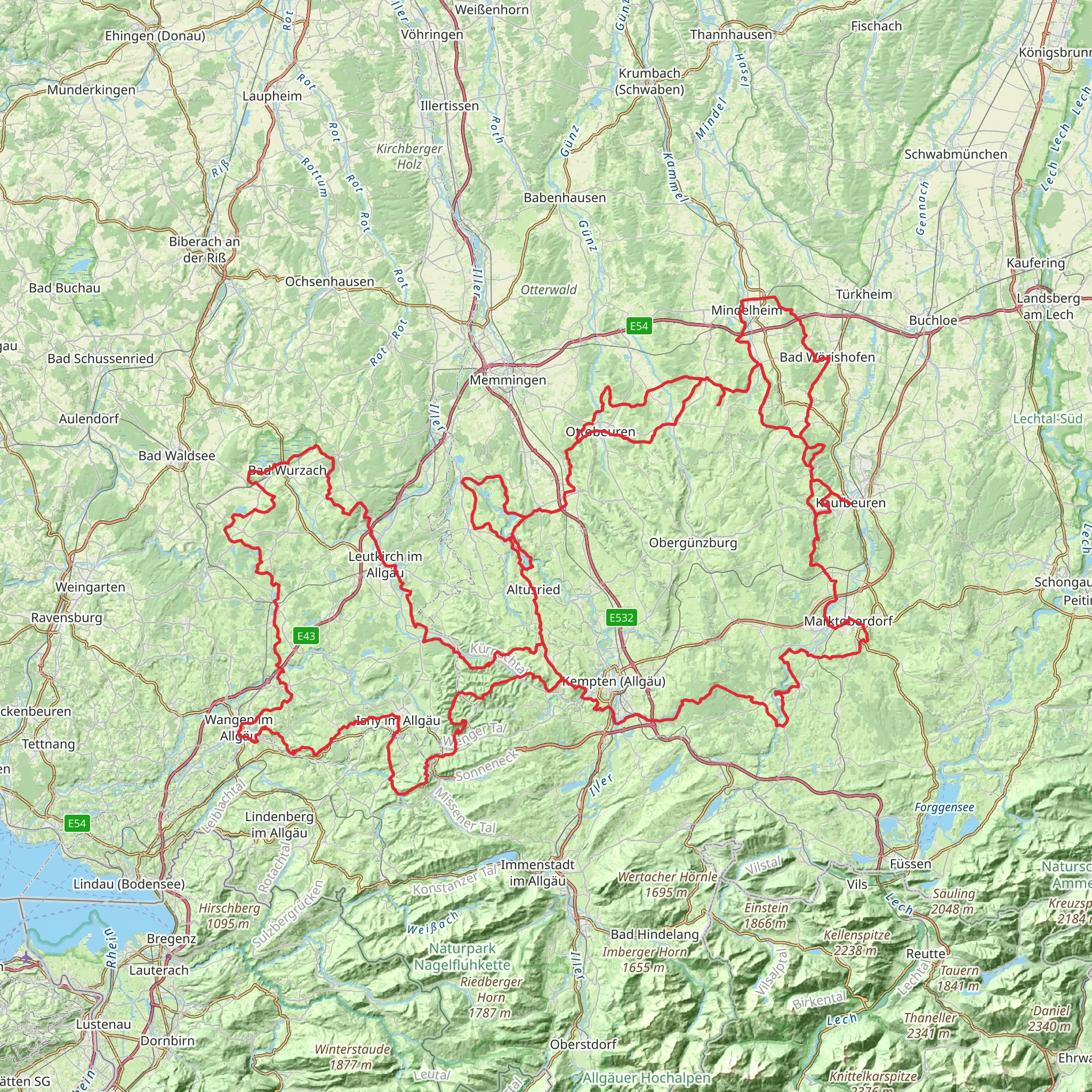
Embarking on the Wiesengänger-Route, hikers will traverse approximately 398 kilometers (about 247 miles) of varied landscapes, starting near the region of Ostallgäu in Germany. With an elevation gain of roughly 5600 meters (around 18,372 feet), this point-to-point trail offers a medium difficulty rating, presenting a rewarding challenge for those with some hiking experience.
Getting to the Trailhead
The journey begins near Ostallgäu, a picturesque area in the Bavarian Alps. To reach the starting point, hikers can fly into Munich Airport and take regional trains towards Füssen, with possible connections in Kaufbeuren or Buchloe. From Füssen, local buses serve the Ostallgäu area. For those driving, the trailhead is accessible via the A7 motorway, exiting towards Füssen and following signs to Ostallgäu.
Navigating the Trail
The Wiesengänger-Route is well-marked, but hikers should always carry a reliable navigation tool like HiiKER to ensure they stay on the correct path. The trail meanders through lush meadows, dense forests, and alpine terrain, offering a diverse hiking experience.
Landmarks and Nature
As hikers progress along the route, they will encounter a tapestry of natural and cultural landmarks. The trail passes through charming Bavarian villages where traditional architecture and customs are still alive. Notable historical sites include ancient castles and monasteries that dot the landscape, some dating back to medieval times.
The natural scenery is equally impressive, with panoramic views of the Alps, serene lakes, and the chance to witness a variety of wildlife. The region is home to red deer, chamois, and a plethora of bird species. The trail also crosses several nature reserves, where conservation efforts preserve the unique flora and fauna of the area.
Elevation and Terrain
The elevation gain is spread throughout the trail, with some sections more challenging than others. Hikers will encounter a mix of ascents and descents, with the steepest climbs found as the path winds through the alpine regions. Proper footwear and trekking poles are recommended to navigate these areas safely.
Historical Significance
The region is steeped in history, with the trail offering a glimpse into the past. The Bavarian Alps have been a pivotal location throughout European history, from Roman times through the Middle Ages and into modern history. Hikers will walk paths that were once trade routes and witness fortifications that served as defense mechanisms in bygone eras.
Preparation and Planning
Given the length and varied terrain of the Wiesengänger-Route, hikers should plan for multiple days of trekking and consider the necessary gear for overnight stays, whether in huts or camping where permitted. It's essential to check the weather forecast and trail conditions before setting out, as mountain weather can be unpredictable.
Conclusion
The Wiesengänger-Route is a journey through time and nature, offering an immersive experience in the Bavarian Alps. With its combination of natural beauty, historical sites, and cultural encounters, it's a trail that promises to leave lasting memories for those who walk its path.
Comments and Reviews
User comments, reviews and discussions about the Wiesengänger-Route, Germany.
4.5
average rating out of 5
8 rating(s)

