8.4 km
~1 hrs 51 min
109 m
“The DAV Gablonzer Rundwanderweg in Ostallgäu, Germany, offers lush landscapes and moderate hiking challenges.”
Starting near the picturesque region of Ostallgäu, Germany, the DAV Gablonzer Rundwanderweg is an 8 km (approximately 5 miles) loop trail with an elevation gain of around 100 meters (328 feet). This trail offers a medium difficulty rating, making it suitable for moderately experienced hikers looking for a rewarding day hike.### Getting There
To reach the trailhead, you can either drive or use public transport. If driving, set your GPS to the nearest significant landmark, which is the town of Füssen. From Füssen, follow the signs towards Ostallgäu. There is ample parking available near the trailhead. For those using public transport, take a train to Füssen and then a local bus towards Ostallgäu. The bus stops close to the trailhead, making it convenient for hikers.### Trail Navigation
For navigation, it is highly recommended to use the HiiKER app, which provides detailed maps and real-time updates. The trail is well-marked, but having a reliable navigation tool will ensure you stay on track.### Trail Highlights
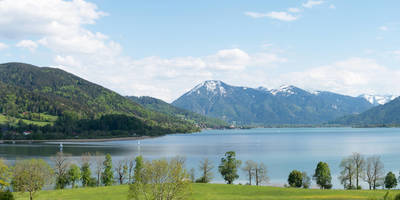
As you embark on the DAV Gablonzer Rundwanderweg, you'll be greeted by lush forests and rolling meadows. The trail meanders through a variety of landscapes, offering a mix of shaded woodland paths and open fields with panoramic views of the surrounding mountains.#### Significant Landmarks
- Gablonzer Hütte: About 3 km (1.86 miles) into the hike, you'll come across the Gablonzer Hütte, a charming mountain hut where you can take a break and enjoy some local Bavarian cuisine. The hut is a great spot to rest and take in the stunning alpine scenery.
- Alpine Meadows: Around the 5 km (3.1 miles) mark, the trail opens up into expansive alpine meadows. During the spring and summer months, these meadows are blanketed with wildflowers, making it a perfect spot for photography.
- Historical Sites: The region is steeped in history, and you'll pass by several old farmhouses and traditional Bavarian buildings. These structures offer a glimpse into the rural life of the past centuries.### Nature and Wildlife
The trail is home to a diverse range of flora and fauna. Keep an eye out for deer, foxes, and a variety of bird species. The forested sections are particularly rich in wildlife, so move quietly and you might spot some of the more elusive animals.### Elevation and Terrain
The elevation gain of 100 meters (328 feet) is spread out over the 8 km (5 miles), making the ascent gradual and manageable. The terrain varies from well-trodden paths to rocky sections, so sturdy hiking boots are recommended. There are a few steep sections, but they are short and interspersed with flatter areas where you can catch your breath.### Weather Considerations
Weather in the Ostallgäu region can be unpredictable, so it's wise to check the forecast before heading out. In the summer, temperatures can be warm, but the forested areas provide ample shade. In the winter, the trail can be icy and snow-covered, so appropriate gear is essential.### Final Tips
- Water and Snacks: Carry enough water and some high-energy snacks, especially if you plan to take your time and enjoy the scenery.
- Clothing: Dress in layers, as the weather can change rapidly. A waterproof jacket is advisable.
- Safety: Always let someone know your hiking plans and estimated return time.The DAV Gablonzer Rundwanderweg offers a delightful mix of natural beauty, historical landmarks, and moderate physical challenge, making it a must-visit for hikers in the Ostallgäu region.
Reviews
User comments, reviews and discussions about the DAV Gablonzer Rundwanderweg, Germany.
4.0
average rating out of 5
2 rating(s)
Loading reviews...


