12.1 km
~4 hrs 11 min
1057 m
“Embark on a captivating 12 km loop in Oberallgäu with stunning alpine views and rich history.”
Starting your adventure near Oberallgäu, Germany, the Sonnenkopf, Heidelbeerkopf, and Schnippenkopf Loop is a captivating 12 km (7.5 miles) journey with an elevation gain of approximately 1000 meters (3280 feet). This loop trail is rated medium in difficulty, making it suitable for moderately experienced hikers.### Getting There
To reach the trailhead, you can either drive or use public transport. If you're driving, set your GPS to the nearest known address in Oberallgäu. For those using public transport, take a train to the nearest station in Oberstdorf and then a local bus to the trailhead area. The bus services are frequent and well-connected, making it convenient for hikers.### Trail Overview
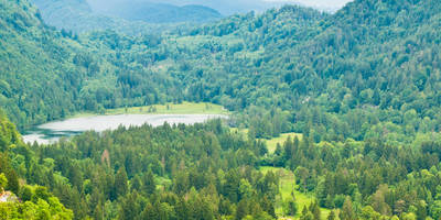
The loop begins with a gradual ascent through lush forests, where you’ll be greeted by the serene sounds of nature. As you climb, the trail opens up to panoramic views of the Allgäu Alps, offering a stunning backdrop for your hike.#### Sonnenkopf
At around 3 km (1.9 miles) into the hike, you’ll reach Sonnenkopf. This section involves a steep climb but rewards you with breathtaking views of the surrounding valleys and peaks. The elevation gain here is significant, so take your time and enjoy the scenery.#### Heidelbeerkopf
Continuing on, the trail leads you to Heidelbeerkopf, approximately 6 km (3.7 miles) from the start. This area is known for its rich flora, especially during the summer months when wild blueberries are abundant. Keep an eye out for local wildlife, including deer and various bird species.#### Schnippenkopf
The final peak, Schnippenkopf, is reached around the 9 km (5.6 miles) mark. This section of the trail is less steep but offers equally impressive views. The summit provides a perfect spot for a rest and a picnic, with panoramic vistas that stretch as far as the eye can see.### Historical Significance
The region around Oberallgäu has a rich history, with evidence of human settlement dating back to the Bronze Age. The trails you hike today were once used by local shepherds and traders. The area also played a role during World War II, with remnants of old bunkers and fortifications still visible in some parts.### Navigation and Safety
Given the elevation changes and varying terrain, it’s advisable to use a reliable navigation tool like HiiKER to keep track of your progress and ensure you stay on the correct path. The trail is well-marked, but weather conditions can change rapidly, so always be prepared with appropriate gear.### Flora and Fauna
The loop is a haven for nature enthusiasts. In spring and summer, the meadows are carpeted with wildflowers, while autumn brings a burst of color to the forests. Wildlife is abundant, so keep your camera ready for unexpected encounters with local fauna.### Final Stretch
The descent back to the trailhead is gradual, allowing you to soak in the final views of the majestic Allgäu Alps. The loop brings you full circle, ending where you began, near Oberallgäu.This trail offers a perfect blend of natural beauty, moderate challenge, and historical intrigue, making it a must-visit for any hiking enthusiast.
Reviews
User comments, reviews and discussions about the Sonnenkopf, Heidelbeerkopf and Schnippenkopf Loop, Germany.
4.0
average rating out of 5
5 rating(s)
Loading reviews...


