Schollang, Zimmerberg and Gaisalpe Loop via Wanderwegenetz Oberstdorf
Download
Preview
Add to list
More
9.2 km
~2 hrs 45 min
559 m
Loop
“Embark on a 9 km scenic hike blending natural beauty, historical intrigue, and moderate adventure in Oberallgäu.”
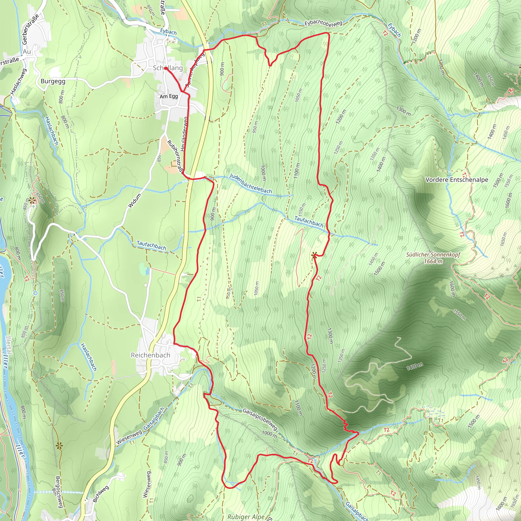
Starting your adventure near Oberallgäu, Germany, the Schollang, Zimmerberg, and Gaisalpe Loop via Wanderwegenetz Oberstdorf is a captivating 9 km (5.6 miles) loop trail with an elevation gain of approximately 500 meters (1,640 feet). This medium-difficulty hike offers a blend of natural beauty, historical significance, and a touch of adventure.### Getting There To reach the trailhead, you can either drive or use public transport. If driving, head towards Oberallgäu and look for parking near the village of Schollang. For those using public transport, take a train to Oberstdorf and then a local bus to Schollang. The nearest significant landmark is the Schollang Church, which is a good starting point for your hike.### Trail Overview The trail begins in the picturesque village of Schollang, known for its charming Bavarian architecture and serene atmosphere. As you start your ascent, you'll pass through lush meadows and dense forests, offering a peaceful escape from urban life. The initial part of the trail is relatively gentle, making it a good warm-up for the more challenging sections ahead.### Schollang to Zimmerberg Approximately 2 km (1.2 miles) into the hike, you'll reach the Zimmerberg area. This section offers stunning panoramic views of the Allgäu Alps. The elevation gain here is moderate, around 150 meters (492 feet), making it a great spot to take a short break and soak in the scenery. Keep an eye out for local wildlife such as deer and various bird species that inhabit this region.### Zimmerberg to Gaisalpe Continuing on, the trail becomes steeper as you head towards Gaisalpe. This section is about 3 km (1.9 miles) long with an elevation gain of approximately 200 meters (656 feet). The Gaisalpe area is rich in history, with remnants of old alpine huts and pastures that date back centuries. It's a fantastic place to explore and imagine the lives of the early settlers who once called this area home.### Gaisalpe to Schollang The final leg of the loop takes you back to Schollang, covering the remaining 4 km (2.5 miles) with a descent of about 150 meters (492 feet). This part of the trail is less strenuous, allowing you to enjoy the diverse flora and fauna. You'll pass through mixed forests and open fields, offering a variety of landscapes to appreciate.### Navigation and Safety For navigation, it's highly recommended to use the HiiKER app, which provides detailed maps and real-time updates. The trail is well-marked, but having a reliable navigation tool ensures you stay on track. Always carry sufficient water, snacks, and a first-aid kit. Weather in the Alps can be unpredictable, so check the forecast and dress in layers.### Points of Interest - Schollang Church: A beautiful example of Bavarian architecture and a great starting point. - Zimmerberg Viewpoint: Offers panoramic views of the Allgäu Alps. - Historical Alpine Huts in Gaisalpe: Explore the remnants of old alpine life.This trail offers a perfect blend of natural beauty, historical intrigue, and moderate physical challenge, making it an ideal choice for hikers looking to experience the best of the Oberallgäu region.
What to expect?
Activity types
Comments and Reviews
User comments, reviews and discussions about the Schollang, Zimmerberg and Gaisalpe Loop via Wanderwegenetz Oberstdorf, Germany.
4.5
average rating out of 5
2 rating(s)
