Birgsau to Mindelheimer Huette Via Alpina Red
9.7 km
~4 hrs 23 min
1464 m
“Embark on an enchanting 10 km hike from Birgsau to Mindelheimer Huette, revealing Bavarian Alps' natural and historical wonders.”
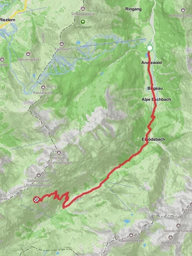
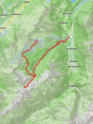
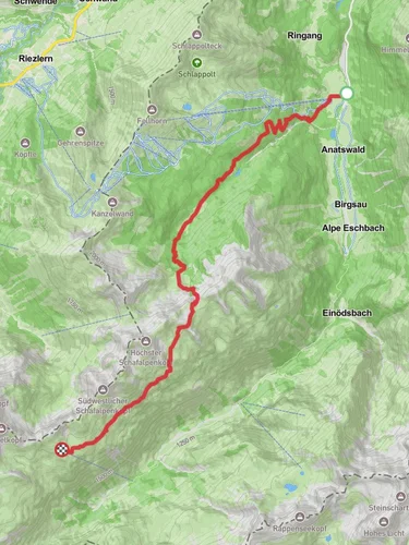
Starting near Oberallgäu, Germany, the trail from Birgsau to Mindelheimer Huette Via Alpina Red is a captivating journey through the Bavarian Alps. This point-to-point trail spans approximately 10 km (6.2 miles) with an elevation gain of around 1400 meters (4593 feet), making it a moderately challenging hike suitable for those with a good level of fitness.
### Getting There To reach the trailhead near Oberallgäu, you can either drive or use public transport. If driving, head towards Birgsau, a small hamlet located near Oberstdorf. For those using public transport, take a train to Oberstdorf, which is well-connected to major cities in Germany. From Oberstdorf, a local bus service can take you directly to Birgsau.
### Trail Overview The trail begins in the picturesque village of Birgsau, nestled in the Allgäu Alps. As you start your ascent, you'll be greeted by lush meadows and dense forests. The initial part of the trail is relatively gentle, allowing you to warm up before the steeper sections begin.
### Significant Landmarks and Nature Around the 3 km (1.9 miles) mark, you'll encounter the Breitachklamm, a stunning gorge carved by the Breitach River. This natural wonder is a highlight of the trail, with its dramatic rock formations and cascading waterfalls. Be sure to take a moment to appreciate the sheer beauty of this geological marvel.
Continuing on, the trail becomes steeper and more rugged. At approximately 5 km (3.1 miles), you'll reach the Rappensee Hut, a popular resting spot for hikers. Here, you can take a break, enjoy some refreshments, and soak in the panoramic views of the surrounding peaks.
### Wildlife and Flora The trail is home to a diverse range of flora and fauna. Keep an eye out for alpine flowers such as edelweiss and gentian, which bloom in the summer months. Wildlife enthusiasts may spot chamois, marmots, and even golden eagles soaring above.
### Historical Significance The region has a rich history, with evidence of human settlement dating back to the Bronze Age. The trail itself is part of the Via Alpina Red, a network of long-distance hiking trails that traverse the Alps from Slovenia to Monaco. This historic route has been used by traders, pilgrims, and adventurers for centuries.
### Final Ascent to Mindelheimer Huette The final stretch of the trail involves a steep ascent to the Mindelheimer Huette. This section can be challenging, with rocky terrain and narrow paths. However, the effort is well worth it. Upon reaching the hut, located at an elevation of 2013 meters (6604 feet), you'll be rewarded with breathtaking views of the surrounding peaks and valleys.
### Navigation and Safety Given the trail's elevation gain and varying terrain, it's essential to be well-prepared. Use the HiiKER app for accurate navigation and real-time updates on trail conditions. Ensure you have appropriate hiking gear, including sturdy boots, weather-appropriate clothing, and sufficient water and snacks.
This trail offers a perfect blend of natural beauty, historical significance, and physical challenge, making it a must-do for any avid hiker exploring the Bavarian Alps.
Reviews
User comments, reviews and discussions about the Birgsau to Mindelheimer Huette Via Alpina Red, Germany.
0.0
average rating out of 5
0 rating(s)


