18.1 km
~1 day 0 hrs
1204 m
Download
Preview
Add to list
More
“Embark on a breathtaking alpine adventure through lush meadows, historical paths, and sweeping mountain vistas.”
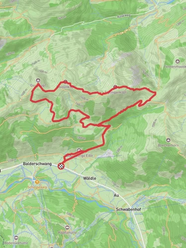
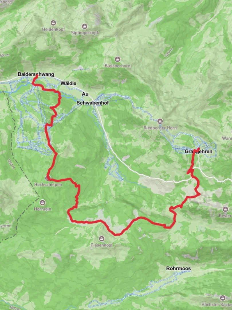
Nestled in the picturesque region of Oberallgäu, Germany, this trail offers a challenging yet rewarding journey through the Bavarian Alps. The trail stretches approximately 18 kilometers (about 11 miles) with an elevation gain of around 1200 meters (approximately 3937 feet), making it a demanding trek suitable for experienced hikers. The trail is point-to-point, beginning near Balderschwang and concluding at the Grasgehrenhütte.
Getting There
To reach the trailhead, travelers can opt for public transport or drive. If using public transport, the nearest major town is Oberstdorf, which is well-connected by train. From Oberstdorf, buses run to Balderschwang, where the trail begins. For those driving, Balderschwang is accessible via the B308 road, with parking available near the trailhead.
Trail Highlights
Scenic Landscapes
The trail offers breathtaking views of the Allgäu Alps, with lush green meadows and dense forests providing a stunning backdrop. As you ascend, the landscape transforms, offering panoramic vistas of the surrounding peaks and valleys. The trail is particularly beautiful in late spring and early summer when wildflowers are in full bloom.
Flora and Fauna
Hikers will encounter a diverse range of flora and fauna. The region is home to various alpine plants, including edelweiss and gentians. Wildlife enthusiasts may spot chamois, marmots, and a variety of bird species, such as golden eagles and alpine choughs.
Historical Significance
The area around Balderschwang has a rich history, with settlements dating back to the Roman era. The trail itself passes through regions that were historically used for transhumance, the seasonal movement of livestock, which has shaped the cultural landscape of the area.
Trail Navigation
The trail is well-marked, but due to its difficulty, it is advisable to use a reliable navigation tool like HiiKER to ensure you stay on track. The path includes steep ascents and descents, with some sections requiring careful footing, especially in wet conditions.
Key Landmarks
- Balderschwang: The starting point of the trail, this charming village is known for its traditional Bavarian architecture and hospitality.
- Riedberger Horn: Approximately halfway through the hike, this peak offers a perfect spot for a rest and to take in the sweeping views of the Allgäu Alps.
- Grasgehrenhütte: The endpoint of the trail, this mountain hut provides a cozy place to relax and enjoy a well-deserved meal. It is a popular spot for hikers and skiers alike.
Preparation Tips
Given the trail's difficulty, proper preparation is essential. Hikers should wear sturdy hiking boots and bring layers to accommodate changing weather conditions. It's also important to carry enough water and snacks, as there are limited facilities along the route. Checking the weather forecast before setting out is crucial, as conditions in the mountains can change rapidly.
This trail promises an unforgettable adventure through one of Germany's most beautiful alpine regions, offering both physical challenge and the opportunity to connect with nature and history.

Reviews
User comments, reviews and discussions about the Balderschwang to Grasgehrenhutte Walk, Germany.
0.0
average rating out of 5
0 rating(s)