11.4 km
~2 hrs 46 min
299 m
“Experience the perfect blend of natural beauty, history, and moderate challenge on the Schlader Weg and Breitenbruch Loop.”
Starting near Märkischer Kreis, Germany, the Schlader Weg and Breitenbruch Loop is a scenic 11 km (approximately 6.8 miles) loop trail with an elevation gain of around 200 meters (656 feet). This medium-difficulty trail offers a delightful mix of natural beauty, historical landmarks, and diverse wildlife, making it a rewarding experience for hikers.
### Getting There To reach the trailhead, you can drive or use public transport. If driving, set your GPS to Märkischer Kreis, Germany, and look for parking options near the trailhead. For those using public transport, the nearest significant landmark is the town of Iserlohn. From Iserlohn, you can take a local bus or taxi to the trailhead.
### Trail Overview The trail begins with a gentle ascent through a dense forest, where you'll be surrounded by towering trees and the soothing sounds of nature. The initial 2 km (1.2 miles) are relatively easy, allowing you to warm up and enjoy the serene environment. As you continue, the trail becomes steeper, gaining elevation more rapidly over the next 3 km (1.9 miles).
### Historical Significance Around the 5 km (3.1 miles) mark, you'll come across remnants of old fortifications and historical markers that date back to medieval times. This region has a rich history, having been a strategic location during various historical conflicts. Take a moment to appreciate the historical significance and imagine the events that once took place here.
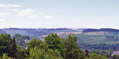
### Nature and Wildlife The trail is home to a variety of flora and fauna. Keep an eye out for deer, foxes, and a wide range of bird species. The forest is particularly vibrant in spring and autumn, with wildflowers blooming and leaves changing color. Around the 7 km (4.3 miles) point, you'll find a small clearing with a picturesque view of the surrounding hills and valleys.
### Navigation and Safety The trail is well-marked, but it's always a good idea to have a reliable navigation tool. HiiKER is an excellent app for this purpose, providing detailed maps and real-time updates. Ensure you have adequate water, snacks, and appropriate clothing, as weather conditions can change rapidly.
### Final Stretch The last 4 km (2.5 miles) of the trail are a mix of gentle descents and flat sections, allowing you to cool down as you make your way back to the starting point. Along this stretch, you'll pass through open meadows and small streams, offering a peaceful end to your hike.
This trail offers a perfect blend of natural beauty, historical intrigue, and moderate physical challenge, making it a must-visit for any hiking enthusiast.
Reviews
User comments, reviews and discussions about the Schlader Weg and Breitenbruch Loop, Germany.
0.0
average rating out of 5
0 rating(s)


