11.1 km
~3 hrs 14 min
608 m
“Discover the Steinbühler Gesenke Walk: an 11 km trail blending natural beauty, history, and moderate adventure.”
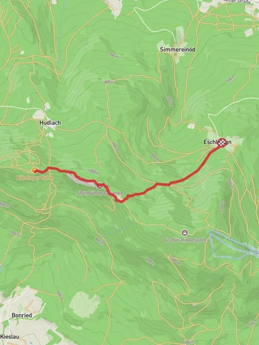
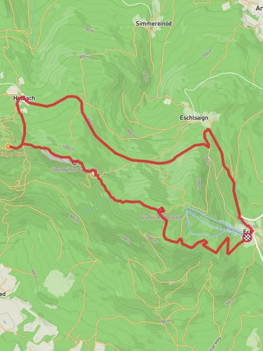
Starting near Cham, Germany, the Steinbühler Gesenke Walk from Arrach is an 11 km (approximately 6.8 miles) out-and-back trail with an elevation gain of around 600 meters (about 1,970 feet). This medium-difficulty hike offers a blend of natural beauty, historical significance, and a moderate challenge suitable for most hikers.
### Getting There To reach the trailhead, you can either drive or use public transport. If driving, head towards Arrach, which is easily accessible from Cham. For those using public transport, take a train or bus to Cham and then a local bus to Arrach. The trailhead is conveniently located near the town center, making it easy to find.
### Trail Overview The trail begins with a gentle ascent through lush forests, offering a serene start to your hike. As you progress, the path becomes steeper, leading you through a mix of deciduous and coniferous trees. The forest is home to a variety of wildlife, including deer, foxes, and numerous bird species, so keep your eyes peeled for these natural inhabitants.
### Significant Landmarks At around the 3 km (1.9 miles) mark, you'll come across the first significant landmark, the Steinbühler Gesenke rock formations. These impressive geological structures are a highlight of the trail, offering a glimpse into the region's ancient past. The rocks are believed to have formed millions of years ago and provide a fascinating contrast to the surrounding greenery.
Continuing on, the trail leads you to a scenic viewpoint at approximately 5.5 km (3.4 miles). Here, you can take a break and enjoy panoramic views of the Bavarian Forest and the distant Bohemian Forest. This spot is perfect for photography and a well-deserved rest before you begin your descent.
### Historical Significance The region around Cham and Arrach has a rich history dating back to medieval times. The trail itself passes near several historical sites, including remnants of old trade routes and ancient boundary markers. These markers were used to delineate territories and are a testament to the area's historical importance as a crossroads of cultures and commerce.
### Navigation and Safety Given the moderate difficulty of the trail, it's advisable to use a reliable navigation tool like HiiKER to ensure you stay on track. The trail is well-marked, but having a digital map can provide additional peace of mind. Wear sturdy hiking boots, as the terrain can be uneven and rocky in places. Also, bring sufficient water and snacks, especially if you plan to take your time exploring the various landmarks.
### Flora and Fauna The trail is a haven for nature enthusiasts. In spring and summer, the forest floor is carpeted with wildflowers, including species like wood anemones and wild garlic. The diverse plant life supports a rich ecosystem, making it a great spot for birdwatching. You might spot woodpeckers, owls, and even the occasional eagle soaring above.
### Final Stretch As you make your way back, the descent offers a different perspective of the landscape, with the changing light creating a magical atmosphere in the forest. The return journey allows you to revisit the landmarks from a new angle, providing a comprehensive experience of the trail's natural and historical beauty.
This hike is a rewarding adventure that combines physical challenge with the opportunity to immerse yourself in the natural and historical richness of the Bavarian Forest.
Reviews
User comments, reviews and discussions about the Steinbühler Gesenke Walk from Arrach, Germany.
0.0
average rating out of 5
0 rating(s)


