Cotswold Round trail stages
stage 1
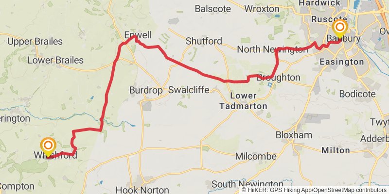
Starting at: Cherwell, Oxfordshire, OX16 9RS
Distance: 22.1 km
Elevation gain: 354 m
Duration: 05:00:40
stage 2
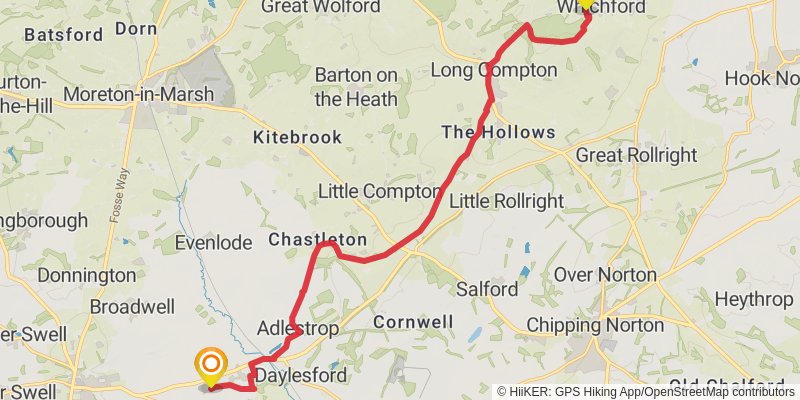
Starting at: Whichford, Stratford-on-Avon, Warwickshire, CV36 5PH
Distance: 16.4 km
Elevation gain: 279 m
Duration: 03:44:41
stage 3
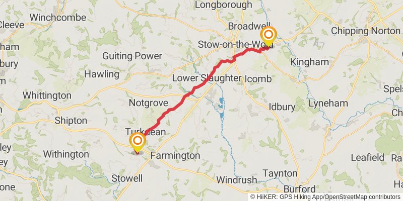
Starting at: Upper Oddington, Cotswold, Gloucestershire, GL56 0XH
Ending at: Cotswold, Gloucestershire, GL54 3NW
Distance: 18.8 km
Elevation gain: 389 m
Duration: 04:24:50
stage 4
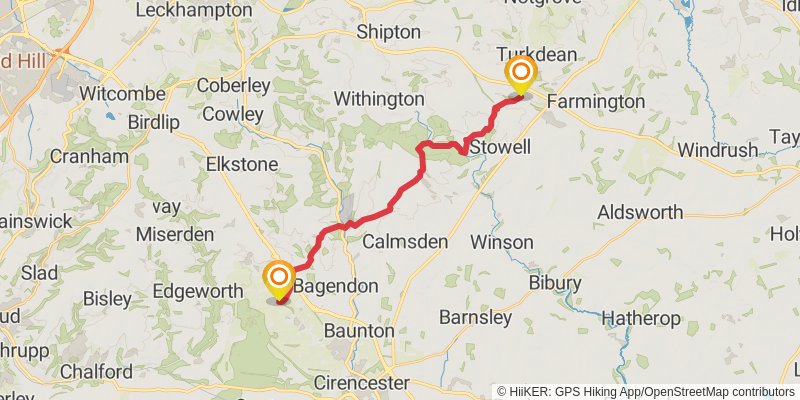
Starting at: Hampnett, Cotswold, Gloucestershire, GL54 3NW
Distance: 19.3 km
Elevation gain: 399 m
Duration: 04:31:45
stage 5
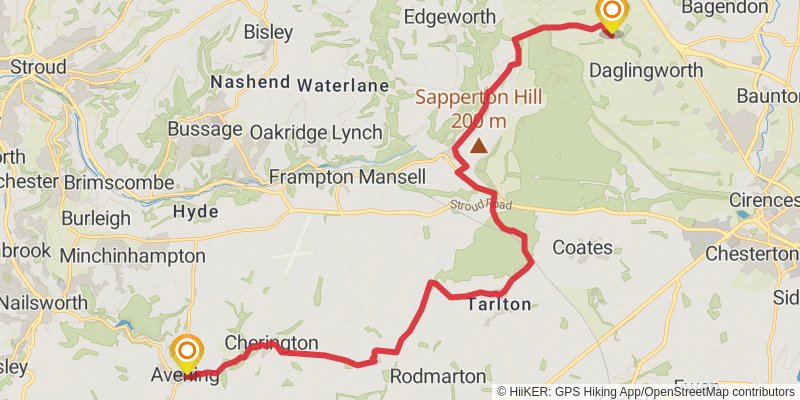
Ending at: Cotswold, Gloucestershire, GL8 8NT
Distance: 20.4 km
Elevation gain: 244 m
Duration: 04:29:08
stage 6
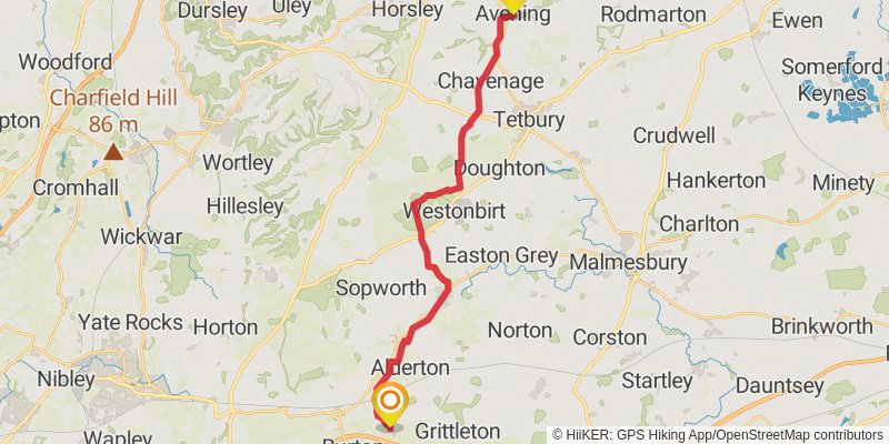
Starting at: Avening, Cotswold, Gloucestershire, GL8 8LU
Distance: 22.8 km
Elevation gain: 243 m
Duration: 04:58:10
stage 7
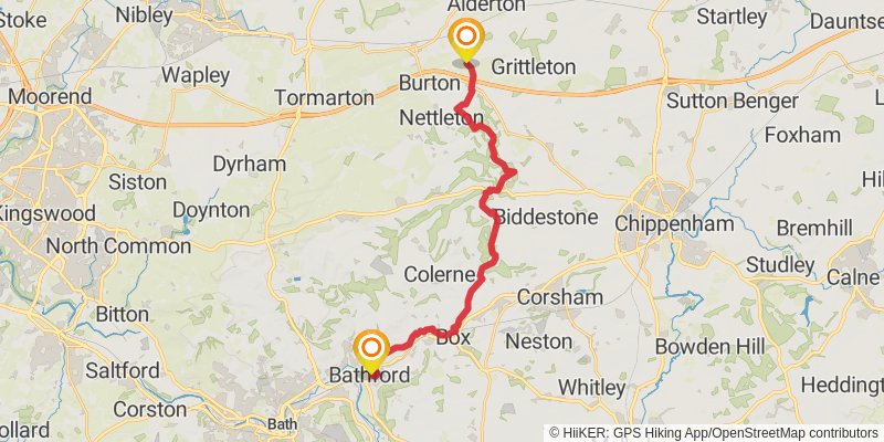
Starting at: Littleton Drew, Wiltshire, SN14 7NB
Distance: 21.5 km
Elevation gain: 364 m
Duration: 04:53:52
stage 8
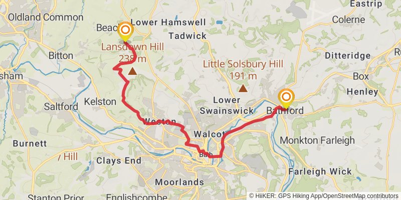
Starting at: Bathford, Bath and North East Somerset, BA1 7SL
Ending at: Beach, South Gloucestershire, BS30 5RP
Distance: 15.7 km
Elevation gain: 402 m
Duration: 03:48:40
stage 9
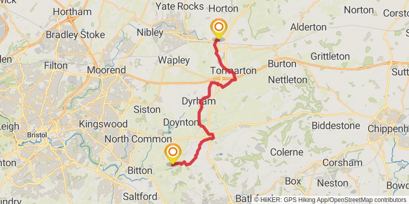
Starting at: Beach, South Gloucestershire, BS30 5RP
Distance: 20.6 km
Elevation gain: 387 m
Duration: 04:45:51
stage 10
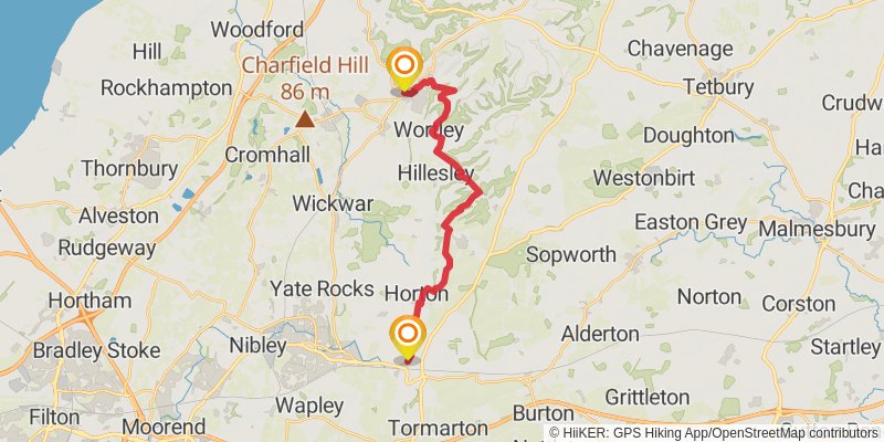
Starting at: Old Sodbury, South Gloucestershire, BS37 6NB
Ending at: Wotton-under-Edge, Gloucestershire, GL12 7DE
Distance: 19.1 km
Elevation gain: 442 m
Duration: 04:33:41
stage 11
stage 12
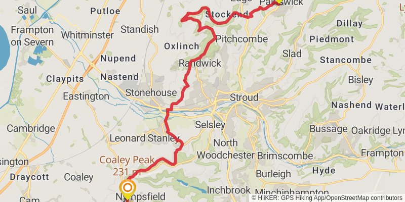
Starting at: Nympsfield, Gloucestershire, GL11 5AU
Distance: 20.4 km
Elevation gain: 603 m
Duration: 05:05:28
stage 13
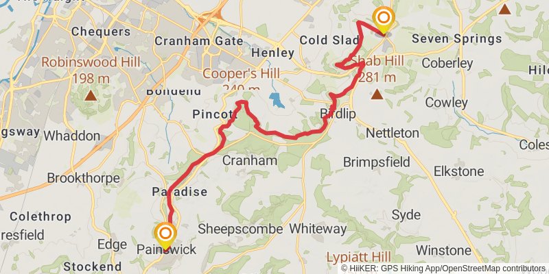
Starting at: Ham Butts, Gloucestershire, GL6 6UN
Ending at: Cotswold, Gloucestershire, GL53 9QS
Distance: 18.1 km
Elevation gain: 610 m
Duration: 04:38:48
stage 14
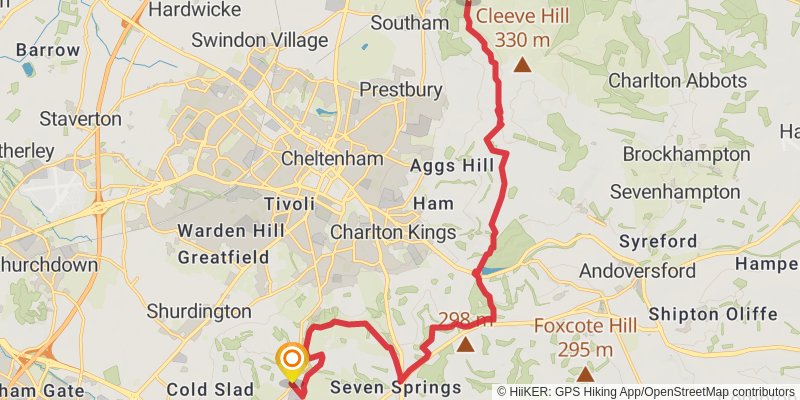
Starting at: Cotswold, Gloucestershire, GL53 9QS
Distance: 18.3 km
Elevation gain: 535 m
Duration: 04:33:14
stage 15
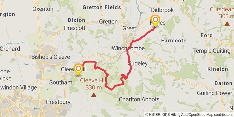
Starting at: Cleeve Hill, Gloucestershire, GL52 3PR
Distance: 14.4 km
Elevation gain: 261 m
Duration: 03:18:26
stage 16
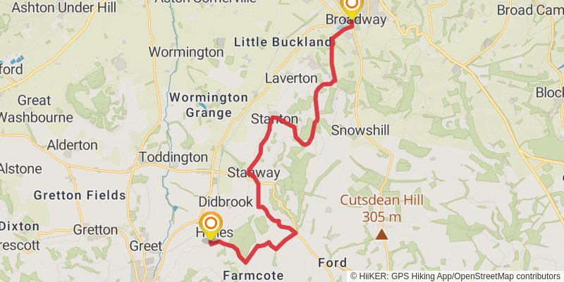
Starting at: Hailes, Gloucestershire, GL54 5PB
Ending at: Wychavon, Worcestershire, WR12 7AE
Distance: 16.1 km
Elevation gain: 437 m
Duration: 03:56:40
stage 17
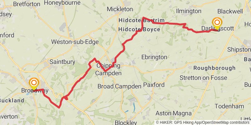
Starting at: Broadway, Wychavon, Worcestershire, WR12 7AA
Distance: 21.5 km
Elevation gain: 443 m
Duration: 05:02:29
stage 18
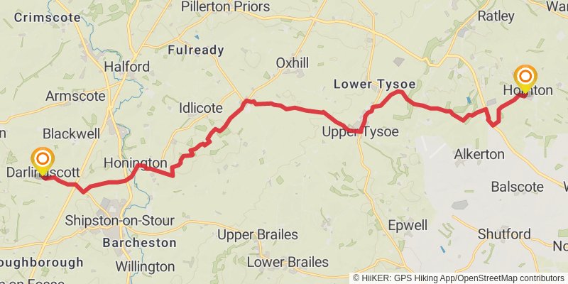
Ending at: Dun Cow, Cherwell, Oxfordshire, OX15 6BY
Distance: 21.0 km
Elevation gain: 331 m
Duration: 04:45:20
stage 19
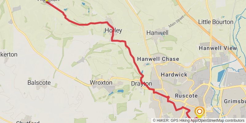
Starting at: Hornton, Cherwell, Oxfordshire, OX15 6BZ
Distance: 9.4 km
Elevation gain: 109 m
Duration: 02:03:20