St Bernard's Way trail stages
stage 1
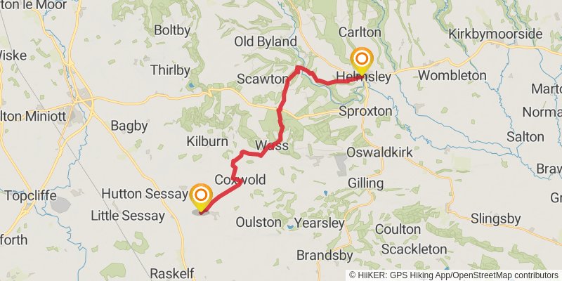
Starting at: Ryedale, North Yorkshire, YO62 5AQ
Distance: 19.3 km
Elevation gain: 372 m
Duration: 04:29:00
stage 2
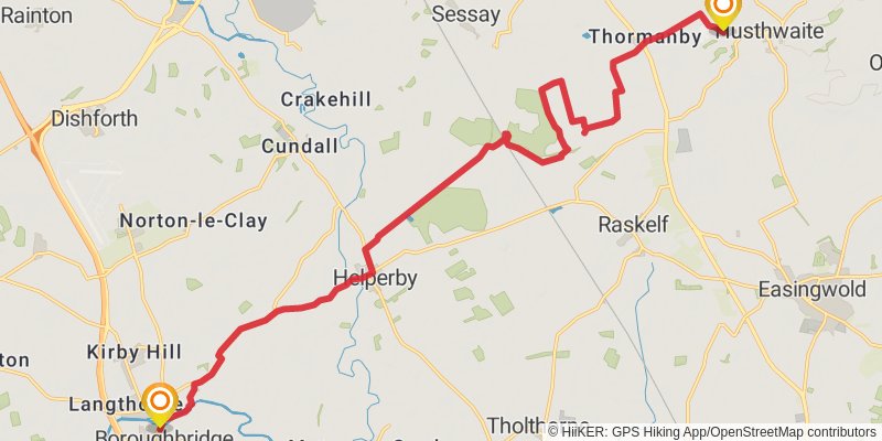
Starting at: Husthwaite, York, North Yorkshire, YO61 4PW
Distance: 20.1 km
Elevation gain: 98 m
Duration: 04:11:14
stage 3
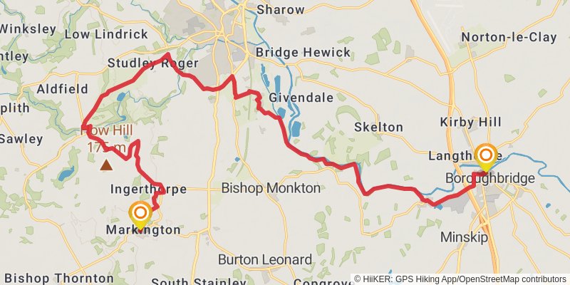
Starting at: Aldborough, North Yorkshire, YO51 9YU
Ending at: Markington, North Yorkshire, HG3 3NX
Distance: 25.0 km
Elevation gain: 279 m
Duration: 05:27:32
stage 4
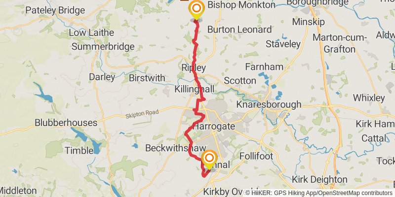
Starting at: Markington, North Yorkshire, HG3 3NS
Ending at: Burn Bridge, North Yorkshire, HG3 1LZ
Distance: 20.4 km
Elevation gain: 340 m
Duration: 04:38:23
stage 5
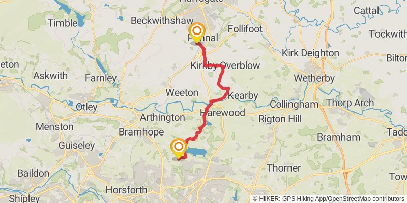
Starting at: Burn Bridge, North Yorkshire, HG3 1LZ
Ending at: Leeds, Leeds, LS17 5PS
Distance: 17.0 km
Elevation gain: 304 m
Duration: 03:54:59
stage 6
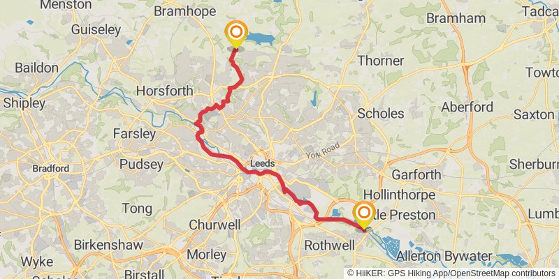
Starting at: Leeds, Leeds, LS17 5PS
Ending at: Leeds, Leeds, LS26 8PL
Distance: 24.1 km
Elevation gain: 176 m
Duration: 05:06:30
stage 7
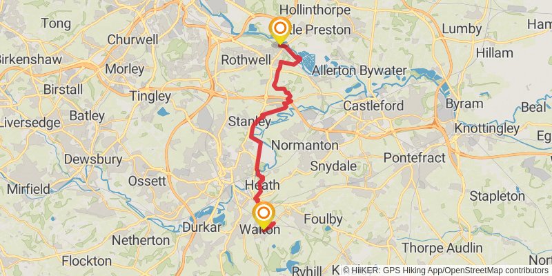
Starting at: Woodlesford, Leeds, Leeds, LS26 8PL
Ending at: Wakefield, Wakefield, WF2 6LF
Distance: 20.0 km
Elevation gain: 187 m
Duration: 04:18:17
stage 8
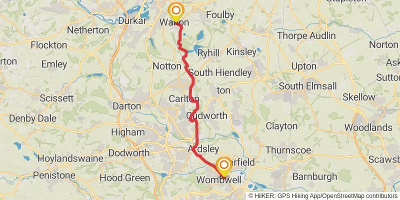
Starting at: Walton, Wakefield, Wakefield, WF2 6LF
Ending at: Wombwell, Wombwell, S73 8HL
Distance: 19.4 km
Elevation gain: 179 m
Duration: 04:10:53
stage 9
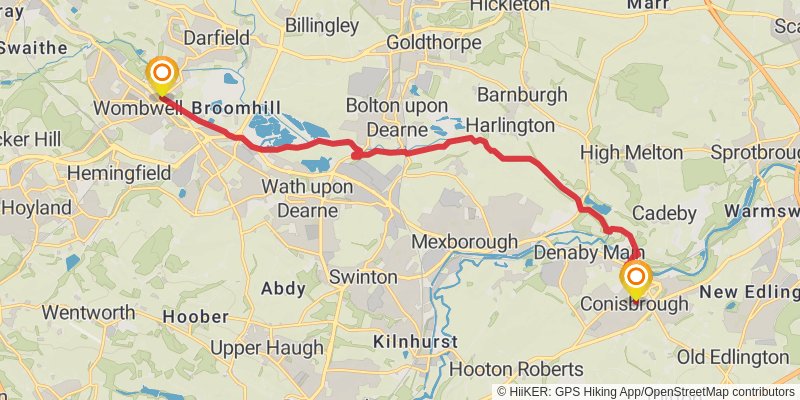
stage 10
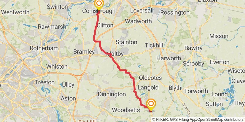
Starting at: Doncaster, Doncaster, DN12 3JL
Ending at: Bassetlaw, Nottinghamshire, S81 9EF
Distance: 22.4 km
Elevation gain: 251 m
Duration: 04:53:49
stage 11
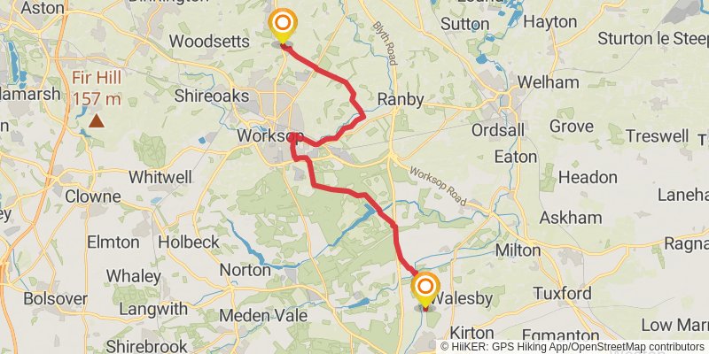
Distance: 24.0 km
Elevation gain: 245 m
Duration: 05:12:48
stage 12
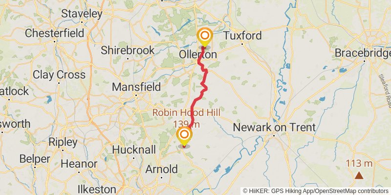
Distance: 24.6 km
Elevation gain: 255 m
Duration: 05:20:27
stage 13
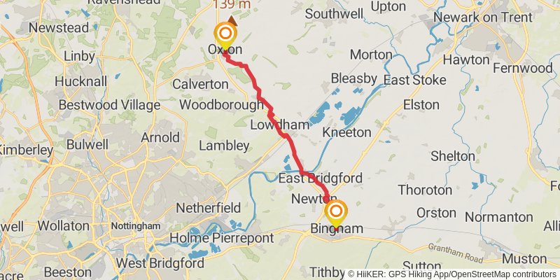
Ending at: Birds, Rushcliffe, Nottinghamshire, NG13 8AR
Distance: 17.0 km
Elevation gain: 169 m
Duration: 03:41:01
stage 14
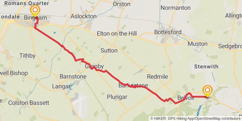
Starting at: Rushcliffe, Nottinghamshire, NG13 8AR
Ending at: South Kesteven, Lincolnshire, NG32 1LZ
Distance: 18.4 km
Elevation gain: 181 m
Duration: 03:58:24
stage 15
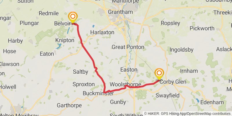
Ending at: South Kesteven, Lincolnshire, NG33 4JW
Distance: 23.2 km
Elevation gain: 250 m
Duration: 05:03:56
stage 16
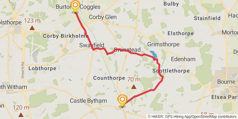
Distance: 15.3 km
Elevation gain: 199 m
Duration: 03:23:27
stage 17
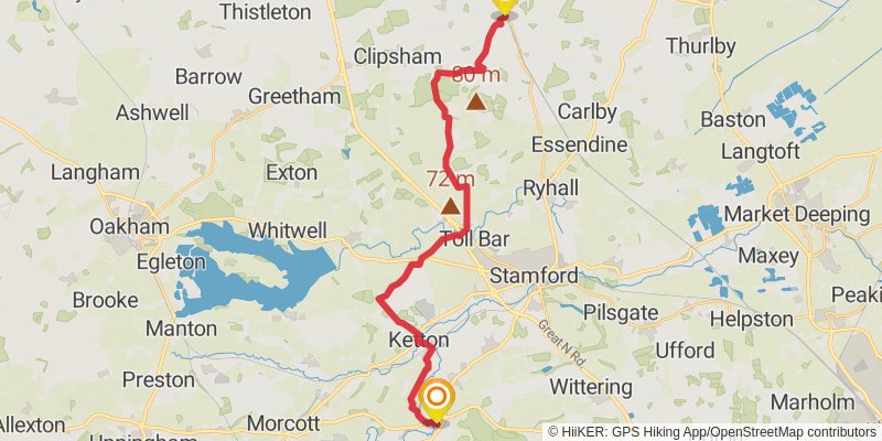
Ending at: Duddington, North Northamptonshire, PE9 3QQ
Distance: 25.6 km
Elevation gain: 288 m
Duration: 05:35:54
stage 18
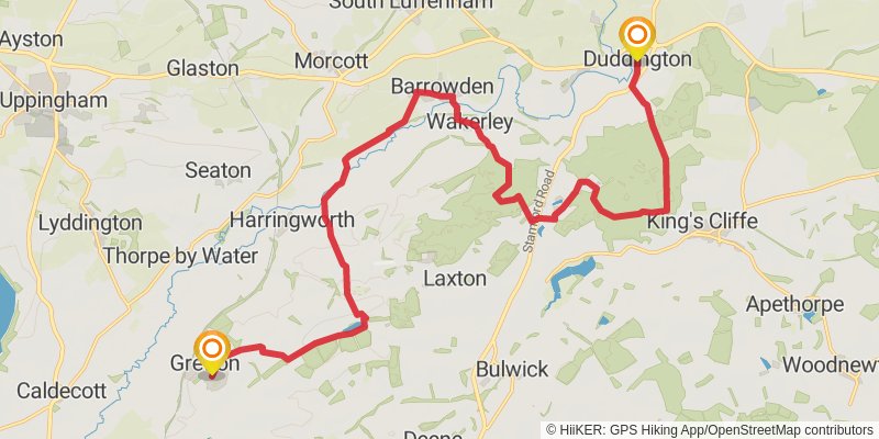
Starting at: Duddington, North Northamptonshire, PE9 3QQ
Distance: 22.4 km
Elevation gain: 317 m
Duration: 05:00:35
stage 19
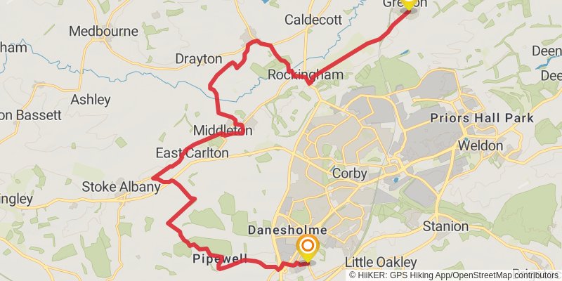
Starting at: North Northamptonshire, NN17 3EF
Ending at: Corby, North Northamptonshire, NN18 8JT
Distance: 24.4 km
Elevation gain: 277 m
Duration: 05:20:14
stage 20
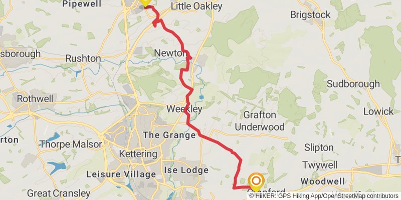
Starting at: Great Oakley, North Northamptonshire, NN18 8JT
Distance: 14.2 km
Elevation gain: 137 m
Duration: 03:04:29
stage 21
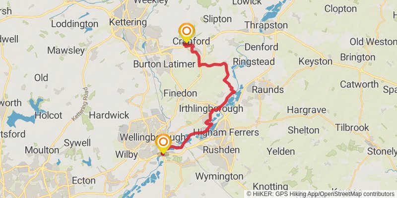
Starting at: Duck End Farm, North Northamptonshire, NN14 4QH
Distance: 21.9 km
Elevation gain: 164 m
Duration: 04:39:06
stage 22
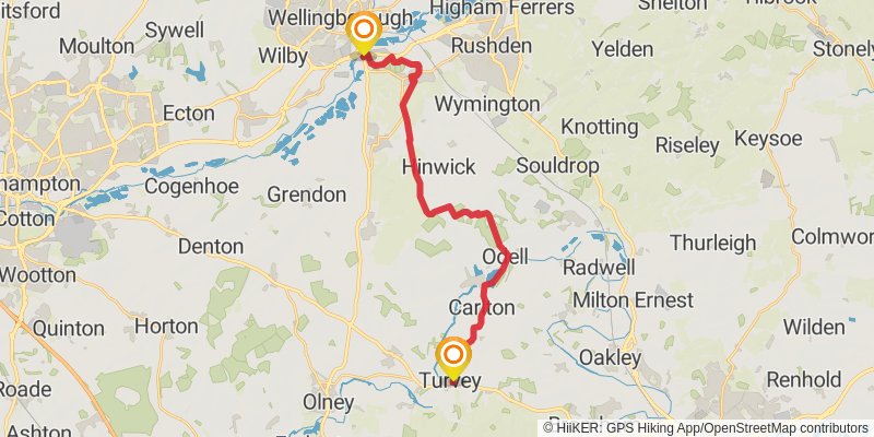
Starting at: Little Irchester, North Northamptonshire, NN8 2EA
Ending at: Turvey, Bedford, MK43 8DB
Distance: 21.9 km
Elevation gain: 186 m
Duration: 04:41:48
stage 23
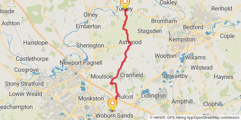
stage 24
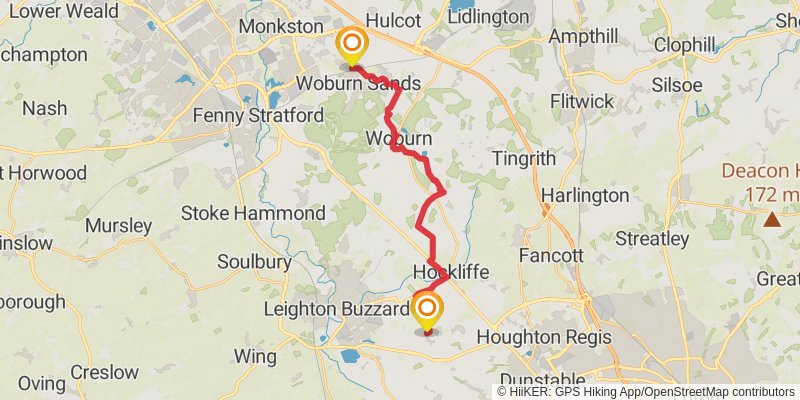
Starting at: City of Milton Keynes, MK17 8UT
Ending at: Stanbridge, Central Bedfordshire, LU7 9HT
Distance: 19.4 km
Elevation gain: 247 m
Duration: 04:17:43
stage 25
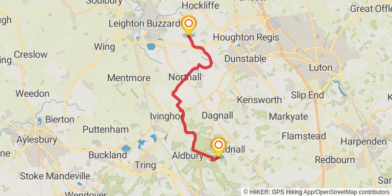
Starting at: Stanbridge, Central Bedfordshire, LU7 9HT
Ending at: Dacorum, Hertfordshire, HP4 1PL
Distance: 19.8 km
Elevation gain: 302 m
Duration: 04:27:32
stage 26
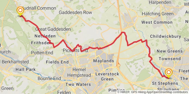
Starting at: Little Gaddesden, Dacorum, Hertfordshire, HP4 1PL
Ending at: St Albans, Hertfordshire, AL1 1HR
Distance: 24.4 km
Elevation gain: 243 m
Duration: 05:17:24
stage 27
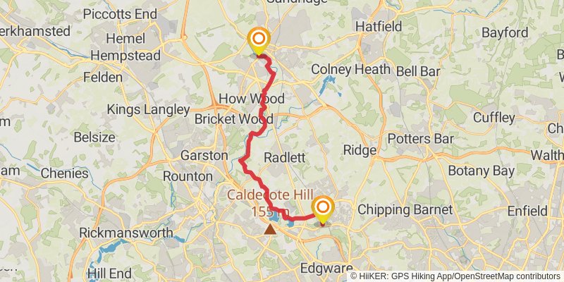
Starting at: St Albans, Hertfordshire, AL1 1HR
Distance: 19.3 km
Elevation gain: 208 m
Duration: 04:12:15
stage 28
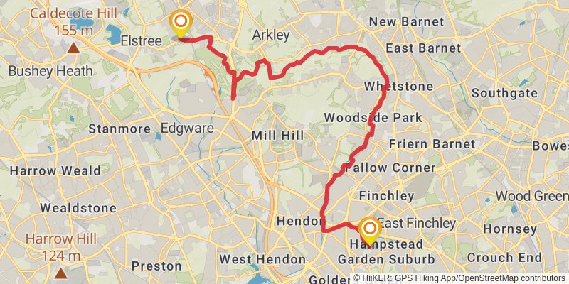
Starting at: Hertsmere, Hertfordshire, WD6 3JF
Ending at: London, London, N3 3JD
Distance: 20.3 km
Elevation gain: 200 m
Duration: 04:23:58
stage 29
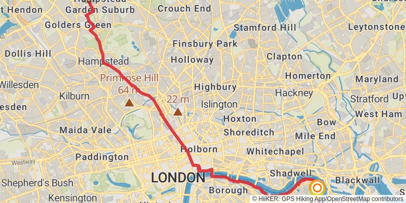
Starting at: London, London, NW11 6PB
Ending at: London, London, SE16 5UW
Distance: 19.3 km
Elevation gain: 204 m
Duration: 04:11:59
stage 30
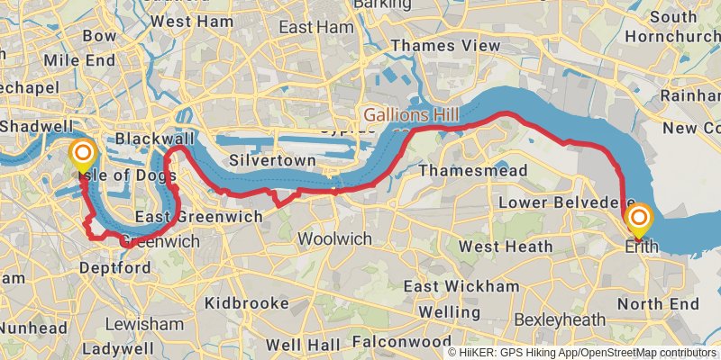
Starting at: London, London, SE16 7LX
Ending at: Riverside Gardens, London, London, DA8 1FE
Distance: 25.0 km
Elevation gain: 193 m
Duration: 05:19:25