17.8 km
~4 hrs 47 min
742 m
“Embark on the Quakey Mountain West Loop Trail for a historic, wildlife-rich hike amid Colorado's stunning peaks.”
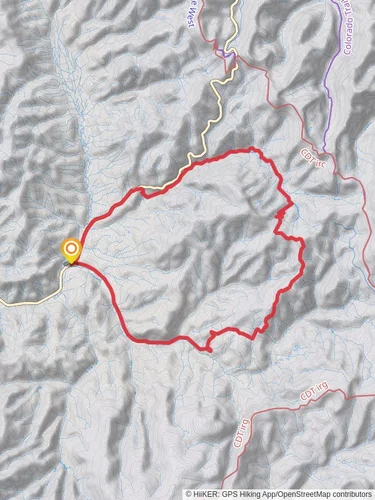
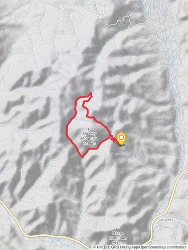
The Quakey Mountain West Loop Trail offers an immersive hiking experience through the diverse landscapes near Saguache County, Colorado. Spanning approximately 18 kilometers (about 11 miles) with an elevation gain of around 700 meters (roughly 2300 feet), this loop trail is a medium-difficulty adventure suitable for hikers with some experience.
Starting at the trailhead, which is accessible by car, hikers can find the beginning of the trail a short distance from the intersection of County Road 42ZS and Forest Service Road 870. There is no direct public transportation to the trailhead, so a personal vehicle or a taxi service is required to reach this remote location.
Navigating the Trail
As you embark on the Quakey Mountain West Loop Trail, you'll be greeted by a mix of dense forested areas and open meadows. The initial segment of the trail is a gradual ascent through a coniferous forest, where the scent of pine fills the air. After about 2 kilometers (1.2 miles), the trail opens up to a meadow with stunning views of the surrounding peaks.
The trail continues to weave through the forest, with intermittent clearings that offer panoramic vistas. At approximately the 6-kilometer (3.7-mile) mark, hikers reach a notable elevation where they can observe the geological formations that give Quakey Mountain its name. The terrain here is characterized by aspen groves, which are particularly breathtaking in the fall when the leaves turn a vibrant yellow.
Historical Significance and Wildlife
This region is steeped in history, with the trail passing through areas that were once the hunting grounds of the Ute people. As you hike, imagine the indigenous tribes that traversed these mountains for centuries.
Wildlife is abundant in this area. It's not uncommon to spot mule deer, elk, and an array of bird species. Remember to keep a respectful distance from any wildlife you encounter and to store your food securely to avoid attracting bears.
Reaching the Summit and Descending
The most challenging part of the hike is the ascent to the summit, which occurs around the 9-kilometer (5.6-mile) point. Here, the trail becomes steeper, and the thinning air at higher altitudes may slow your pace. Upon reaching the summit, you'll be rewarded with a 360-degree view of the San Juan Mountains.
The descent from the summit is less strenuous, with switchbacks easing the grade. The trail loops back towards the starting point, passing through a different but equally enchanting section of the forest. As you complete the loop, the final kilometers are a gentle descent back to the trailhead.
Preparation and Safety
Before setting out, ensure you have a map of the trail, which can be downloaded from HiiKER to your mobile device for offline navigation. It's essential to carry enough water, as there are no reliable water sources along the trail, and to dress in layers due to the variable mountain weather.
In conclusion, the Quakey Mountain West Loop Trail is a rewarding hike that offers a blend of natural beauty, wildlife sightings, and a touch of history. With proper preparation and respect for the environment, hikers will find this trail to be a memorable Colorado adventure.
Reviews
User comments, reviews and discussions about the Quakey Mountain West Loop Trail, Colorado.
4.0
average rating out of 5
1 rating(s)


