38.9 km
~1 day 4 hrs
1168 m
“Explore diverse landscapes, historical sites, and abundant wildlife on this 39-km loop trail near Saguache, Colorado.”
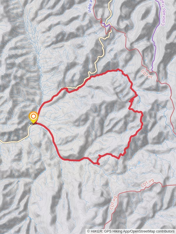
Starting near Saguache County, Colorado, this loop trail spans approximately 39 kilometers (24 miles) with an elevation gain of around 1100 meters (3600 feet). The trailhead is accessible by car, with the nearest significant landmark being the town of Saguache. Public transport options are limited, so driving is the most reliable way to reach the starting point.
### Trail Overview
The Agate Creek, Lime Creek, and Marshall Pass Road Loop offers a diverse hiking experience, combining lush forests, alpine meadows, and historical sites. The trail is rated as medium difficulty, making it suitable for moderately experienced hikers.
### Agate Creek Section
The first section of the trail follows Agate Creek, a serene waterway that meanders through dense forests of aspen and pine. This part of the trail is relatively gentle, with a gradual ascent. Keep an eye out for wildlife such as deer and elk, which are commonly seen in this area. The sound of the creek provides a soothing backdrop as you hike.
### Lime Creek Section
As you transition to the Lime Creek section, the trail becomes steeper, gaining elevation more rapidly. This part of the hike offers stunning views of the surrounding mountains and valleys. The flora changes as well, with more alpine vegetation appearing as you climb higher. Lime Creek itself is a picturesque stream, often flanked by wildflowers in the warmer months.
### Marshall Pass Road
The final section of the loop takes you along Marshall Pass Road, a historic route that was once a vital passage for settlers and miners in the 19th century. The road is now a well-maintained trail, offering easier terrain compared to the Lime Creek section. Historical markers along the way provide insights into the region's past, including the significance of Marshall Pass in the development of Colorado's mining industry.
### Navigation and Safety
Given the trail's length and elevation gain, it's crucial to be well-prepared. Use HiiKER for accurate navigation and trail information. The app provides detailed maps and real-time updates, ensuring you stay on the right path. Weather in this region can be unpredictable, so pack layers and be prepared for sudden changes.
### Points of Interest
- Agate Creek: Approximately 5 kilometers (3 miles) from the trailhead, this area is perfect for a short break and some wildlife spotting. - Lime Creek Overlook: Around 15 kilometers (9 miles) into the hike, this viewpoint offers panoramic views of the surrounding landscape. - Marshall Pass: At about 30 kilometers (18 miles), you'll reach Marshall Pass, a historical site with informative plaques detailing its significance.
### Wildlife and Flora
The trail is home to a variety of wildlife, including deer, elk, and occasionally black bears. Birdwatchers will also find plenty to enjoy, with species such as the mountain bluebird and the Steller's jay commonly seen. The flora ranges from dense forests of aspen and pine to alpine meadows filled with wildflowers, depending on the season.
### Getting There
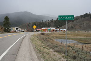
To reach the trailhead, drive to Saguache County, Colorado. The nearest significant landmark is the town of Saguache, which offers basic amenities such as food and lodging. From Saguache, follow local roads to the trailhead, which is well-marked and has parking available. Public transport options are limited, so driving is recommended.
This loop trail offers a blend of natural beauty, historical significance, and moderate challenge, making it a rewarding experience for those who undertake it.
Reviews
User comments, reviews and discussions about the Agate Creek, Lime Creek and Marshall Pass Road Loop, Colorado.
5.0
average rating out of 5
4 rating(s)


