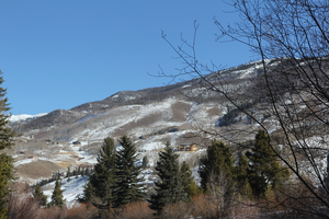
South Fork Trail - Short
Arapaho and Roosevelt National Forests · Grand County, Colorado
11.9 km
~2 hrs 58 min
355 m
“The South Fork Trail - Short offers stunning views, historical sites, and moderate challenges for seasoned hikers.”
Starting near Grand County, Colorado, the South Fork Trail - Short is an out-and-back trail that spans approximately 12 kilometers (around 7.5 miles) with an elevation gain of about 300 meters (roughly 984 feet). This trail is rated as medium difficulty, making it suitable for moderately experienced hikers.
### Getting There To reach the trailhead, you can drive or use public transport. If driving, head towards Grand County, Colorado, and look for parking near the trailhead, which is close to the Fraser River. For those using public transport, the nearest significant landmark is the town of Fraser. From Fraser, you can take a local shuttle or taxi service to the trailhead.
### Trail Overview The South Fork Trail - Short begins with a gentle ascent through a dense forest of lodgepole pines and aspens. The initial 2 kilometers (1.2 miles) are relatively easy, with a gradual elevation gain of about 50 meters (164 feet). This section is well-marked and offers a serene introduction to the hike.
### Key Landmarks and Nature As you progress, you'll encounter a small, picturesque meadow around the 3-kilometer (1.9-mile) mark. This meadow is a great spot for a short break and offers stunning views of the surrounding mountains. Keep an eye out for local wildlife such as mule deer and various bird species, including the mountain bluebird.
Continuing on, the trail becomes steeper, gaining another 100 meters (328 feet) in elevation over the next 2 kilometers (1.2 miles). This section is more challenging but rewards hikers with breathtaking vistas of the Fraser River Valley. The trail here is rocky, so sturdy hiking boots are recommended.
### Historical Significance Around the 5-kilometer (3.1-mile) mark, you'll come across remnants of old mining equipment. This area was once part of a bustling mining community in the late 19th century. The trail offers a glimpse into the region's rich history, with interpretive signs providing information about the mining activities that took place here.
### Final Stretch The final 1 kilometer (0.6 miles) to the turnaround point involves a moderate climb, adding another 150 meters (492 feet) in elevation. This section is less forested, offering expansive views of the surrounding peaks and valleys. Upon reaching the turnaround point, you'll find a small clearing perfect for a picnic or simply to rest and take in the scenery before heading back.
### Navigation and Safety For navigation, it's advisable to use the HiiKER app, which provides detailed maps and real-time updates. The trail is generally well-marked, but having a reliable navigation tool can enhance your hiking experience and ensure you stay on track.
### Wildlife and Flora Throughout the hike, you'll be surrounded by diverse flora, including wildflowers in the spring and summer months. Wildlife sightings are common, so keep your camera ready but maintain a respectful distance from any animals you encounter.
### Preparation Tips Given the medium difficulty rating, it's essential to bring plenty of water, snacks, and a first-aid kit. Weather in the mountains can change rapidly, so pack layers and be prepared for sudden temperature drops or rain showers.
This trail offers a perfect blend of natural beauty, historical intrigue, and moderate physical challenge, making it a rewarding experience for those who venture out.
Reviews
User comments, reviews and discussions about the South Fork Trail - Short, Colorado.
5.0
average rating out of 5
5 rating(s)


