Download
Preview
Add to list
More
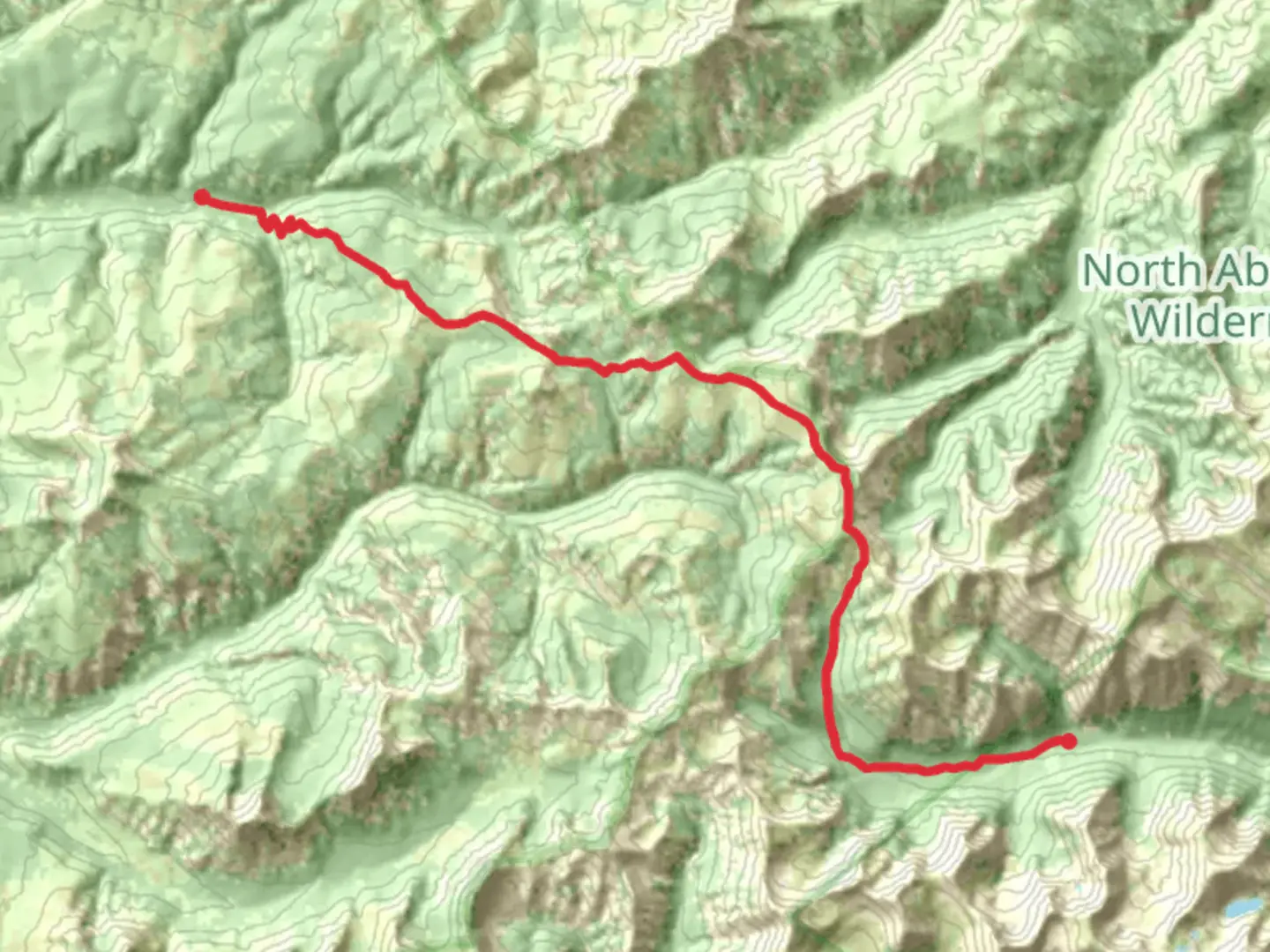
25.9 km
~7 hrs 23 min
1330 m
Point-to-Point
“The 26-kilometer Hoodoo Basin Trail offers stunning landscapes, diverse wildlife, and rich historical significance.”
Starting near Park County, Wyoming, the Hoodoo Basin Trail Point to Point stretches approximately 26 kilometers (16 miles) with an elevation gain of around 1300 meters (4265 feet). This trail is classified as medium difficulty, making it suitable for moderately experienced hikers.
Getting There
To reach the trailhead, you can drive or use public transport. If driving, head towards the nearest significant landmark, which is the town of Cody, Wyoming. From Cody, take the Chief Joseph Scenic Byway (WY-296) and follow the signs towards the Sunlight Basin. The trailhead is located near the Sunlight Creek Bridge. For those using public transport, the nearest major bus station is in Cody, and from there, you may need to arrange a taxi or shuttle service to the trailhead.
Trail Overview
The Hoodoo Basin Trail offers a diverse range of landscapes, from lush meadows to rugged mountain terrain. The trail begins with a gentle ascent through dense forests, where you might spot wildlife such as deer, elk, and various bird species. As you progress, the trail becomes steeper, leading you through rocky outcrops and alpine meadows.
Significant Landmarks
- Sunlight Creek: Approximately 5 kilometers (3 miles) into the hike, you'll cross Sunlight Creek. This is a good spot to take a break and enjoy the serene surroundings.
- Hoodoo Basin: Around the 13-kilometer (8-mile) mark, you'll reach the Hoodoo Basin, a stunning area filled with unique rock formations known as hoodoos. These natural pillars are a highlight of the trail and offer excellent photo opportunities.
- Viewpoints: Several viewpoints along the trail provide panoramic views of the Absaroka Range and the surrounding wilderness. Notable viewpoints are located at approximately 8 kilometers (5 miles) and 20 kilometers (12 miles) into the hike.
Flora and Fauna
The trail is rich in biodiversity. In the lower elevations, you'll find a variety of wildflowers, including lupines and Indian paintbrush. As you ascend, the vegetation changes to hardy alpine plants. Wildlife is abundant, so keep an eye out for marmots, pikas, and possibly even a black bear or two. Always practice safe wildlife viewing by keeping a respectful distance.
Historical Significance
The region around the Hoodoo Basin Trail has a rich history. It was once traversed by Native American tribes, including the Crow and Shoshone, who used the area for hunting and gathering. In the late 19th century, the trail was part of the route used by early explorers and trappers. The Chief Joseph Scenic Byway, which you use to access the trailhead, is named after the Nez Perce leader Chief Joseph, who led his people through this area during their flight from the U.S. Cavalry in 1877.
Navigation and Safety
Given the trail's moderate difficulty and varying terrain, it's advisable to use a reliable navigation tool like HiiKER to stay on track. The trail is well-marked, but weather conditions can change rapidly, especially at higher elevations. Be prepared for sudden temperature drops and possible snow, even in summer months. Carry sufficient water, snacks, and a first-aid kit.
Final Stretch
The final section of the trail descends gradually through a series of switchbacks, leading you back into forested areas before reaching the endpoint. This descent offers a chance to reflect on the diverse landscapes and rich history you've encountered along the way.

What to expect?
Activity types
Comments and Reviews
User comments, reviews and discussions about the Hoodoo Basin Trail Point to Point, Wyoming.
4.5
average rating out of 5
12 rating(s)