Download
Preview
Add to list
More
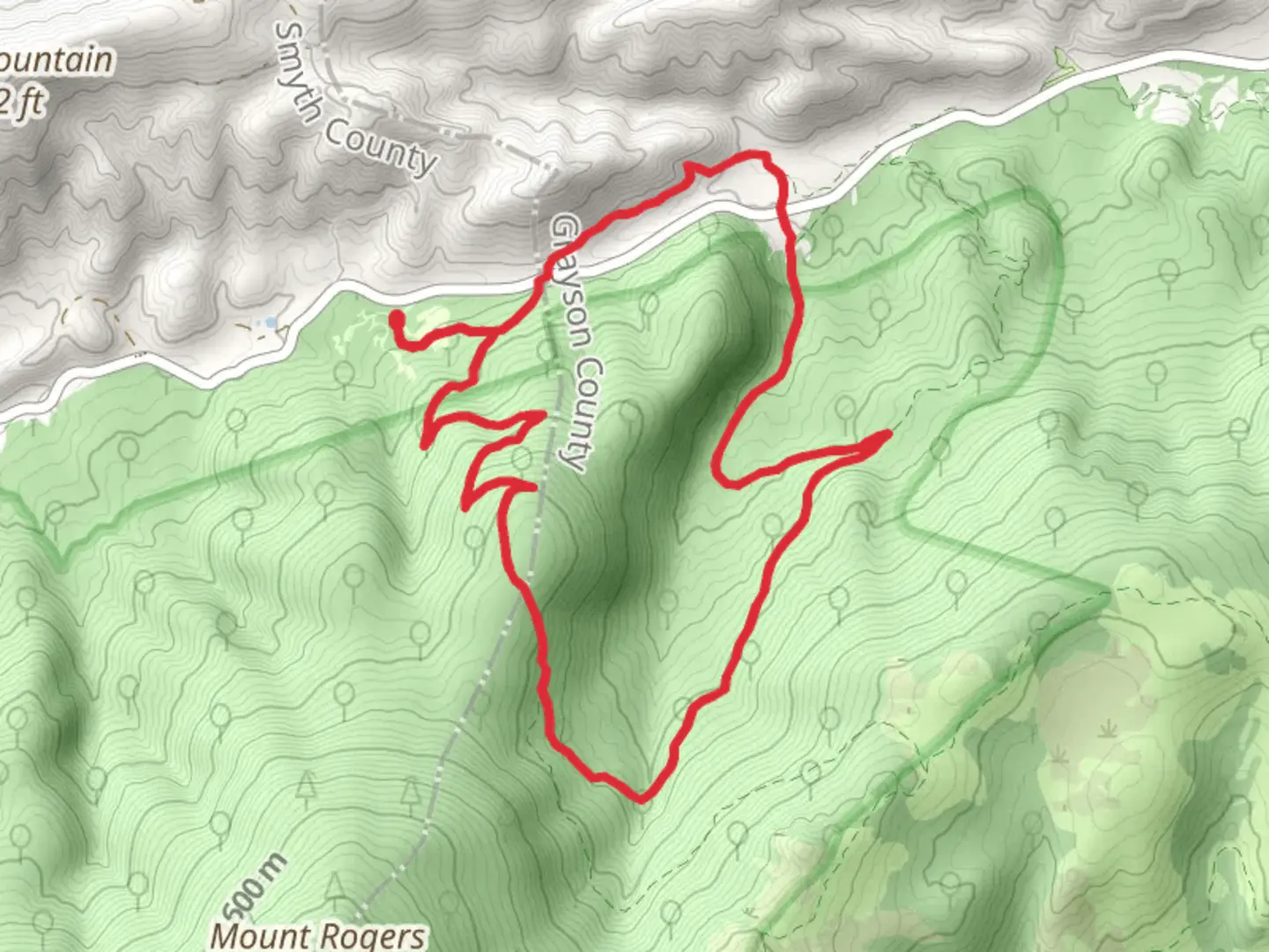
12.5 km
~3 hrs 20 min
508 m
Loop
“Explore Virginia's highlands on a loop trail rich with wildlife, history, and breathtaking vistas.”
Embarking on the Mount Rogers, Lewis Fork, and Fairwood Valley Loop Trail offers a diverse and enriching hiking experience through the highlands of Virginia's Grayson and Smyth Counties. This approximately 13 km (8 miles) loop, with an elevation gain of around 500 meters (1640 feet), begins near the Massie Gap area in Grayson Highlands State Park, which is accessible by car from the nearby towns of Marion or Independence, Virginia. There is no direct public transportation to the trailhead, so driving is the most feasible option.As you set out from the trailhead, the path will lead you through a mixed forest, gradually ascending towards the open, grassy balds that the area is famous for. These balds offer stunning panoramic views of the surrounding landscape, and it's not uncommon to encounter wild ponies grazing here, a highlight for many hikers.Wildlife and FloraThe trail is a haven for wildlife enthusiasts. In addition to the wild ponies, you may spot white-tailed deer, a variety of birds, and with some luck, you might catch a glimpse of the elusive Appalachian black bear. The flora along the trail is equally impressive, with rhododendron and azalea blooms providing a colorful display in the spring and early summer.Ascending Mount RogersThe most challenging and rewarding segment of the hike is the ascent to the summit of Mount Rogers, Virginia's highest peak at 1,746 meters (5,729 feet). Although the summit itself is forested and does not offer a view, the journey to the top is filled with remarkable scenery. The trail to the summit is not part of the loop, but many hikers choose to take the 1.6 km (1 mile) detour to stand atop Virginia's highest point.Historical SignificanceThe region is steeped in history, with Mount Rogers named after William Barton Rogers, Virginia's first State Geologist and founder of the Massachusetts Institute of Technology. The area also has a rich cultural history, with the nearby Whitetop Mountain being a traditional gathering place for local Cherokee tribes.Navigating the TrailFor navigation, hikers can rely on the HiiKER app, which provides detailed maps and GPS coordinates to ensure you stay on the correct path. The trail is well-marked, but the app can be especially helpful in the more remote sections where the trail can become less distinct.Fairwood ValleyAfter summiting Mount Rogers or bypassing it, the loop continues through the serene Fairwood Valley, a less-traveled section that offers a sense of solitude and connection with nature. Here, the trail meanders through dense forests and crosses several streams, which can be full and fast-flowing after heavy rains.Preparation and SafetyHikers should be prepared for variable weather conditions, as the high elevation can lead to sudden changes. It's essential to carry layers of clothing, sufficient water, and snacks. The trail can be rocky and steep in places, so sturdy hiking boots are recommended.Access to the TrailheadTo reach the trailhead, take Grayson Highland Lane from US-58, which leads directly into Grayson Highlands State Park. There is a parking fee to enter the park, and the trailhead is located near the park's visitor center. The park provides amenities such as restrooms and picnic areas, making it a convenient starting point for your adventure.Remember, this loop trail offers a rich blend of natural beauty, wildlife sightings, and historical significance, making it a must-hike for those exploring the Virginia highlands.

What to expect?
Activity types
Comments and Reviews
User comments, reviews and discussions about the Mount Rogers, Lewis Fork and Fairwood Valley Loop Trail, Virginia.
4.36
average rating out of 5
22 rating(s)