Download
Preview
Add to list
More
17.4 km
~4 hrs 37 min
689 m
Out and Back
“Embark on the Power Line Trail for a 17-kilometer adventure of diverse landscapes and historical intrigue.”
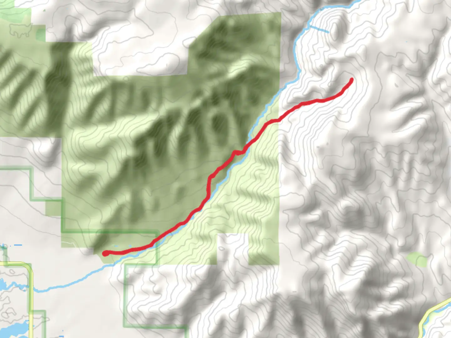
Starting near Weber County, Utah, the Power Line Trail is an invigorating out-and-back hike stretching approximately 17 kilometers (10.5 miles) with an elevation gain of around 600 meters (1,970 feet). This trail is rated as medium difficulty, making it suitable for moderately experienced hikers looking for a rewarding challenge.### Getting There To reach the trailhead, you can drive or use public transportation. If driving, head towards the nearest significant landmark, the North Ogden Divide Trailhead, which is easily accessible from North Ogden, Utah. For those using public transport, the closest bus stop is in North Ogden, from where you can take a short taxi ride to the trailhead.### Trail Overview The Power Line Trail offers a diverse hiking experience, featuring a mix of open meadows, dense forests, and panoramic views. The trail begins with a gentle ascent through a forested area, providing ample shade and a cool start to your hike. As you progress, the trail becomes steeper, leading you to more exposed sections where the power lines are visible, hence the trail's name.### Key Landmarks and Sections - First 3 Kilometers (1.9 Miles): The initial stretch is relatively easy, with a gradual incline. You'll pass through a lush forest with a variety of trees, including pines and aspens. Keep an eye out for local wildlife such as deer and various bird species.
- 3 to 8 Kilometers (1.9 to 5 Miles): This section is where the trail starts to climb more steeply. You'll encounter several switchbacks that offer stunning views of the surrounding valleys and mountains. The elevation gain here is noticeable, so take breaks as needed. Around the 5-kilometer (3.1-mile) mark, you'll reach a clearing that provides a perfect spot for a rest and some photos.- 8 to 12 Kilometers (5 to 7.5 Miles): As you continue, the trail levels out slightly but remains challenging. This part of the trail runs parallel to the power lines, offering unique photo opportunities. The terrain here is more rugged, with rocky outcrops and occasional steep drops. Watch your footing and stay on the marked path.- Final 5 Kilometers (3.1 Miles): The last stretch to the turnaround point is a mix of moderate climbs and flat sections. You'll be rewarded with expansive views of the Weber County landscape. This is a great spot to take a break, enjoy a snack, and soak in the scenery before heading back.### Historical Significance The region around Weber County has a rich history, with Native American tribes such as the Shoshone and Ute having inhabited the area for centuries. The trail itself follows a route that has been used for various purposes over the years, including early pioneer travel and, more recently, maintenance access for the power lines that give the trail its name.### Wildlife and Flora The Power Line Trail is home to a variety of wildlife. Besides deer, you might spot foxes, rabbits, and a range of bird species, including hawks and eagles. The flora is equally diverse, with wildflowers blooming in the spring and summer months, adding vibrant colors to the landscape.### Navigation and Safety For navigation, it's recommended to use the HiiKER app, which provides detailed maps and real-time updates. Ensure you have enough water, snacks, and appropriate clothing for changing weather conditions. The trail can be slippery after rain, so good hiking boots with grip are essential.This trail offers a mix of natural beauty, moderate challenge, and historical intrigue, making it a must-visit for hikers in the Weber County area.

What to expect?
Activity types
Comments and Reviews
User comments, reviews and discussions about the Power Line Trail, Utah.
4.5
average rating out of 5
8 rating(s)