Download
Preview
Add to list
More
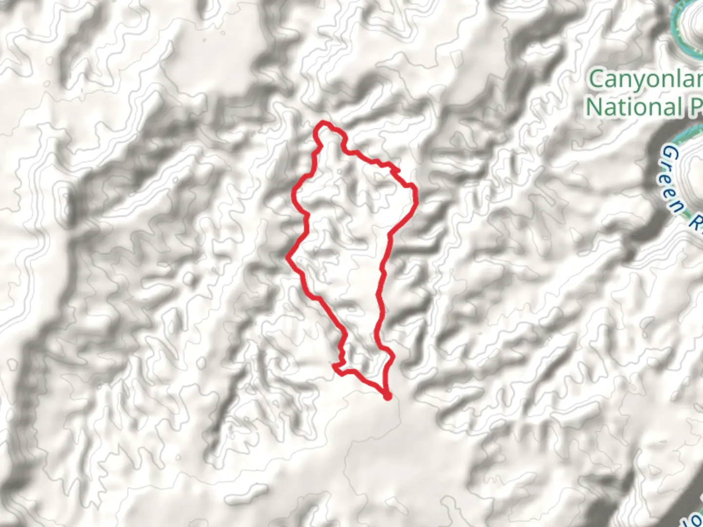
13.4 km
~3 hrs 37 min
559 m
Loop
“Embark on a mesmerizing 13 km journey through ancient pictographs and stunning vistas at Pete's Mesa.”
Starting your adventure near Wayne County, Utah, the Pictograph Fork Route and Pete's Mesa Route Loop offers a captivating 13 km (8 miles) journey with an elevation gain of approximately 500 meters (1,640 feet). This loop trail is rated as medium difficulty, making it suitable for moderately experienced hikers.
Getting There To reach the trailhead, you can drive or use public transport. If driving, head towards Wayne County, Utah, and look for the nearest significant landmark, Capitol Reef National Park. From there, follow the signs to the trailhead. Public transport options are limited, so it's advisable to rent a car if you're not driving your own.
Trail Overview The trail begins with a gentle ascent, allowing you to warm up as you navigate through the initial 2 km (1.2 miles). The terrain here is relatively easy, with well-marked paths. As you progress, you'll encounter the first significant landmark, a series of ancient pictographs that give the trail its name. These rock art pieces are believed to be created by the Fremont culture, dating back over a thousand years. Take a moment to appreciate these historical artifacts before continuing your hike.
Ascending to Pete's Mesa Around the 4 km (2.5 miles) mark, the trail starts to climb more steeply as you approach Pete's Mesa. This section is more challenging, with rocky terrain and switchbacks. The elevation gain here is about 200 meters (656 feet) over a distance of 1.5 km (0.9 miles). Make sure to pace yourself and take breaks as needed. The views from Pete's Mesa are breathtaking, offering panoramic vistas of the surrounding canyons and mesas.
Wildlife and Flora As you hike, keep an eye out for the diverse wildlife that inhabits this region. You might spot mule deer, desert bighorn sheep, and various bird species such as golden eagles and peregrine falcons. The flora is equally fascinating, with juniper trees, pinyon pines, and a variety of desert shrubs dotting the landscape.
Navigating the Loop After reaching Pete's Mesa, the trail loops back towards the starting point. This section is less strenuous, with a gradual descent over 5 km (3.1 miles). The path here is well-defined, but it's always a good idea to have a reliable navigation tool like HiiKER to ensure you stay on track. Along the way, you'll pass through narrow canyons and open desert plains, offering a mix of shaded and exposed areas.
Final Stretch The last 2 km (1.2 miles) of the trail bring you back to the trailhead. This section is relatively flat, allowing you to cool down and reflect on the journey. As you near the end, you'll pass by a small creek, a perfect spot to rest and enjoy the serene environment before concluding your hike.
This loop trail not only offers a moderate physical challenge but also immerses you in the rich history and natural beauty of the region. Whether you're an avid hiker or a history enthusiast, the Pictograph Fork Route and Pete's Mesa Route Loop promises a memorable experience.

What to expect?
Activity types
Comments and Reviews
User comments, reviews and discussions about the Pictograph Fork Route and Pete's Mesa Route Loop, Utah.
4.6
average rating out of 5
10 rating(s)