Download
Preview
Add to list
More
7.7 km
~2 hrs 16 min
433 m
Out and Back
“Tibble Fork Trail offers scenic beauty, historical intrigue, and moderate challenge, perfect for diverse hiking enthusiasts.”
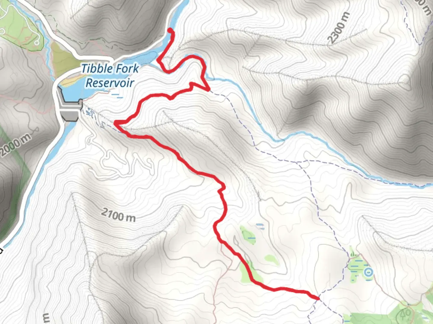
Starting near Utah County, Utah, the Tibble Fork Trail is an 8 km (approximately 5 miles) out-and-back trail with an elevation gain of around 400 meters (about 1,312 feet). This medium-difficulty trail offers a blend of natural beauty, historical significance, and a moderately challenging hike suitable for a variety of skill levels.### Getting There To reach the trailhead, you can drive or use public transport. If driving, head towards the Tibble Fork Reservoir, located at the end of Tibble Fork Road, which is accessible via American Fork Canyon. For those using public transport, the nearest major city is Provo, Utah. From Provo, you can take a bus to the American Fork Canyon area and then a taxi or rideshare service to the Tibble Fork Reservoir.### Trail Overview The trail begins near the Tibble Fork Reservoir, a popular spot for fishing and picnicking. The reservoir itself is a picturesque location, surrounded by towering pine trees and offering stunning reflections of the nearby mountains. As you start your hike, you'll be greeted by a well-marked path that gradually ascends through a dense forest of aspen and pine.### Key Landmarks and Nature At approximately 1.5 km (0.9 miles) into the hike, you'll come across a small, serene meadow. This is an excellent spot to take a short break and enjoy the surrounding wildflowers, especially during the spring and summer months. Keep an eye out for local wildlife such as deer, squirrels, and a variety of bird species.Continuing on, the trail becomes steeper as you approach the 3 km (1.8 miles) mark. Here, you'll encounter a series of switchbacks that offer panoramic views of the American Fork Canyon. The elevation gain is more noticeable in this section, so take your time and enjoy the vistas.### Historical Significance The region around the Tibble Fork Trail has a rich history. American Fork Canyon was once a bustling area during the late 19th century due to mining activities. Remnants of old mining equipment and structures can still be found scattered throughout the canyon, offering a glimpse into the area's past. The trail itself passes near some of these historical sites, adding an educational element to your hike.### Final Stretch and Return As you near the 4 km (2.5 miles) point, you'll reach the highest elevation of the trail. This section offers breathtaking views of the surrounding peaks and valleys. It's a perfect spot for taking photos and soaking in the natural beauty before you begin your descent back to the trailhead.### Navigation and Safety For navigation, it's highly recommended to use the HiiKER app, which provides detailed maps and real-time updates. The trail is generally well-marked, but having a reliable navigation tool can enhance your hiking experience and ensure you stay on track.### Wildlife and Flora Throughout the hike, you'll encounter a diverse range of flora and fauna. The trail is particularly beautiful in the fall when the aspen trees turn a vibrant yellow. Wildlife sightings are common, so keep your camera ready but maintain a respectful distance from any animals you encounter.### Preparation Tips Given the moderate difficulty of the trail, it's advisable to wear sturdy hiking boots and bring plenty of water, especially during the hotter months. Weather can change rapidly in the mountains, so pack a light jacket or rain gear just in case. The Tibble Fork Trail offers a rewarding hike with a mix of natural beauty, historical intrigue, and moderate physical challenge. Whether you're a seasoned hiker or a beginner looking for a bit of adventure, this trail has something for everyone.

What to expect?
Activity types
Comments and Reviews
User comments, reviews and discussions about the Tibble Fork Trail, Utah.
4.37
average rating out of 5
19 rating(s)