Download
Preview
Add to list
More
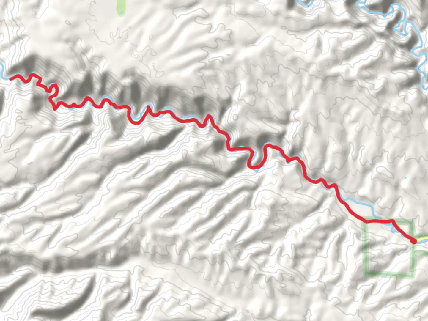
40.3 km
~1 day 3 hrs
400 m
Out and Back
“Experience the enchanting blend of history, nature, and adventure on New Mexico's stunning West Fork Gila River Trail.”
Nestled in the rugged terrain of Catron County, New Mexico, the West Fork Gila River via Grand Enchantment Trail offers a captivating journey through a landscape rich in history and natural beauty. This out-and-back trail stretches approximately 40 kilometers (about 25 miles) with an elevation gain of around 400 meters (1,312 feet), providing a moderately challenging adventure for hikers.### Getting ThereTo reach the trailhead, travelers can drive to the vicinity of Catron County. If you're coming by car, the nearest significant landmark is the Gila Cliff Dwellings National Monument. From there, follow the signs to the trailhead, which is accessible via well-maintained roads. For those relying on public transport, the closest major city is Silver City, New Mexico. From Silver City, you can arrange for a shuttle or taxi service to the trailhead, as public transport options are limited in this remote area.### Trail Highlights#### Scenic River CrossingsThe trail meanders alongside the West Fork of the Gila River, offering numerous river crossings that add an element of adventure. These crossings can vary in depth depending on the season, so be prepared for wet feet and consider bringing water shoes. The river's gentle flow and the lush greenery along its banks create a serene atmosphere, perfect for nature enthusiasts.#### Diverse Flora and FaunaAs you hike, you'll encounter a diverse array of plant life, from towering ponderosa pines to vibrant wildflowers that bloom in the spring and summer months. The area is also home to a variety of wildlife, including mule deer, black bears, and numerous bird species. Keep your eyes peeled for the elusive Gila trout, a native fish species that inhabits the river.#### Historical SignificanceThe region is steeped in history, with the Gila Cliff Dwellings offering a glimpse into the lives of the Mogollon people who inhabited the area over 700 years ago. While the dwellings themselves are not directly on the trail, they are a short drive away and make for an excellent side trip. The trail itself follows part of the historic Grand Enchantment Trail, a long-distance route that spans from Arizona to New Mexico, showcasing the diverse landscapes of the American Southwest.### Navigation and SafetyGiven the trail's remote location, it's crucial to come prepared with navigation tools. HiiKER is an excellent resource for downloading offline maps and ensuring you stay on track. Cell service is limited, so having a reliable map and compass is advisable. The trail is well-marked, but it's always wise to be prepared for unexpected changes in weather or trail conditions.### Planning Your HikeThe West Fork Gila River trail is best hiked in the spring or fall when temperatures are mild, and the river crossings are manageable. Summer can bring intense heat, while winter may present icy conditions. Ensure you pack plenty of water, sun protection, and layers to accommodate changing weather. Camping is permitted along the trail, allowing for a multi-day exploration of this stunning region.Embarking on the West Fork Gila River via Grand Enchantment Trail promises an unforgettable experience, blending natural beauty, historical intrigue, and the thrill of adventure in one of New Mexico's most captivating landscapes.

What to expect?
Activity types
Comments and Reviews
User comments, reviews and discussions about the West Fork Gila River via Grand Enchantment Trail, New Mexico.
average rating out of 5
0 rating(s)