Download
Preview
Add to list
More
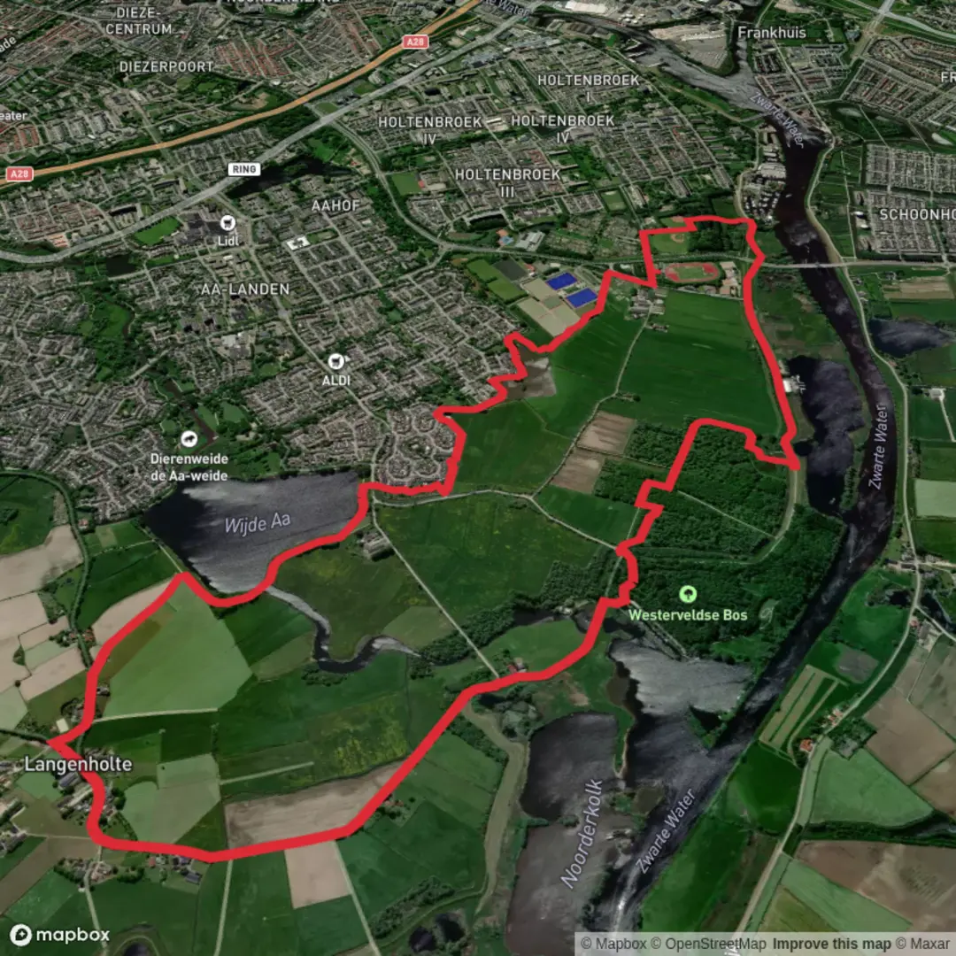
8.5 km
~1 hrs 42 min
0 m
Loop
“Trace tranquil waterways, lush meadows, and storied paths beneath vast Dutch skies and timeless windmills.”
Starting near the tranquil waters of the Wijde Aa, this 9 km (about 5.6 miles) loop offers a flat, easy-going route with virtually no elevation gain, making it accessible for hikers of all abilities. The trailhead is conveniently located close to the village of Roelofarendsveen, a well-known spot in South Holland, Netherlands. For those arriving by public transport, buses from Leiden or Alphen aan den Rijn stop at Roelofarendsveen, from where it’s a short walk to the starting point. Drivers will find parking available near the marina and local shops.
Scenic Waterways and Open Fields
The route follows the Brinkhoek Weg and Doden Weg, tracing the edges of the Wijde Aa lake and passing through quintessential Dutch polder landscapes. Expect wide, open skies, lush green meadows, and the gentle lapping of water along the canal banks. The area is dotted with traditional windmills, some of which date back to the 18th century, serving as reminders of the region’s long history of water management and land reclamation.
Wildlife and Nature Highlights
Birdwatchers will appreciate the abundance of waterfowl, including grebes, coots, and herons, especially in spring and early summer. The meadows are home to hares and, if you’re lucky, you might spot a roe deer grazing at dawn. The trail skirts reed beds and small woodlands, providing shelter for songbirds and butterflies.
Historical Significance
The Doden Weg, or “Death Road,” carries a somber history. During World War II, this path was reportedly used by local resistance members and has since become a quiet memorial route. Along the way, you may notice small plaques or markers commemorating events from the war years. The surrounding polder landscape itself is a testament to centuries of Dutch engineering, with dikes and drainage canals shaping the land into fertile farmland.
Navigation and Trail Conditions
The entire route is well-marked and maintained, with wide gravel and paved sections suitable for walking year-round. HiiKER is recommended for navigation, offering up-to-date maps and waypoints to keep you on track. There are several benches along the way, perfect for a rest or picnic with views over the water.
Facilities and Refreshments
Roelofarendsveen offers several cafés and bakeries near the start and end of the hike, ideal for a pre- or post-walk treat. Public toilets are available at the marina and in the village center. The area is popular with cyclists and boaters, so expect a lively but peaceful atmosphere, especially on weekends.
This gentle loop is perfect for those seeking a relaxing day outdoors, with plenty of opportunities to enjoy Dutch rural scenery, local history, and abundant wildlife.

Surfaces
Unknown
Asphalt
Grass
Concrete
Wood
Unpaved
Comments and Reviews
User comments, reviews and discussions about the Wijde Aa and Jochthaven via Brinkhoek Weg and Doden Weg, Netherlands.
average rating out of 5
0 rating(s)