Download
Preview
Add to list
More
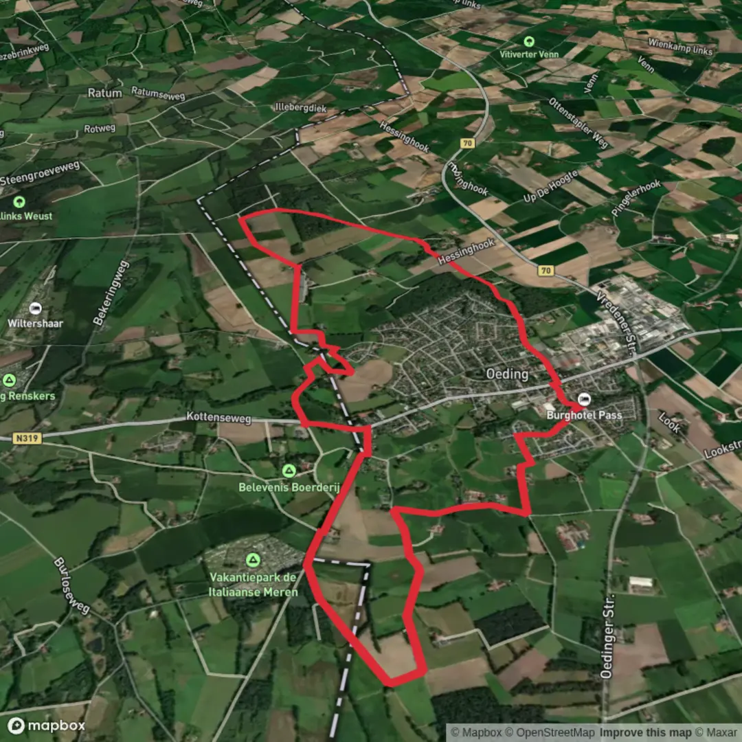
10.6 km
~2 hrs 9 min
17 m
Loop
“Wander through blooming fields, ancient castles, and tranquil forests on this enchanting borderland journey.”
The Oeding and Hinterm Loop is an approximately 11 km (6.8 miles) trail with minimal elevation gain, making it an accessible and enjoyable hike for individuals of varying fitness levels.
Getting There
The trailhead is located near the town of Oeding, Germany, close to the Dutch border. For those traveling by car, Oeding is accessible via the B70 federal road. Parking is available near the town center, providing convenient access to the trailhead. If you're using public transportation, regional trains and buses serve the area, with the nearest train station in the neighboring town of Borken. From Borken, you can take a bus to Oeding; check the latest schedules for the most accurate information.
Trail Overview
The loop begins in Oeding and meanders through a picturesque landscape characterized by open fields, dense woodlands, and serene waterways. The well-marked path ensures a straightforward navigation experience. For enhanced route guidance, consider using the HiiKER app, which provides detailed maps and real-time updates.
Significant Landmarks
- Oeding Castle: Shortly after commencing the hike, you'll encounter Oeding Castle, a historic moated castle dating back to the 14th century. While the castle is privately owned and not open to the public, its impressive architecture is visible from the trail and offers a glimpse into the region's medieval past.
- Hinterm Holz Forest: Approximately 3 km (1.9 miles) into the hike, the trail enters the Hinterm Holz Forest. This dense woodland is home to a variety of native flora and fauna, including oak and beech trees, as well as deer and numerous bird species. The forest provides a tranquil environment and a welcome shade during warmer months.
Flora and Fauna
The trail traverses diverse ecosystems, from agricultural fields to wetlands and forests. In spring and summer, wildflowers such as poppies and cornflowers adorn the fields, while the wetlands are teeming with amphibians and waterfowl. Birdwatchers may spot species like the European robin, blackbird, and various types of woodpeckers.
Historical Significance
The region around Oeding has a rich history, with settlements dating back to the medieval period. The proximity to the Dutch border has influenced the cultural and architectural landscape, evident in the blend of German and Dutch styles in local buildings. The trail itself follows paths that have been used for centuries by traders and travelers moving between the two countries.
Trail Conditions and Recommendations
The Oeding and Hinterm Loop is predominantly flat, with well-maintained paths suitable for hikers of all ages. However, certain sections through the forest and wetlands can become muddy after rainfall, so waterproof footwear is advisable. There are several benches and rest areas along the route, providing opportunities to pause and enjoy the surroundings.
Navigation and Safety
While the trail is well-marked, it's always prudent to carry a reliable navigation tool. The HiiKER app is recommended for its detailed trail maps and user-friendly interface. Mobile reception is generally good throughout the hike, but it's advisable to inform someone of your plans before setting out.
Amenities
In Oeding, you'll find several cafes and restaurants where you can enjoy local cuisine before or after your hike. Public restrooms are available in the town center. Along the trail, there are no facilities, so ensure you carry sufficient water and snacks for the journey.
Embarking on the Oeding and Hinterm Loop offers a delightful blend of natural beauty, historical landmarks, and cultural insights, making it a rewarding experience for any hiker.

Surfaces
Unknown
Asphalt
Comments and Reviews
User comments, reviews and discussions about the Oeding and Hinterm Loop, Netherlands.
average rating out of 5
0 rating(s)