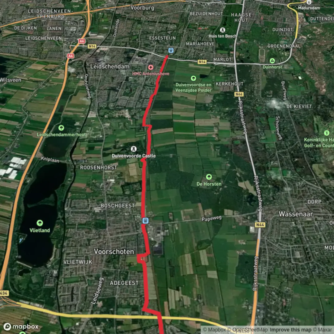
De Vink to Den Haag Mariahoeve via Van Wassenaerlaantje and Kastelenring
Download
Preview
Add to list
More
9.2 km
~1 hrs 50 min
0 m
Point-to-Point
“Stroll through leafy avenues and noble estates, where history and nature intertwine in peaceful harmony.”
Starting from the vicinity of De Vink railway station, this gentle 9 km (about 5.6 miles) route traces a scenic and historic corridor between Leiden and The Hague, with virtually no elevation gain—making it accessible for most walkers. The trail is well-suited for those seeking a leisurely day out, with easy navigation using HiiKER.
Getting There
De Vink station is easily reached by train from Leiden or The Hague, with frequent services throughout the day. For those arriving by car, parking is available near the station, though spaces can fill quickly during peak hours.
Route Overview and Key Highlights
The path begins near De Vink station, quickly immersing you in the green outskirts of Leiden. The first section follows quiet suburban lanes before joining the Van Wassenaerlaantje, a tranquil, tree-lined avenue that hints at the region’s aristocratic past. This area was once dotted with country estates belonging to Dutch nobility, and the remnants of these grand properties can still be glimpsed through ornate gates and old brick walls.
Van Wassenaerlaantje and Kastelenring
After about 2 km (1.2 miles), the route transitions onto the Kastelenring, a circular path that loops around several historic manor houses and castle sites. While many of the original structures have been lost to time, interpretive signs along the way provide insight into the area’s significance during the Dutch Golden Age. Keep an eye out for the moated grounds and formal gardens that remain, offering a sense of the landscape’s former grandeur.
Nature and Wildlife
The trail is flanked by mature beech and oak trees, especially vibrant in spring and autumn. Birdlife is abundant, with woodpeckers, nuthatches, and the occasional heron spotted along the waterways. In the quieter stretches, you may see rabbits or even a fox darting across the path. The route skirts several small ponds and canals, which are home to frogs and dragonflies in the warmer months.
Approaching Den Haag Mariahoeve
As you near the final 3 km (1.9 miles), the landscape shifts from rural to suburban, with the trail weaving through parks and residential neighborhoods. The approach to Den Haag Mariahoeve station is straightforward, with clear signage and well-maintained paths. This station is well-connected by train and bus to central The Hague and other regional destinations.
Navigation and Practical Tips
The entire route is flat, with a total elevation gain of less than 5 metres (16 feet), making it ideal for families, casual walkers, and those with limited mobility. Surfaces are a mix of paved paths and compacted gravel, suitable for most footwear. Rest areas and benches are spaced at regular intervals, particularly near the historic sites and water features.
For navigation, HiiKER provides detailed mapping and waypoint information, ensuring you stay on track and don’t miss any points of interest. Public toilets and small cafés can be found near both trailheads and at several points along the route, especially close to the larger parks.
This hike offers a blend of Dutch history, natural beauty, and easy accessibility, making it a rewarding outing for anyone exploring the region between Leiden and The Hague.

Surfaces
Asphalt
Unknown
Comments and Reviews
User comments, reviews and discussions about the De Vink to Den Haag Mariahoeve via Van Wassenaerlaantje and Kastelenring, Netherlands.
average rating out of 5
0 rating(s)