Download
Preview
Add to list
More
28.8 km
~1 day 0 hrs
15 m
Point-to-Point
“Step into history along rivers and orchards, where the ancient Roman frontier meets tranquil Dutch landscapes.”
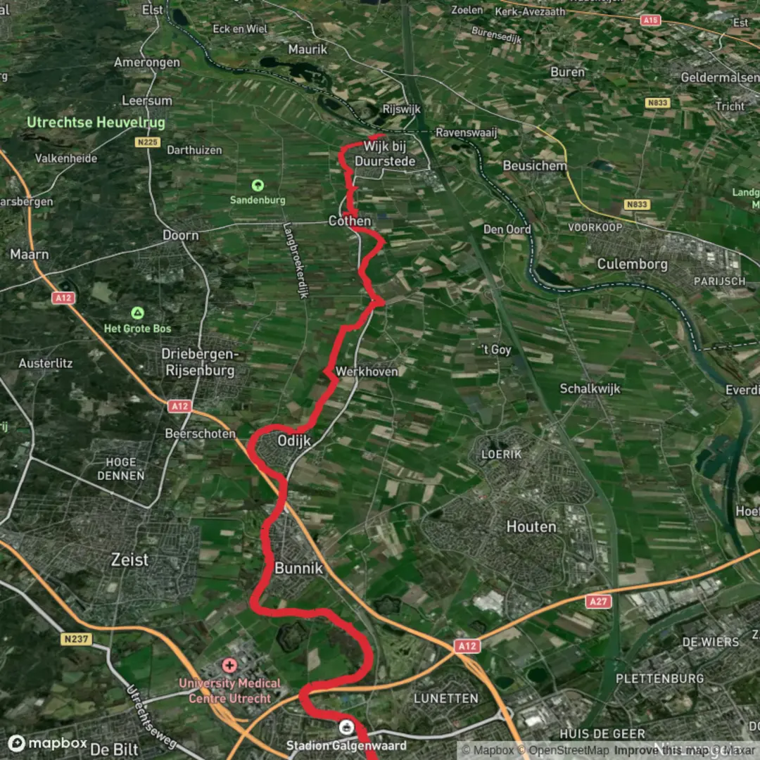
Starting near the Krommerijnbrug in Utrecht, this 29 km (about 18 miles) section of the Romeinse Limespad is a flat, easy walk with virtually no elevation gain, making it accessible for most hikers. The route follows the ancient Roman frontier, the Limes, which once marked the northern boundary of the Roman Empire. This historical significance is woven throughout the landscape, with remnants and markers highlighting the Roman presence in the Netherlands.
Getting There
To reach the starting point at Krommerijnbrug, Utrecht’s central train station is the most convenient hub. From Utrecht Centraal, local buses or a short cycle ride will bring you to the vicinity of the Krommerijnbrug, located near the intersection of the Kromme Rijn river and the city’s southeastern edge. For those arriving by car, parking is available in nearby residential areas or at designated lots close to the river.
Trail Experience and Navigation
The Romeinse Limespad is well-marked, but for detailed navigation and real-time updates, HiiKER is recommended. The path meanders through a mix of urban green spaces, riverside trails, and stretches of open countryside. Expect a blend of paved and unpaved surfaces, with the route largely following the Kromme Rijn river before heading east toward the Haven area.
Landmarks and Historical Highlights
- Kromme Rijn River: The trail hugs the river for much of the early section, offering views of willow-lined banks and passing rowers. This waterway was once a vital Roman transport route. - Fort Vechten (Castellum Fectio): Around 7 km (4.3 miles) from the start, you’ll encounter the site of a major Roman fort. The area now hosts the Waterliniemuseum, where you can learn about both Roman and Dutch military history. - Roman Watchtowers and Markers: Throughout the hike, interpretive signs and occasional reconstructions mark the ancient Limes. These offer insight into the Roman military’s daily life and the strategic importance of the region. - Rural Villages and Orchards: The middle section passes through small villages like Bunnik and Werkhoven, where traditional Dutch farmhouses and orchards line the route. In spring, fruit trees blossom, attracting bees and songbirds. - Natural Reserves: The trail skirts several protected areas, home to herons, kingfishers, and, in summer, grazing sheep and cattle. Wildflowers are abundant along the riverbanks from late spring through early autumn.
Approaching Haven
The final stretch leads toward the Haven area, where the Kromme Rijn meets the Lek river. This confluence was a key Roman crossing point, and today it’s a tranquil spot with wide river views and opportunities to spot waterfowl. The endpoint is accessible by local bus or a short taxi ride to the nearest train station for onward travel.
Preparation Tips
With a total distance of 29 km (18 miles) and no significant elevation, this hike is manageable in a single day for most walkers. Sturdy walking shoes are recommended due to mixed surfaces, and weatherproof clothing is advisable as the Dutch climate can be changeable. Water and snacks are essential, though cafes and shops are available in the villages along the way. Public toilets are found at major landmarks and in village centers.
For navigation, offline maps from HiiKER ensure you stay on track, especially in rural stretches where signage may be less frequent. The route’s historical markers and natural beauty make it a rewarding journey for those interested in both history and the Dutch countryside.

Surfaces
Unknown
Asphalt
Gravel
Unpaved
Ground
Paved
Grass
Wood
Dirt
Concrete
Sand
Comments and Reviews
User comments, reviews and discussions about the Krommerijnbrug to Haven via Romeinse Limespad, Netherlands.
average rating out of 5
0 rating(s)