Download
Preview
Add to list
More
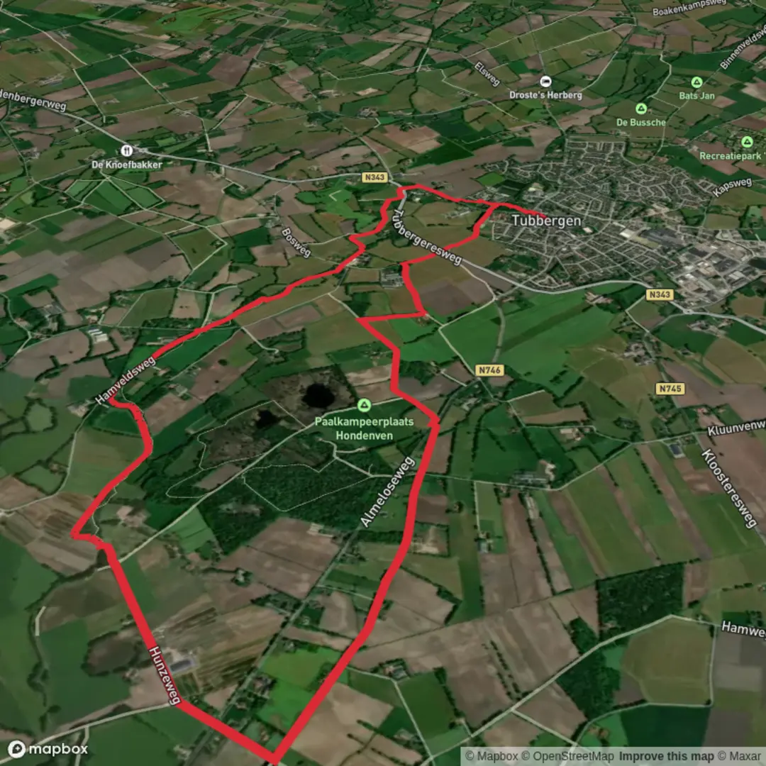
10.6 km
~2 hrs 7 min
0 m
Loop
“Amid wildflowers and historic farms, this peaceful loop unveils the gentle heart of Tubbergen’s countryside.”
Starting from the outskirts of Tubbergen, a charming town in the Dutch province of Overijssel, this loop trail covers approximately 11 km (about 6.8 miles) with virtually no elevation gain, making it an accessible and leisurely walk for most hikers. The trailhead is conveniently located near the center of Tubbergen, close to the recognizable Sint Pancratius Basilica, a prominent landmark that’s easy to find whether arriving by car or public transport. Buses from Almelo and Oldenzaal connect directly to Tubbergen, with stops just a short walk from the starting point. For those driving, parking is available near the town center.
Scenery and Natural Features
The route quickly transitions from the historic streets of Tubbergen into the open landscapes of Tubbergerveld, a patchwork of heathland, meadows, and small woodland groves. The flat terrain is typical of this region, offering expansive views and a tranquil atmosphere. In spring and summer, the heath bursts into color with wildflowers and heather, attracting butterflies and bees. Birdwatchers will appreciate the presence of skylarks, lapwings, and the occasional kestrel hovering above the fields.
Landmarks and Points of Interest
At roughly 2 km (1.2 miles) into the walk, you’ll pass the edge of the Tubbergerveld nature reserve, a protected area known for its rare flora and fauna. Keep an eye out for grazing sheep, which help maintain the heathland ecosystem. The trail meanders past several traditional Dutch farms, some of which date back centuries and showcase the region’s agricultural heritage.
About halfway through the loop, near the 5.5 km (3.4 miles) mark, you’ll encounter the historic watermill of Fleringen, a picturesque spot that offers insight into the area’s rural past. The mill, set beside a gentle stream, is a great place to pause for a snack and enjoy the peaceful surroundings.
Navigation and Trail Conditions
The entire loop is well-marked and follows a combination of paved paths, gravel tracks, and grassy trails. The flat profile and clear signage make navigation straightforward, but for added confidence and up-to-date route information, use HiiKER’s digital maps and GPS guidance. The trail is suitable for families, casual walkers, and those seeking a relaxed day outdoors.
Wildlife and Seasonal Highlights
Depending on the season, you may spot roe deer at dawn or dusk, and the wetlands attract frogs and dragonflies in warmer months. The absence of significant elevation means the trail remains accessible year-round, though waterproof footwear is recommended after heavy rain due to occasional muddy patches.
Getting There and Practical Tips
Public transport users can reach Tubbergen via regional buses from nearby cities, with the main bus stop located near the town center. Drivers will find ample parking options close to the Sint Pancratius Basilica. Facilities such as cafes, shops, and restrooms are available in Tubbergen before and after your hike, but services are limited along the route itself, so bring water and snacks.
This loop offers a gentle immersion into the Dutch countryside, blending natural beauty, local history, and rural tranquility in a manageable distance suitable for all experience levels.

Surfaces
Unknown
Sand
Concrete
Asphalt
Grass
Cobblestone
Wood
Comments and Reviews
User comments, reviews and discussions about the Tubbergen and Tubbergerveld Loop, Netherlands.
average rating out of 5
0 rating(s)