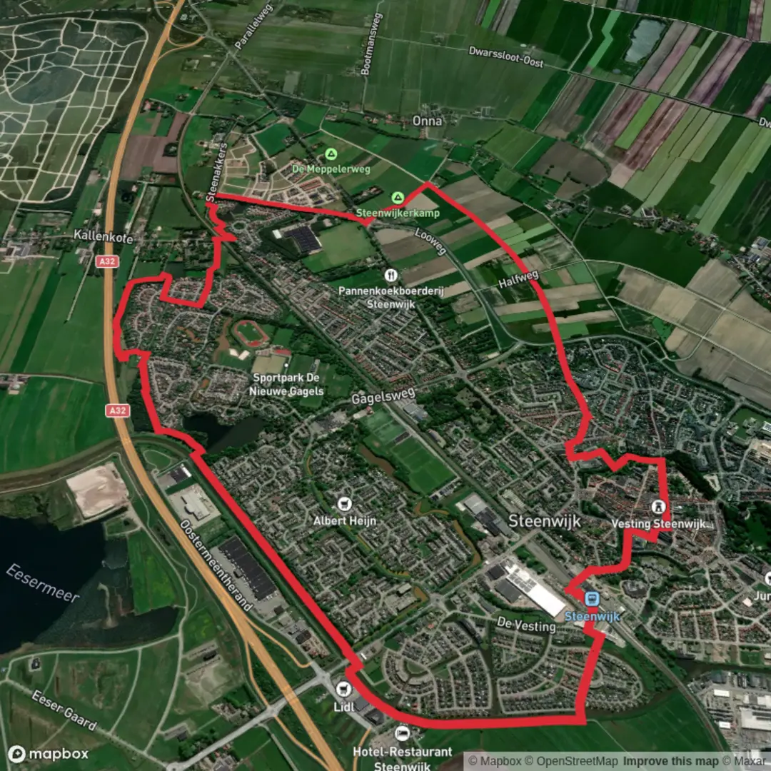
Nieuwe Gagels and Dolder Kanaal via Maarten van Rossumpad and Woldmeenthepad
Download
Preview
Add to list
More
9.8 km
~1 hrs 57 min
0 m
Loop
“Wander through vibrant wetlands and historic canals, where wildflowers, wildlife, and local history meet serene Dutch charm.”
Starting from the outskirts of Steenwijk, a charming town in the Dutch province of Overijssel, this 10 km (about 6.2 miles) loop hike offers a gentle, flat route with virtually no elevation gain, making it accessible for hikers of all abilities. The trailhead is conveniently located near Steenwijk railway station, which is well-served by regional trains and buses, making public transport a practical option. For those arriving by car, parking is available at or near the station.
Navigating the Route
The route follows sections of the Maarten van Rossumpad and Woldmeenthepad, both well-marked long-distance trails. For precise navigation and up-to-date trail conditions, HiiKER is the recommended tool. The paths are mostly wide, well-maintained, and suitable for walking year-round, though waterproof footwear is advisable after rain due to occasional muddy patches.
Landscapes and Natural Features
The hike meanders through the Nieuwe Gagels nature reserve, a mosaic of wetlands, reed beds, and open water. This area is a haven for birdlife, with regular sightings of herons, reed warblers, and, in spring and autumn, migratory waterfowl. The Dolder Kanaal, a historic canal, forms a tranquil spine through the landscape, its banks lined with willows and wildflowers in the warmer months. The route also skirts the edge of the Woldmeenthe, a reclaimed polder landscape characterized by open meadows and grazing livestock.
Points of Interest and Historical Context
At approximately 3 km (1.9 miles) into the hike, you’ll pass close to the Steenwijker Aa, a small river that played a significant role in the region’s agricultural development. The canal systems, including the Dolder Kanaal, were engineered in the 19th century to drain the surrounding peat bogs and facilitate transport of peat, once a vital fuel source for the Netherlands. Remnants of this history are visible in the form of old locks and bridges, some of which are still operational.
The Maarten van Rossumpad is named after a 16th-century Gelderland field marshal, and the trail loosely follows routes he may have used during his campaigns. Interpretive signs along the way provide insights into the area’s military and agricultural past.
Wildlife and Flora
Spring and early summer bring a burst of wildflowers along the canal banks, including marsh marigold and purple loosestrife. The wetlands support a variety of amphibians and dragonflies, while the meadows are frequented by hares and roe deer. Birdwatchers should bring binoculars for the chance to spot marsh harriers and kingfishers.
Facilities and Accessibility
There are benches and picnic spots at intervals, particularly near the canal and in the Woldmeenthe. The route passes close to Steenwijk at several points, allowing for easy detours into town for refreshments or supplies. Public toilets are available at the railway station and in the town center.
This easy, scenic hike is ideal for those seeking a peaceful day outdoors, with plenty of opportunities to observe wildlife and explore the unique cultural landscape of northern Overijssel.

Surfaces
Unknown
Asphalt
Sand
Ground
Grass
Gravel
Wood
Comments and Reviews
User comments, reviews and discussions about the Nieuwe Gagels and Dolder Kanaal via Maarten van Rossumpad and Woldmeenthepad, Netherlands.
average rating out of 5
0 rating(s)