Download
Preview
Add to list
More
12.4 km
~2 hrs 28 min
0 m
Loop
“Wander along tranquil canals and timeless villages, soaking in the gentle beauty of Groningen’s countryside.”
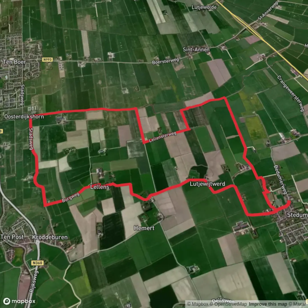
Embarking on the Stedumermaar and Westerwijtwerdermaar via Peertilpad offers a serene 12-kilometer (approximately 7.5-mile) journey through the picturesque landscapes of the Groningen province in the Netherlands. With virtually no elevation gain, this easy trail is ideal for hikers of all levels seeking to immerse themselves in the region's natural beauty and historical charm.
Trail Overview
The hike commences in the quaint village of Stedum, renowned for its historic architecture and tranquil ambiance. As you set out, you'll follow the Peertilpad, a path that meanders alongside the Stedumermaar and Westerwijtwerdermaar canals. These waterways are quintessential features of the Dutch landscape, reflecting the country's rich history of water management and trade.
Key Landmarks and Natural Features
- Stedumermaar and Westerwijtwerdermaar Canals: These canals are central to the trail, offering peaceful waterside views and opportunities to observe local aquatic life.
- Peertil Bridge: Approximately 4 kilometers (2.5 miles) into the hike, you'll encounter the Peertil, a traditional Dutch drawbridge. This charming structure is not only a functional piece of infrastructure but also a nod to the region's architectural heritage.
- Westerwijtwerd Village: Around the 8-kilometer (5-mile) mark, the trail passes through Westerwijtwerd, a small village that boasts historic farms and a serene countryside atmosphere.
Flora and Fauna
The trail traverses a variety of landscapes, including open fields, wetlands, and small wooded areas. Depending on the season, hikers can expect to see a range of wildflowers, particularly in spring and summer. Birdwatchers will appreciate the presence of species such as herons, ducks, and songbirds that inhabit the canal areas.
Historical Significance
The Groningen province is steeped in history, with settlements dating back to the medieval period. The canals along this trail were historically vital for transportation and trade, contributing to the economic development of the region. The villages of Stedum and Westerwijtwerd feature traditional Dutch architecture, including centuries-old churches and farmhouses, offering a glimpse into the area's past.
Getting to the Trailhead
- By Public Transport: Stedum is accessible via train from Groningen Central Station. The journey takes approximately 20 minutes. Upon arrival at Stedum Station, the trailhead is a short walk away.
- By Car: For those driving, Stedum is located about 20 kilometers (12 miles) northeast of Groningen city. Parking is available near the village center, close to the starting point of the hike.
Trail Navigation
To ensure a smooth hiking experience, it's advisable to use a reliable navigation tool. HiiKER offers detailed maps and trail information for this route, assisting hikers in staying on track and making the most of their journey.
Additional Considerations
- Weather: The Netherlands experiences a temperate maritime climate. It's recommended to check the local weather forecast before setting out, as conditions can change rapidly.
- Trail Conditions: The path is well-maintained and primarily flat, making it suitable for hikers of all ages and skill levels. However, after heavy rains, certain sections may become muddy, so appropriate footwear is recommended.
- Amenities: Both Stedum and Westerwijtwerd have limited facilities. It's advisable to carry sufficient water and snacks. Local cafes or shops may be available for refreshments, but their hours can vary.
This hike offers a delightful blend of natural beauty and historical intrigue, providing a peaceful escape into the Dutch countryside.

Surfaces
Concrete
Asphalt
Unknown
Ground
Grass
Wood
Comments and Reviews
User comments, reviews and discussions about the Stedumermaar and Westerwijtwerdermaar via Peertilpad, Netherlands.
average rating out of 5
0 rating(s)