Download
Preview
Add to list
More
21.4 km
~4 hrs 39 min
224 m
Loop
“Wander through Valkenburg’s timeless streets, lush forests, and sweeping hills on a storybook countryside adventure.”
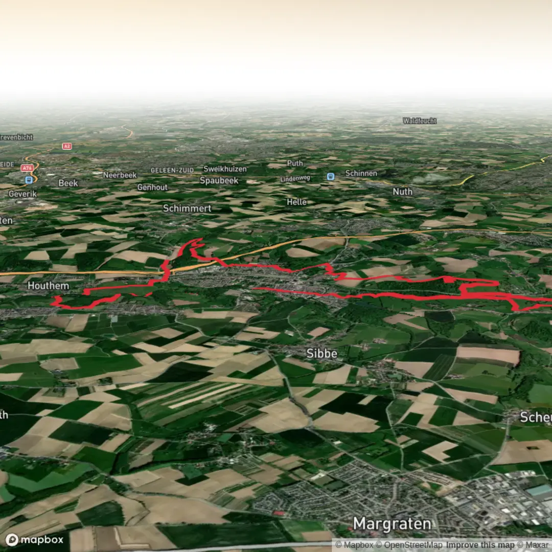
Starting from the outskirts of Valkenburg, a charming town in the South Limburg region of the Netherlands, this 21 km (13 miles) circular hike with approximately 200 metres (656 feet) of elevation gain offers a gentle but immersive exploration of the rolling Dutch countryside. The trailhead is conveniently located near the Valkenburg railway station, making it easily accessible by train from Maastricht, Heerlen, or other regional hubs. For those arriving by car, parking is available near the station or in the town center, which is well-signposted and close to the start of the route.
Through Valkenburg and Up the Schaelsberg
The route begins by weaving through the historic streets of Valkenburg, renowned for its medieval castle ruins and limestone caves. As you leave the town, the path ascends gently towards the Schaelsberg, a wooded hill that rises above the Geul valley. The climb is gradual, making it suitable for most fitness levels, and offers panoramic views over the patchwork of fields and orchards typical of Limburg. At about 3 km (1.9 miles) in, you’ll pass the Schaelsberg Chapel, a small whitewashed pilgrimage site dating back to the 18th century, surrounded by ancient wayside crosses.
Krulsweg and the Ravensbosch Forest
Continuing along the Krulsweg, the trail enters the Ravensbosch, a protected forest area known for its biodiversity. The woodland is home to roe deer, foxes, and a variety of birdlife, including woodpeckers and nuthatches. In spring and early summer, the forest floor is carpeted with wildflowers and ferns. The path here is well-marked but can be muddy after rain, so waterproof footwear is recommended. At around 10 km (6.2 miles), you’ll find several clearings with benches—ideal for a rest or picnic.
Historic Sites and Panoramic Vistas
Emerging from the Ravensbosch, the route skirts the edge of several small hamlets, where traditional half-timbered farmhouses and chapels reflect the region’s rich cultural heritage. The area has been inhabited since Roman times, and you may notice remnants of old field boundaries and sunken lanes, known locally as “holle wegen.” At approximately 15 km (9.3 miles), the trail offers sweeping views across the Geul valley, with the spires of Valkenburg visible in the distance.
Final Stretch and Return to Valkenburg
The final section descends gently back towards Valkenburg, passing through open meadows and orchards. Keep an eye out for kestrels and buzzards circling overhead, as well as the occasional herd of grazing sheep. The last few kilometers follow quiet country lanes and footpaths, eventually leading you back to the town center, where you can explore local cafés or visit the famous Valkenburg caves.
For navigation, the entire route is best followed using the HiiKER app, which provides up-to-date trail maps and waypoints. Public transport options are frequent, with trains and buses connecting Valkenburg to major cities in the region. The hike’s easy rating makes it suitable for families and those looking for a relaxed day out, while the varied scenery and historical landmarks ensure there’s plenty to discover along the way.

Surfaces
Unknown
Asphalt
Dirt
Gravel
Grass
Unpaved
Sand
Ground
Wood
Cobblestone
Concrete
Comments and Reviews
User comments, reviews and discussions about the Krulsweg op de Schaelsberg and Ravensbosch via Valkenburg, Netherlands.
average rating out of 5
0 rating(s)