Download
Preview
Add to list
More
14.5 km
~2 hrs 53 min
0 m
Loop
“Wander through vibrant fields, historic forts, and tranquil wetlands where water, wildlife, and Dutch ingenuity meet.”
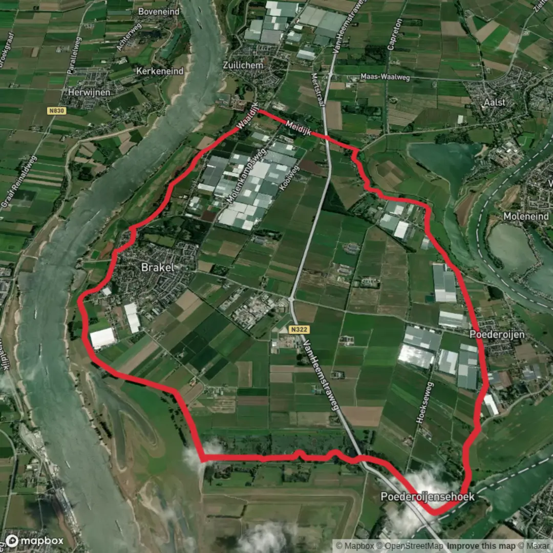
Starting from the outskirts of Waarden, this 14 km (about 8.7 miles) loop trail offers a flat and accessible route, with virtually no elevation gain, making it ideal for hikers of all abilities. The trailhead is conveniently located near the village center, close to the intersection of Waardenseweg and Dorpsstraat, which is easily accessible by both car and public transport. For those arriving by train, the nearest major station is in Gorinchem, from where local buses connect directly to Waarden. Parking is available in the village, and the area is well-signposted for walkers.
Historic Forts and Waterways
The route quickly immerses you in the Dutch polder landscape, characterized by wide open fields, meandering dikes, and tranquil waterways. One of the first significant landmarks is Fort Batterij Onder Brakel, a 19th-century military fortification built as part of the New Dutch Waterline. This UNESCO-listed defense system was designed to flood large areas to protect the country from invaders. The fort itself, located approximately 3 km (1.9 miles) from the start, is surrounded by lush grasslands and reed beds, providing a habitat for waterfowl and other bird species. Interpretive signs detail the fort’s history and its role in Dutch military strategy.
Meidijksche Wielen and Natural Beauty
Continuing along the loop, the trail follows the Meidijk, a historic dike that once protected the land from the unpredictable waters of the River Waal. At around the halfway point, you’ll reach the Meidijksche Wielen, a series of small lakes formed by dike breaches centuries ago. These “wielen” are now peaceful wetlands, rich in biodiversity. Look out for herons, grebes, and sometimes even kingfishers darting across the water. The area is especially beautiful in spring and early summer, when wildflowers bloom along the dike and dragonflies skim the surface of the ponds.
Navigation and Trail Conditions
The entire route is well-marked and follows a combination of paved paths and grassy dike tops. There are no steep sections, and the terrain remains level throughout, with a total elevation gain of less than 5 metres (16 feet). Hikers should be prepared for potentially muddy sections after rain, especially near the wielen. For navigation, the HiiKER app provides detailed maps and waypoints, ensuring you stay on track and don’t miss any points of interest.
Practical Tips and Local Amenities
There are several benches and picnic spots along the route, particularly near the fort and the lakes, making it easy to take breaks and enjoy the scenery. Public toilets and small cafés can be found in Waarden at the start and end of the hike. The trail is suitable for families and those seeking a leisurely day out, with plenty of opportunities for birdwatching and photography. Dogs are allowed on a leash, but be mindful of grazing livestock in some sections.
This loop offers a unique blend of Dutch history, engineering, and natural beauty, all within a manageable distance and with easy logistics for both local and visiting hikers.

Surfaces
Asphalt
Unknown
Concrete
Grass
Comments and Reviews
User comments, reviews and discussions about the Waarden, Fort Batterij Onder Brakel and Meidijksche Wielen Loop, Netherlands.
average rating out of 5
0 rating(s)