Download
Preview
Add to list
More
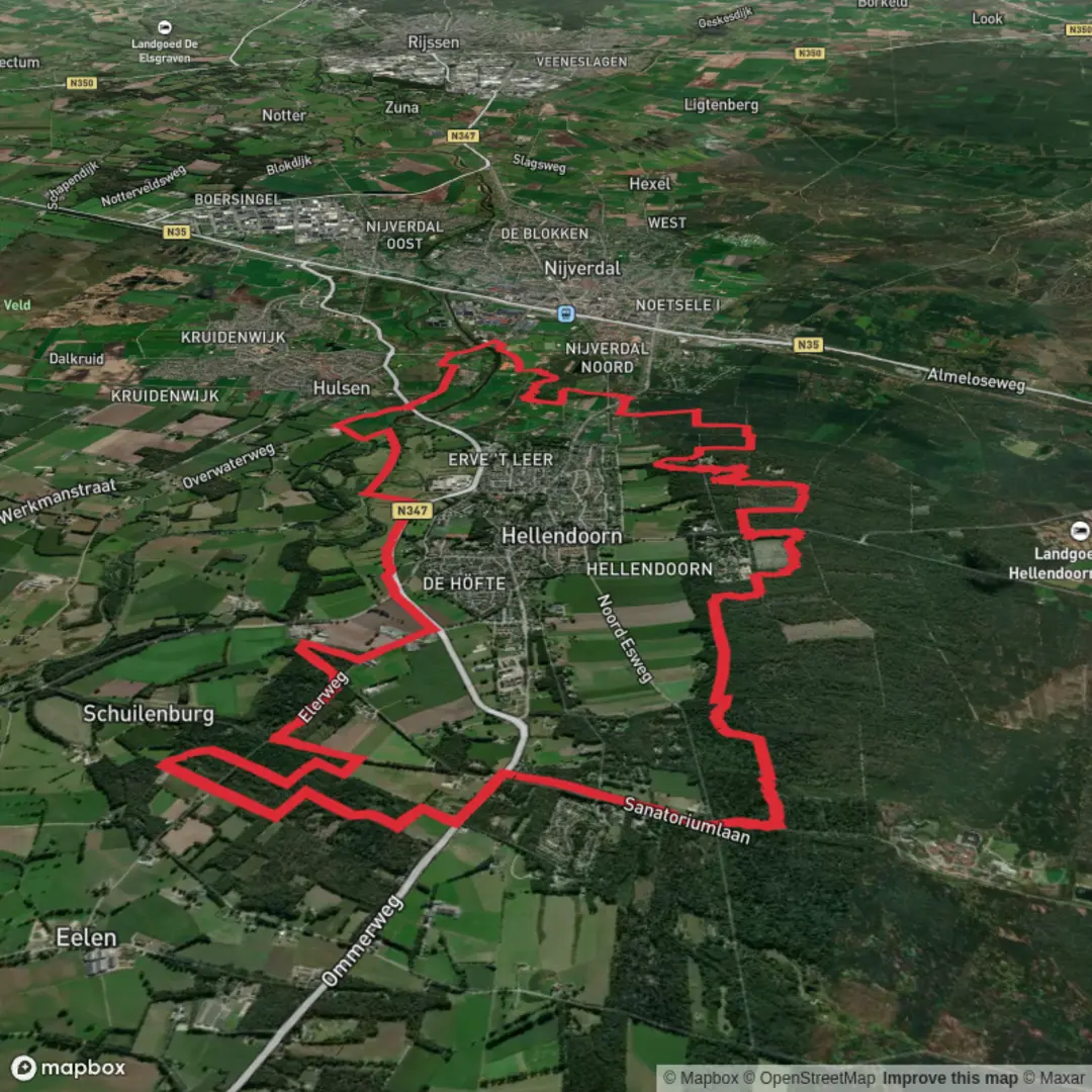
18.9 km
~3 hrs 51 min
53 m
Loop
“Wander through golden forests, blooming heathlands, and patchwork fields on this vibrant Dutch countryside loop.”
The Loobs, Koemaste, and Bruggenbelt Loop is a scenic 19-kilometer (approximately 11.8-mile) circular trail with an elevation gain of around 100 meters (328 feet), offering an easy hiking experience suitable for most fitness levels.
Trailhead Location and Access
The trailhead is situated near the town of Rijssen in the province of Overijssel, Netherlands. For those traveling by car, Rijssen is accessible via the A1 motorway, with parking available near the trail's starting point. Public transportation options include trains to Rijssen station, followed by a short bus ride or walk to the trailhead.
Trail Overview
The loop encompasses a variety of landscapes, including dense forests, open heathlands, and agricultural fields, providing hikers with a diverse and picturesque journey through the Dutch countryside.
Key Landmarks and Points of Interest
- Loobs Forest: Approximately 5 kilometers (3.1 miles) into the hike, you'll enter the Loobs Forest, known for its towering oak and beech trees. This section offers a serene atmosphere and is particularly beautiful during autumn when the foliage turns vibrant shades of red and gold.
- Koemaste Heathlands: Around the 10-kilometer (6.2-mile) mark, the trail opens up to the Koemaste Heathlands. This area is characterized by expansive heath covered in purple heather blooms during late summer. It's an excellent spot for birdwatching, with species such as the European stonechat and the common linnet frequently spotted.
- Bruggenbelt Agricultural Fields: As you approach the 15-kilometer (9.3-mile) point, the landscape transitions to the Bruggenbelt area, featuring traditional Dutch farmland. Here, you'll see a patchwork of fields separated by narrow canals, a testament to the Netherlands' rich agricultural heritage.
Flora and Fauna
Throughout the hike, you'll encounter a variety of plant and animal life. The forests are home to deer and foxes, while the heathlands support reptiles like the common lizard. Wildflowers, including orchids and bell heather, add splashes of color along the trail.
Historical Significance
The region has a rich history dating back to medieval times. The agricultural practices observed in the Bruggenbelt area reflect centuries-old methods of land management. Additionally, remnants of ancient cart tracks and boundary stones can be found along the route, offering glimpses into the area's past.
Navigation and Safety
The trail is well-marked, but it's advisable to use a reliable navigation tool like HiiKER to ensure you stay on course. The terrain is generally flat with some gentle inclines, making it suitable for hikers of all ages. However, certain sections can become muddy after rainfall, so appropriate footwear is recommended.
Amenities
Facilities such as restrooms and picnic areas are available at the trailhead and at designated points along the route. It's advisable to carry sufficient water and snacks, as amenities may be sparse in the more remote sections of the trail.
This loop offers a delightful combination of natural beauty, wildlife, and historical insights, making it a rewarding experience for those looking to explore the Dutch countryside.

Surfaces
Unknown
Asphalt
Sand
Ground
Grass
Unpaved
Dirt
Cobblestone
Wood
Comments and Reviews
User comments, reviews and discussions about the Loobs, Koemaste and Bruggenbelt Loop, Netherlands.
average rating out of 5
0 rating(s)