Download
Preview
Add to list
More
8.1 km
~1 hrs 37 min
0 m
Loop
“Stroll through storybook meadows, dikes, and castles, where Dutch history and wildlife color every step.”
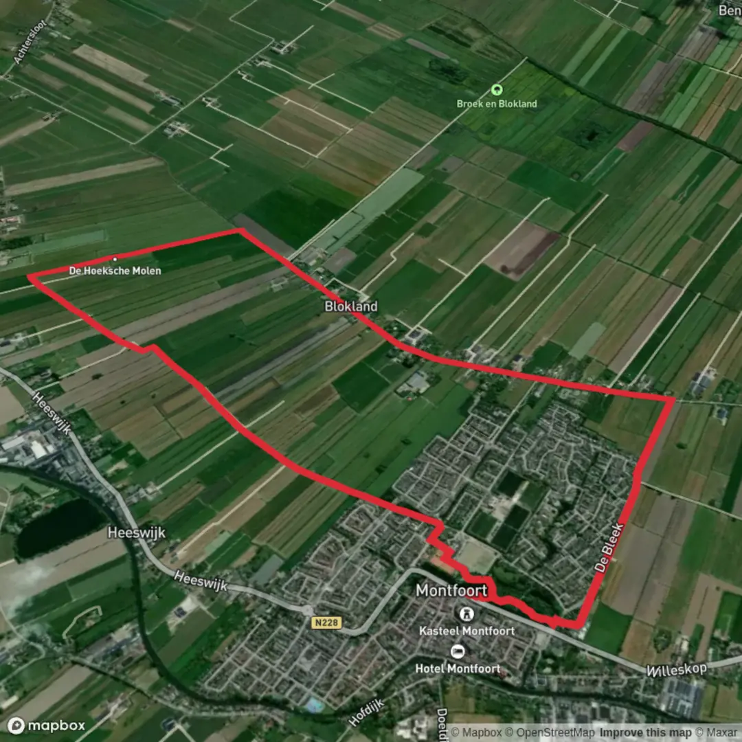
Starting near the charming Dutch town of Montfoort, this 8 km (about 5 miles) loop offers a gentle, flat walk through the heart of the Utrecht countryside, with virtually no elevation gain—perfect for those seeking a leisurely day out. The trailhead is conveniently located close to Montfoort’s historic center, easily accessible by local bus from Utrecht Centraal station (bus lines 107 or 505, alighting at Montfoort, Centrum), or by car with parking available near the town’s main square.
Navigating the Route
The loop is well-marked and follows a combination of quiet country lanes, dike paths, and rural tracks. For precise navigation, HiiKER provides a detailed digital map of the route, ensuring you stay on track through the open fields and alongside the waterways that define this region.
Landmarks and Points of Interest
Shortly after leaving Montfoort, you’ll pass the centuries-old Montfoort Castle, a striking reminder of the town’s medieval heritage. The castle, now a venue for events, stands as a testament to the area’s strategic importance during the Middle Ages. As you continue, the route leads you through the hamlet of Blokland, a peaceful cluster of traditional Dutch farmhouses surrounded by lush meadows and grazing livestock.
Nature and Wildlife
The landscape is quintessentially Dutch: wide, open polders bordered by canals, with expansive views across the flat countryside. In spring and summer, the meadows are alive with wildflowers and the calls of lapwings, godwits, and other wading birds. The waterways attract herons and, if you’re lucky, you might spot a kingfisher darting along the banks. The absence of significant elevation makes this loop ideal for birdwatching and photography.
Historical Significance
Montfoort itself dates back to the 12th century and was once a fortified town guarding the route between Utrecht and Gouda. The surrounding farmland has been shaped by centuries of Dutch water management, with dikes and drainage canals crisscrossing the landscape. The trail offers a glimpse into the Netherlands’ ongoing relationship with water, as you walk atop dikes that have protected these lands for generations.
Trail Conditions and Preparation
Expect well-maintained paths suitable for all fitness levels, with surfaces ranging from paved lanes to grassy tracks. Waterproof footwear is recommended in wetter months, as some sections can become muddy. There are no steep climbs or descents, making the route accessible for families and casual walkers.
Getting There and Facilities
Montfoort is about 15 km (9 miles) west of Utrecht and is well-served by public transport. From the bus stop at Montfoort Centrum, it’s a short walk to the trailhead. For those driving, parking is available near the historic town center. Facilities along the route are limited, but Montfoort offers several cafes and shops for refreshments before or after your walk.
For up-to-date trail maps and navigation, consult HiiKER to ensure a smooth and enjoyable experience on this scenic Dutch loop.

Surfaces
Asphalt
Unknown
Gravel
Wood
Comments and Reviews
User comments, reviews and discussions about the Blokland and Montfoort Loop, Netherlands.
average rating out of 5
0 rating(s)