Download
Preview
Add to list
More
19.5 km
~3 hrs 54 min
7 m
Loop
“Wander through tranquil canals, vibrant wetlands, and shaded forests, where history and nature beautifully intertwine.”
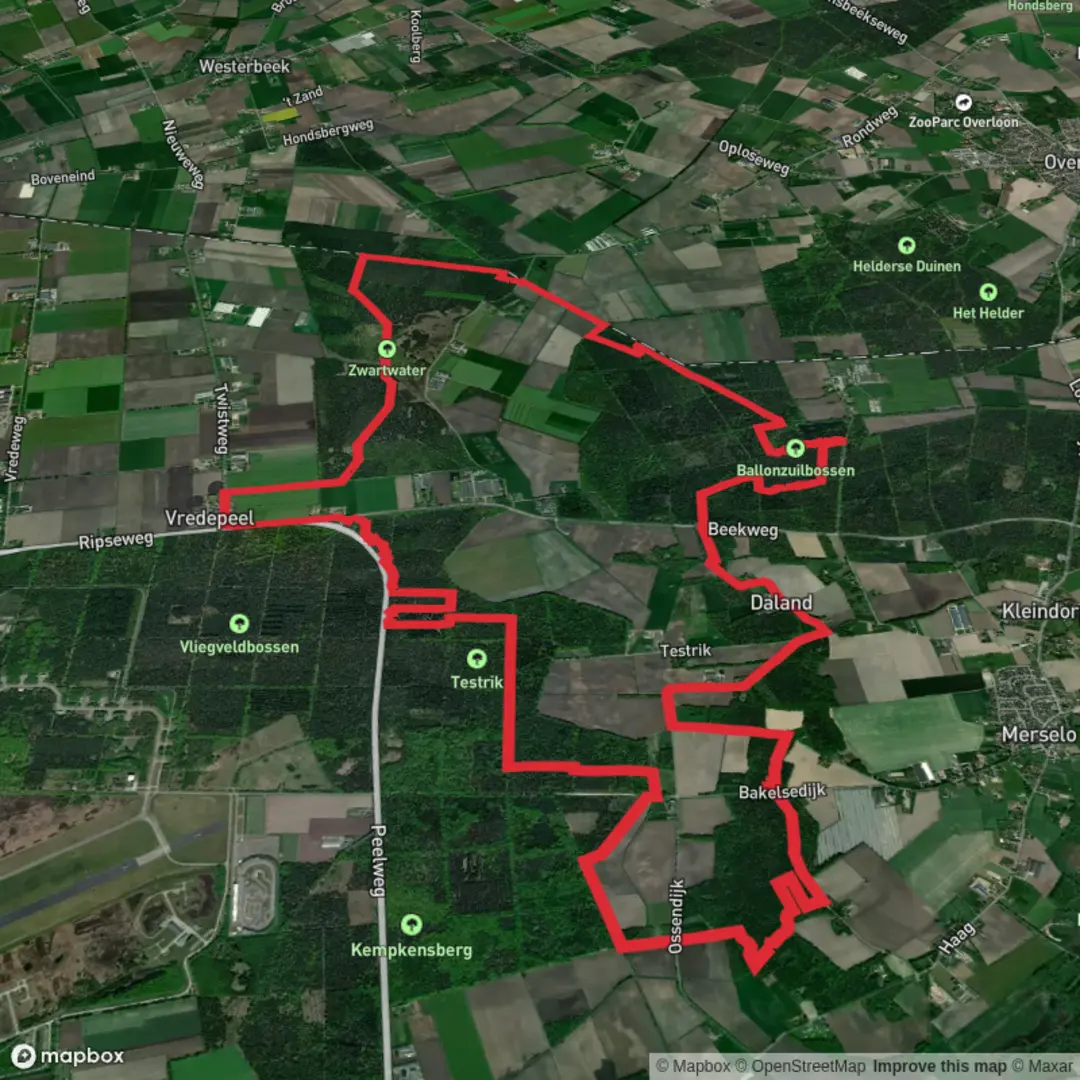
Starting from the outskirts of Venray, near the recognizable landmark of Ballonzuil, this 20 km (about 12.4 miles) loop offers a flat and accessible route with virtually no elevation gain, making it ideal for hikers of all abilities. The trailhead is easily reached by car via the N270, with parking available near Ballonzuil, or by public transport with regular buses from Venray station stopping nearby.
Navigating the Route
The loop follows a well-marked path through a diverse landscape, and navigation is straightforward with the HiiKER app, which provides reliable offline maps and waypoints. The route begins by skirting the Afleidingskanaal, a man-made canal constructed in the early 20th century to manage water levels in the region. This section is characterized by tranquil water views and the occasional sighting of waterfowl such as herons and ducks.
Zwartwater Nature Reserve
After approximately 5 km (3.1 miles), the trail enters the Zwartwater nature reserve, a mosaic of wetlands, heath, and woodland. This area is particularly rich in biodiversity, with the chance to spot roe deer, foxes, and a variety of songbirds. The reserve is also known for its rare plant species, including orchids in late spring and summer. Boardwalks and well-maintained paths keep feet dry even after rain.
Ballonzuilbossen Forest
At around the 12 km (7.5 miles) mark, the trail transitions into the Ballonzuilbossen, a mixed forest named after the historic Ballonzuil monument. This obelisk commemorates the first Dutch hot air balloon flight in 1896 and is a notable waypoint. The forest itself is peaceful, with tall pines and beech trees providing shade and shelter for woodland creatures. Benches along the way offer spots for rest and quiet observation.
Historical and Cultural Highlights
The region’s history is woven into the landscape, from the canal’s engineering heritage to the Ballonzuil monument’s celebration of early aviation. Informational signs along the route provide context about the area's transformation from marshland to managed nature reserve and forest.
Practical Information
The entire loop is on flat terrain, with a total elevation gain of less than 5 metres (16 feet), making it suitable for families and those seeking a leisurely day out. The path is mostly unpaved but well-maintained, and there are several picnic areas and shelters along the way. Dogs are allowed on leash, and cyclists may share some sections of the route.
For those arriving by public transport, Venray train station connects to regional bus lines that stop near the Ballonzuil monument, just a short walk from the trailhead. For drivers, parking is available at the Ballonzuil car park, with clear signage to the start of the loop.
Hikers are encouraged to bring water, snacks, and weather-appropriate clothing, as services along the route are limited. The HiiKER app is recommended for navigation and up-to-date trail information.

Surfaces
Unknown
Unpaved
Asphalt
Concrete
Sand
Comments and Reviews
User comments, reviews and discussions about the Afleidingskanaal, Zwartwater and Ballonzuilbossen Loop, Netherlands.
average rating out of 5
0 rating(s)