Download
Preview
Add to list
More
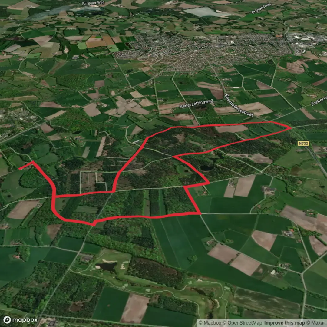
8.2 km
~1 hrs 41 min
27 m
Loop
“Wander through blooming heather and ancient forests on a trail where Dutch and German stories entwine.”
The Noaberpad and Hillingenpad Loop is an approximately 8-kilometer (5-mile) circular trail with minimal elevation gain, offering an easy and enjoyable hiking experience. This route traverses the scenic borderlands between the Netherlands and Germany, immersing hikers in a landscape rich with natural beauty and historical significance.
Trailhead and Access
The trailhead is conveniently located near the village of Bad Nieuweschans in the province of Groningen, Netherlands. For those traveling by public transport, Bad Nieuweschans is accessible via train from Groningen, with the journey taking approximately 45 minutes. If arriving by car, parking is available near the train station or in designated areas within the village.
Trail Overview
Beginning in Bad Nieuweschans, the loop follows sections of the Noaberpad, a long-distance trail that meanders along the Dutch-German border, and the Hillingenpad, a regional path showcasing the area's diverse landscapes. The route is well-marked, guiding hikers through a variety of terrains, including open fields, dense woodlands, and serene waterways.
Natural Highlights
- Buurserzand Nature Reserve: As you progress along the trail, you'll encounter the Buurserzand, a protected heathland known for its unique flora and fauna. This area is particularly vibrant during late summer when the heather blooms, painting the landscape in shades of purple.
- Reichswald Forest: Crossing into Germany, the trail leads through the Reichswald, one of the largest contiguous forests in the region. This dense woodland is home to a variety of wildlife, including deer and numerous bird species, making it a haven for nature enthusiasts.
Historical Significance
The border region has a rich history of neighborly relations, as reflected in the name "Noaberpad," derived from the Dutch word "noaber," meaning neighbor. For centuries, communities on both sides of the border have shared cultural and economic ties, a legacy evident in the architecture and traditions of the villages along the route.
Navigation and Preparation
To ensure a smooth hiking experience, it's advisable to use the HiiKER app for detailed maps and trail information. The app provides up-to-date data on trail conditions, points of interest, and amenities along the route.
Getting There
- By Public Transport: From Groningen, take a train to Bad Nieuweschans. The train station serves as a convenient starting point for the hike.
- By Car: Drive to Bad Nieuweschans via the A7 motorway. Parking is available near the train station or in designated areas within the village.
Additional Tips
- Seasonal Considerations: While the trail is accessible year-round, the best times to hike are during spring and late summer when the flora is most vibrant.
- Amenities: Facilities such as restrooms and cafes can be found in Bad Nieuweschans and other villages along the route.
- Trail Conditions: The path is predominantly flat and well-maintained, suitable for hikers of all skill levels.
Embarking on the Noaberpad and Hillingenpad Loop offers a delightful blend of natural beauty and cultural heritage, providing a memorable experience for all who traverse its path.

Surfaces
Unknown
Sand
Asphalt
Gravel
Comments and Reviews
User comments, reviews and discussions about the Noaberpad and Hillingenpad Loop, Netherlands.
average rating out of 5
0 rating(s)