Kadoelerbos via Dagwandeling Oud-Kraggenburg and Zuiderzeepad Loop
Download
Preview
Add to list
More
10.8 km
~2 hrs 10 min
7 m
Loop
“Stroll through vibrant woodlands and across storied dikes, where wildflowers and history bloom together.”
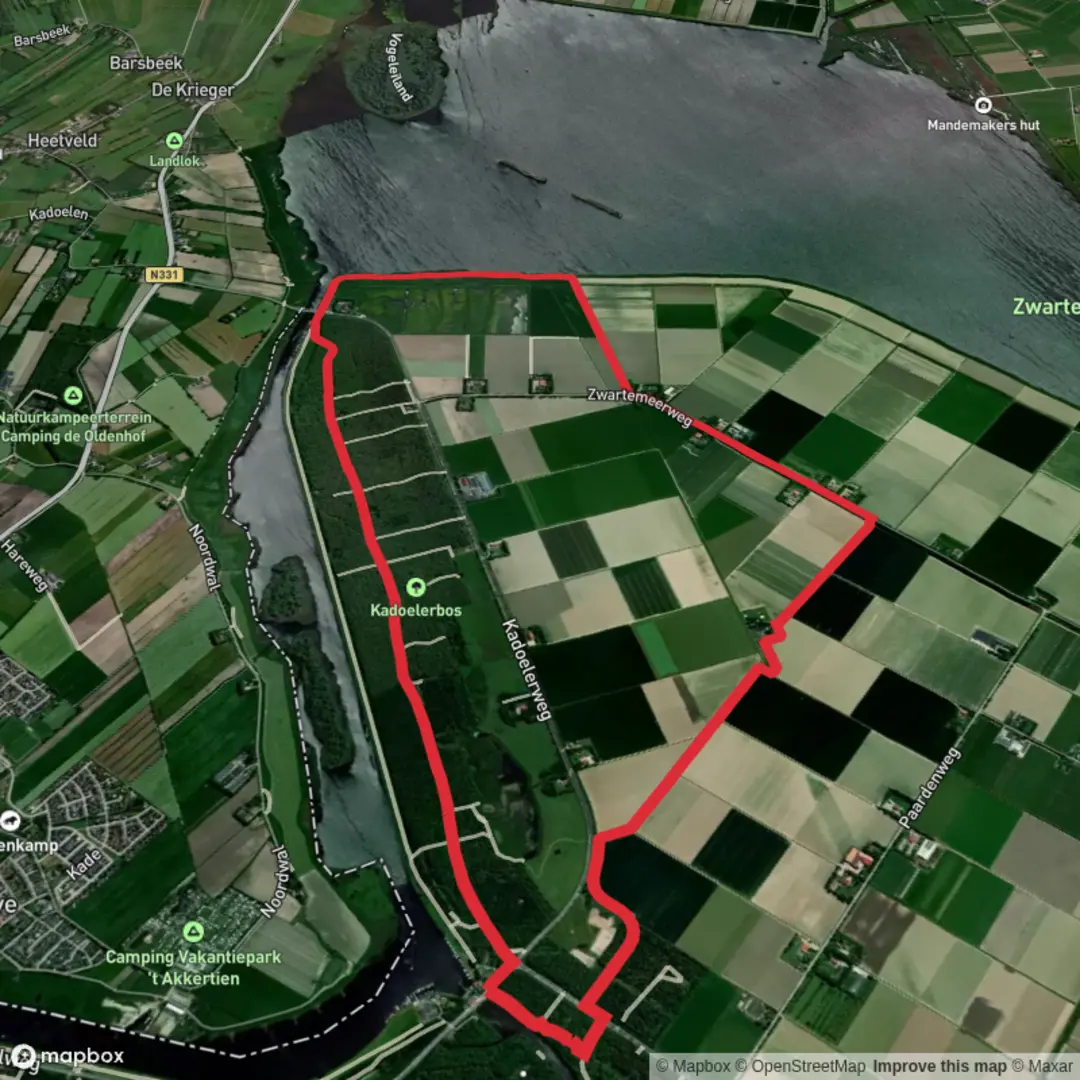
Starting from the edge of the Kadoelerbos, this 11 km (about 6.8 miles) loop offers a gentle, flat walk with virtually no elevation gain, making it accessible for most hikers. The trailhead is conveniently located near the village of Kraggenburg, in the province of Flevoland, Netherlands. For those arriving by car, parking is available near the Kadoelerbos recreational area, close to the intersection of Kadoelerbosweg and Voorsterweg. If using public transport, buses from Emmeloord or Kampen stop at Kraggenburg, from where it’s a short walk to the forest entrance.
Trail Overview and Navigation
The route combines sections of the Dagwandeling Oud-Kraggenburg and the Zuiderzeepad, a long-distance path tracing the historic coastline of the former Zuiderzee. Navigation is straightforward, with well-marked paths and signposts at major junctions. For precise route guidance, HiiKER provides detailed maps and GPS tracks, ensuring you stay on course through the varied landscapes.
Natural Features and Wildlife
The Kadoelerbos is a young, mixed woodland planted on reclaimed land, part of the Noordoostpolder. Expect to walk beneath canopies of oak, birch, and willow, with open glades and grassy clearings. In spring and summer, wildflowers line the paths, and the air is alive with birdsong. Look out for woodpeckers, buzzards, and the occasional roe deer. The forest edges transition into open polder fields, where hares and pheasants are common sights.
Historical Significance and Landmarks
This region is steeped in history, shaped by the ambitious land reclamation projects of the 20th century. The Zuiderzeepad section follows the old sea dike, a reminder of the days when the Zuiderzee was a vast inland sea threatening the Dutch heartland. Along the way, you’ll pass the Oud-Kraggenburg lighthouse, a striking cast-iron structure built in 1877 to guide ships through the treacherous waters before the polder was created. The lighthouse now stands marooned in farmland, a unique relic of the area’s maritime past.
Route Highlights
- At approximately 3 km (1.9 miles), the trail skirts the edge of the Kadoelerbos, offering views across the open polder and glimpses of the distant Ketelmeer. - Around 5 km (3.1 miles), you’ll reach the Oud-Kraggenburg lighthouse, a perfect spot for a break and photos. - The return leg follows the Zuiderzeepad, with interpretive panels explaining the history of the dikes and the transformation of sea to land.
Trail Conditions and Preparation
The paths are mostly wide, well-maintained, and suitable for all fitness levels. Surfaces range from compacted earth to gravel, with occasional grassy stretches. Waterproof footwear is recommended in wetter months, as some sections can become muddy. There are no significant climbs, and the total elevation gain is negligible, making this loop ideal for families or those seeking a relaxed day out.
Facilities are limited along the route, so bring water and snacks. Benches and picnic spots are available at intervals, particularly near the forest entrance and the lighthouse. Toilets can be found at the main parking area.
For up-to-date trail conditions and downloadable maps, consult HiiKER before setting out.

Surfaces
Concrete
Asphalt
Unknown
Gravel
Dirt
Paved
Comments and Reviews
User comments, reviews and discussions about the Kadoelerbos via Dagwandeling Oud-Kraggenburg and Zuiderzeepad Loop, Netherlands.
average rating out of 5
0 rating(s)