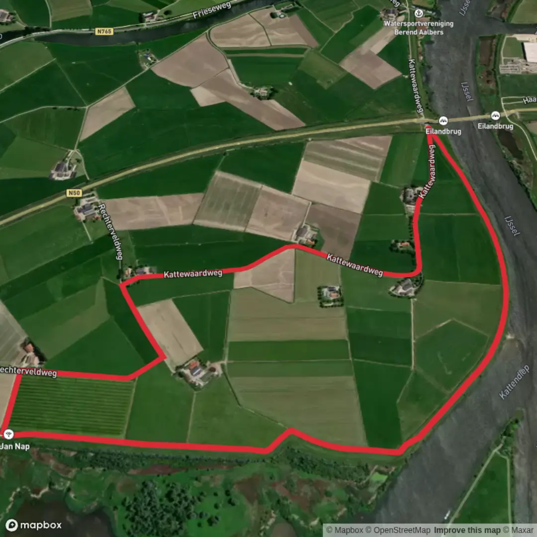
Kattendiep via Kattewaard Weg and WNW Ijsseldelta - Ketelmeer Orange Route
Download
Preview
Add to list
More
5.8 km
~1 hrs 9 min
0 m
Loop
“Stroll through sweeping Dutch polder vistas, where wildflowers, waterbirds, and centuries of history color the journey.”
Starting from the outskirts of Kampen, near the Kattewaardweg, this 6 km (about 3.7 miles) loop through the Ijsseldelta region is a flat, easy walk with virtually no elevation gain, making it accessible for all levels of hikers. The trailhead is conveniently reached by car, with parking available near Kattewaardweg, or by public transport—take a train to Kampen and a local bus or a short taxi ride to the starting point.
Navigating the Route
The path follows the Kattewaardweg and then loops west-northwest along the Ijsseldelta, skirting the Ketelmeer on the Orange Route. Navigation is straightforward, but for added confidence and real-time updates, use HiiKER to track your progress and stay on course.
Landscapes and Natural Highlights
Expect wide, open Dutch polder landscapes, with expansive views across the delta. The route passes through grassy floodplains, reed beds, and alongside tranquil waterways. In spring and summer, wildflowers line the dikes, and the air is filled with birdsong. The Ijsseldelta is a haven for birdwatchers—look for spoonbills, herons, and migratory geese, especially near the water’s edge. The Ketelmeer itself is a broad, shallow lake formed where the IJssel river meets the former Zuiderzee, now the IJsselmeer, and is a key stopover for waterfowl.
Historical and Cultural Points
This region is steeped in Dutch water management history. The dikes and polders you walk along are centuries-old feats of engineering, protecting the land from flooding and reclaiming fertile ground from the water. The nearby city of Kampen, visible from parts of the route, was a powerful Hanseatic trading port in the Middle Ages, and its skyline with church towers and old warehouses is a reminder of its prosperous past.
Trail Conditions and Practical Tips
The trail surface is a mix of paved dike roads and grassy paths, suitable for sturdy walking shoes but generally not technical. There are no significant climbs or descents, and the route is exposed, so bring sun protection and windproof clothing. Facilities are limited along the trail, so carry water and snacks. The open landscape means weather can change quickly—check forecasts before setting out.
Getting There
By car, head to Kattewaardweg, Kampen, and look for parking near the dike. For public transport, take a train to Kampen station, then use a local bus or taxi to reach the trailhead. The area is well-signposted, and the start is easy to find.
For up-to-date trail conditions and navigation, HiiKER provides detailed maps and route tracking to ensure a smooth and enjoyable hike.

Surfaces
Concrete
Asphalt
Unknown
Comments and Reviews
User comments, reviews and discussions about the Kattendiep via Kattewaard Weg and WNW Ijsseldelta - Ketelmeer Orange Route, Netherlands.
average rating out of 5
0 rating(s)