Download
Preview
Add to list
More
35.7 km
~2 days
6 m
Multi-Day
“Stroll from Almere Haven’s vibrant harbor to city lights, tracing tranquil lakeshores and lively marinas.”
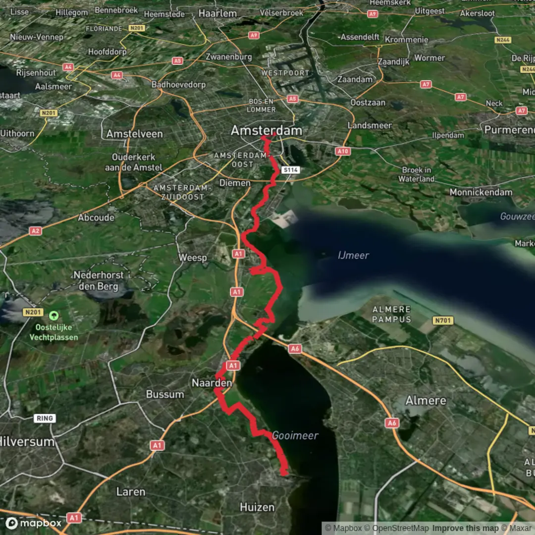
Starting from the lively harbor area of Almere Haven, this 36 km (about 22.4 miles) route offers a flat, easy journey through the heart of Flevoland, with virtually no elevation gain—perfect for those seeking a long but gentle walk. The trail follows the waterfront of Gooimeer, passing through the marina at Jachthaven and continuing toward the urban center of Almere Centrum.
Getting There
Almere Haven is easily accessible by public transport. From Amsterdam Central Station, frequent trains run to Almere Centrum, where you can transfer to a local bus (such as line 1 or 3) that takes you directly to Almere Haven. For those arriving by car, parking is available at the harbor area, particularly near Sluiskade or the marina parking lots.
Route Highlights and Navigation
The trail begins at the bustling Almere Haven harbor, a hub of local activity with cafés and waterfront views. Heading east, the path hugs the shoreline of Gooimeer, a broad lake formed during the reclamation of Flevoland in the 20th century. The route is well-marked and follows paved and gravel paths, making it suitable for all fitness levels. For precise navigation and up-to-date trail conditions, use HiiKER, which provides detailed maps and waypoints.
Nature and Wildlife
As you skirt the Gooimeer, keep an eye out for waterfowl such as grebes, swans, and herons. The reed beds along the shore are home to a variety of bird species, especially during migration seasons. The trail also passes through patches of woodland and open parkland, where you might spot rabbits and, in spring, a burst of wildflowers.
Significant Landmarks
At approximately 8 km (5 miles), you’ll reach Jachthaven, a marina filled with sailboats and a popular spot for a rest. Here, you can enjoy views across the water and perhaps grab a snack at one of the marina cafés. Continuing along the Gooimeer, the route offers panoramic vistas of the lake and, on clear days, distant views of the Gooi region’s wooded hills.
Urban Transition and Historical Context
Around the 25 km (15.5 miles) mark, the landscape shifts as you approach Almere Stad, the city’s modern urban core. Almere is one of the newest cities in the Netherlands, built on land reclaimed from the sea in the 1970s. The city’s architecture is strikingly contemporary, with innovative buildings and green spaces designed for sustainable living.
Finishing at Almere Centrum
The trail concludes at Almere Centrum, the city’s main transport hub and shopping district. Here, you’ll find plenty of options for food and relaxation, as well as direct train connections back to Amsterdam and other major cities.
Preparation Tips
Given the flat terrain and well-maintained paths, standard walking shoes are sufficient. Bring water and snacks, as services are limited between Jachthaven and Almere Stad. Weather can be changeable near the water, so pack a light rain jacket. The route is exposed in places, so sun protection is recommended on clear days.
For navigation, HiiKER offers the most reliable mapping and route information for this trail.

Surfaces
Unknown
Asphalt
Grass
Dirt
Sand
Concrete
Wood
Paved
Comments and Reviews
User comments, reviews and discussions about the Haven to Centrum via Jachthaven and Gooimeer, Netherlands.
average rating out of 5
0 rating(s)