Download
Preview
Add to list
More
9.2 km
~1 hrs 50 min
0 m
Loop
“Wander through a tapestry of wildflowers, waterways, and history where Dutch nature gently embraces the past.”
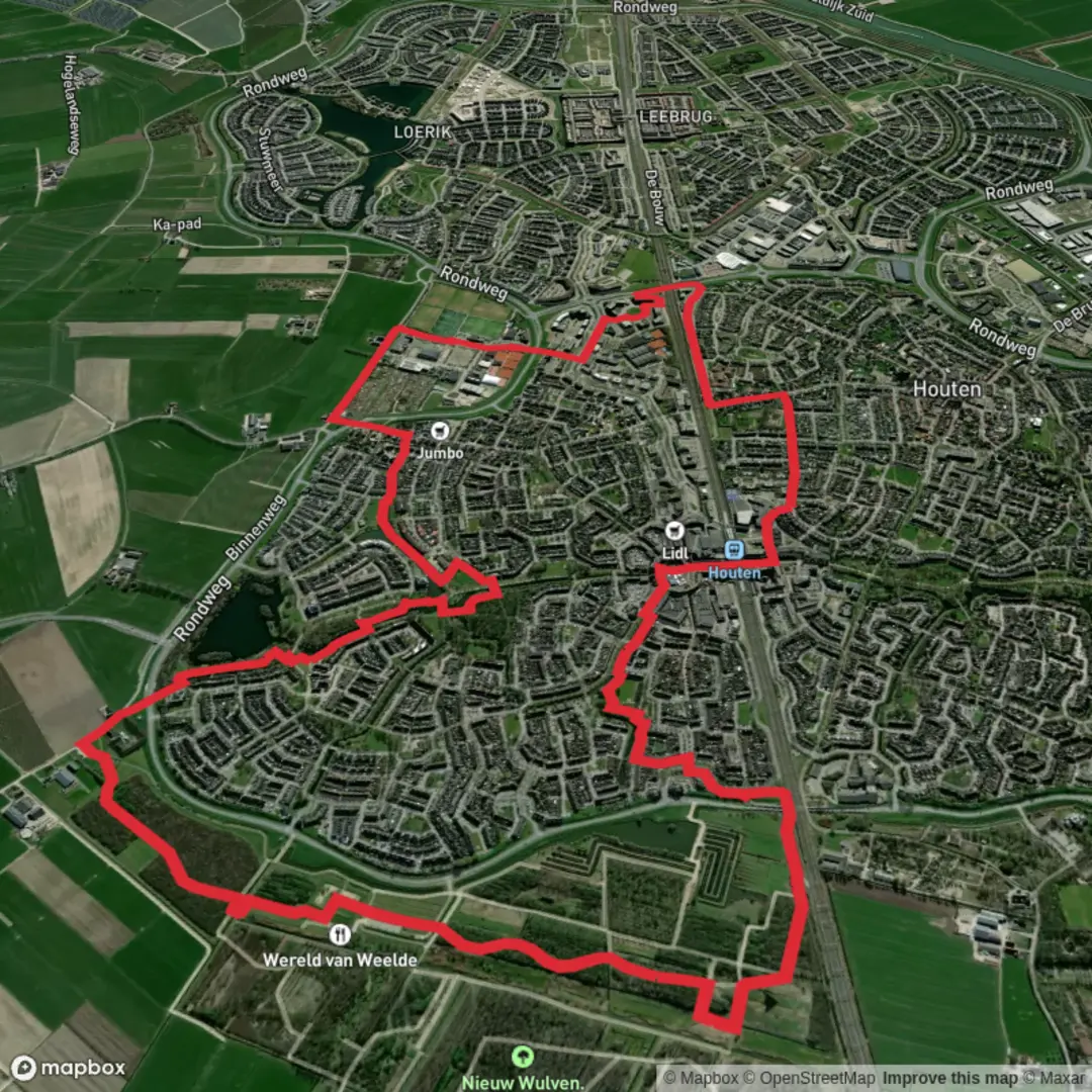
Starting from the vicinity of Houten Castellum train station, this 9 km (about 5.6 miles) loop offers a gentle, flat walk with virtually no elevation gain, making it accessible for most walkers and families. The route weaves through the green corridors and water features of the Utrecht region, blending modern Dutch suburbia with pockets of rich history and natural beauty.
Getting There
The trailhead is easily reached by public transport: take a train to Houten Castellum station, which is well-connected to Utrecht Centraal and other regional hubs. From the station, it’s a short walk to the start of the route. For those arriving by car, parking is available near the station and at several points around Nieuw Wulven park.
Nieuw Wulven Park and Wetlands
The first section leads you into Nieuw Wulven, a spacious parkland on the edge of Houten. This area is a mosaic of open meadows, young woodland, and ponds, designed for both recreation and wildlife. In spring and summer, look for wildflowers along the paths and listen for the calls of songbirds and waterfowl. The park is also home to grazing cattle and sheep, which help maintain the landscape.
Het Grote Fort and Historical Context
At roughly the halfway point, you’ll encounter Het Grote Fort, part of the New Dutch Waterline (Nieuwe Hollandse Waterlinie), a UNESCO World Heritage site. This 19th-century defensive structure was built to protect the heart of the Netherlands by controlled flooding. The fort’s grassy ramparts and moats are now peaceful, but interpretive signs explain their military past. Pause here to appreciate the blend of nature reclaiming history—herons and ducks often nest in the old moat.
Kooikersplas and Waterways
Continuing north, the route skirts the Kooikersplas, a tranquil lake popular with local anglers and birdwatchers. The reed beds and quiet waters attract a variety of waterbirds, including grebes and coots. Benches along the shore provide a good spot for a break or picnic. The path then follows a series of small canals and dikes, typical of the Dutch polder landscape, before looping back toward Houten.
Navigation and Trail Conditions
The entire route is well-marked and follows a mix of paved and gravel paths, suitable for walking year-round. Use HiiKER for up-to-date navigation and trail information. Expect mostly flat terrain, with total elevation gain negligible—less than 10 metres (about 30 feet) over the whole walk. Sturdy walking shoes are recommended, especially after rain when some sections may be muddy.
Wildlife and Seasonal Highlights
Throughout the year, the area supports a variety of wildlife. In addition to birds, you may spot rabbits, foxes, and the occasional roe deer in quieter corners. Spring brings blossoms and butterflies, while autumn colors the woodlands with golden leaves.
Facilities and Refreshments
There are several rest areas and playgrounds in Nieuw Wulven, making this route family-friendly. Cafés and shops can be found near Houten Castellum station for pre- or post-hike refreshments. Public toilets are available at the park entrance and near the station.
This easy, scenic loop is ideal for those seeking a blend of Dutch history, nature, and accessible walking close to Utrecht.

Surfaces
Asphalt
Unknown
Wood
Gravel
Grass
Concrete
Comments and Reviews
User comments, reviews and discussions about the Het Grote Fort and Kooikersplas via Nieuw Wulven and Stationserf, Netherlands.
average rating out of 5
0 rating(s)