Download
Preview
Add to list
More
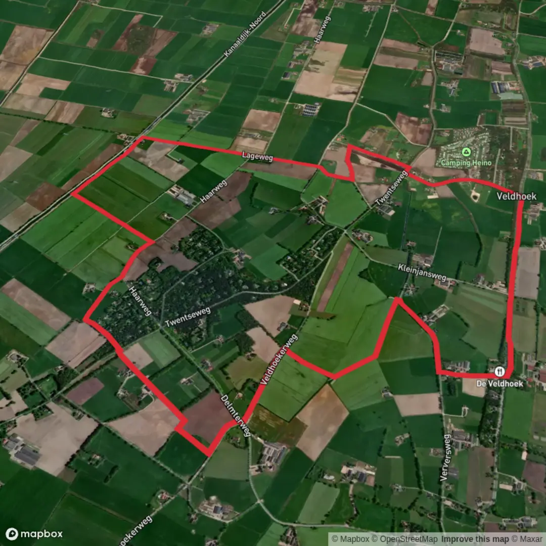
8.9 km
~1 hrs 47 min
0 m
Loop
“Wander through a vibrant mosaic of heath, forest, and history, where nature and stories intertwine.”
Starting near the charming village of Haarle in the Overijssel province of the Netherlands, this loop trail covers approximately 9 km (about 5.6 miles) with virtually no elevation gain, making it an accessible and enjoyable walk for hikers of all abilities. The trailhead is conveniently located close to Haarle’s main street, Dorpsstraat, which serves as a recognizable landmark for those arriving by car or public transport. Ample parking is available in the village, and local buses from Nijverdal or Raalte stop within a short walk of the starting point.
Trail Overview and Navigation
The route combines sections of the Haar Weg and the Sallandpad, weaving through the heart of the Sallandse Heuvelrug National Park. The terrain is predominantly flat, with well-maintained paths that alternate between sandy tracks, forest trails, and open heathland. Navigation is straightforward, but for added confidence and up-to-date trail conditions, hikers are encouraged to use HiiKER, which provides detailed maps and waypoints for this loop.
Natural Highlights and Wildlife
The landscape is a patchwork of heath, pine forests, and open fields, especially vibrant in late summer when the heather blooms in shades of purple. Birdwatchers will appreciate the chance to spot species such as the European nightjar and woodlark, both of which thrive in the heathland habitat. Roe deer are occasionally seen at dawn or dusk, and the area is also home to foxes and a variety of butterflies.
Cultural and Historical Significance
The region’s history is deeply tied to agriculture and land reclamation. The Haar Weg itself is an old trade route, once used by farmers and merchants traveling between villages. Along the way, you’ll pass traditional Dutch farmhouses and may notice remnants of ancient field systems, known locally as “essen.” The Sallandse Heuvelrug area also played a role during World War II, with several memorials and information boards detailing local resistance efforts and the impact of the war on rural communities.
Points of Interest
At around 3 km (1.9 miles), the trail skirts the edge of the Holterberg, a low ridge that offers expansive views across the heath. This is a popular spot for a rest or picnic. The nearby visitor center, Natuurmuseum Holterberg, is worth a short detour for those interested in learning more about the region’s flora and fauna. Further along, the path passes close to the Haarlerberg, another gentle rise with panoramic vistas.
Practical Information
The loop is well-marked and suitable for families, with benches and picnic spots scattered throughout. There are no significant climbs, and the paths are generally accessible year-round, though sections can be sandy or muddy after rain. Public toilets and refreshments are available in Haarle and at the Holterberg visitor center. Dogs are welcome but should be kept on a leash in nature reserve areas.
For those planning their journey, the nearest train stations are in Nijverdal and Raalte, both offering regular bus connections to Haarle. Cyclists will find bike racks at the trailhead, and the route is also popular with local walkers and nature enthusiasts.

Surfaces
Grass
Unknown
Asphalt
Concrete
Sand
Comments and Reviews
User comments, reviews and discussions about the Haar Weg and Sallandpad Loop, Netherlands.
average rating out of 5
0 rating(s)