Download
Preview
Add to list
More
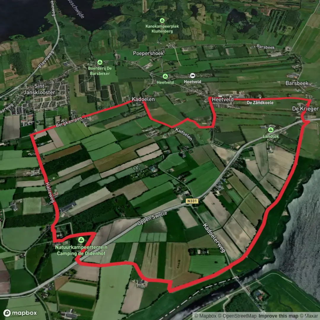
9.0 km
~1 hrs 48 min
7 m
Loop
“Wander through a tapestry of wildflowers, canals, and centuries-old Dutch heritage on this tranquil countryside loop.”
Starting from the outskirts of the charming Dutch village of Hoogkarspel, this 9 km (about 5.6 miles) loop hike follows the gentle, flat landscapes of North Holland, making it accessible for hikers of all abilities. With virtually no elevation gain, the route is perfect for those seeking a leisurely walk through the quintessential Dutch countryside, rich in history and natural beauty.
Getting There
The trailhead is conveniently located near Hoogkarspel railway station, which is easily accessible by train from Amsterdam Centraal in under an hour. For those arriving by car, parking is available at the station or in nearby residential streets. The station itself is a recognizable landmark and serves as a practical starting point for the hike.
Trail Overview and Navigation
The route combines sections of the Zuiderzeepad (LAW 8) and the Christoffelpad, both well-marked long-distance trails. Hikers are encouraged to use HiiKER for up-to-date navigation and trail information, ensuring a seamless experience along the way.
Scenic Farmland and Waterways
Leaving the station, the path quickly immerses you in the open polder landscape, a hallmark of the region. Expect to walk alongside wide canals, with expansive views over fields dotted with grazing sheep and cows. The flatness of the terrain is a result of centuries of Dutch water management, and you’ll notice the intricate network of ditches and sluices that keep the land dry.
Historic Significance and Local Culture
At around 3 km (1.9 miles), the route passes close to the village of Grootebroek, an area with deep agricultural roots. The Zuiderzeepad traces the former coastline of the Zuiderzee, a once-vast inland sea that shaped the livelihoods and culture of the region until it was closed off by the Afsluitdijk in 1932. Interpretive signs along the way provide insight into the transformation of the landscape and the resilience of local communities.
Wildlife and Flora
Spring and summer bring a burst of wildflowers along the dikes, and the waterways attract a variety of birdlife, including herons, swans, and the occasional stork. The hedgerows and meadows are alive with butterflies and bees, making this a pleasant walk for nature enthusiasts.
Landmarks and Points of Interest
At approximately 6 km (3.7 miles), you’ll encounter Het Bergje, a small, tree-covered mound that offers a rare elevated viewpoint in this otherwise flat region. This spot is a local curiosity, believed to be an ancient dwelling mound or “terp,” built to provide refuge from flooding before the land was fully reclaimed.
Continuing along the Christoffelpad, the route meanders back toward Hoogkarspel, passing through quiet residential lanes and past the historic St. Martinuskerk, a striking neo-Gothic church that stands as a testament to the area’s rich religious heritage.
Practical Tips
The entire route is on well-maintained paths and quiet country roads, suitable for walking year-round. There are several benches and picnic spots along the way, particularly near the waterways. Public toilets and small shops can be found in Hoogkarspel and Grootebroek, so it’s easy to stock up on supplies or take a break.
This hike offers a gentle introduction to the Dutch polder landscape, blending rural tranquility with fascinating glimpses into the region’s history and culture.

Surfaces
Asphalt
Concrete
Unknown
Grass
Ground
Wood
Comments and Reviews
User comments, reviews and discussions about the Het Bergje via Zuiderzeepad and Christoffelpad, Netherlands.
average rating out of 5
0 rating(s)