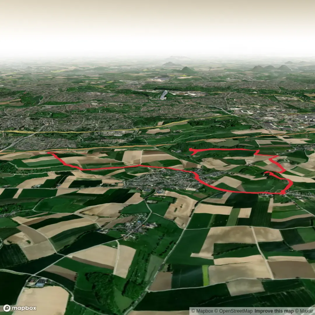
Klein Weegske and Putberg and Vrouwenheide via Achteromkijk Route and Voerendaal Kalkoven Route
Download
Preview
Add to list
More
8.5 km
~1 hrs 52 min
107 m
Loop
“Winding past windmills, wildflowers, and limestone farmhouses, this hike reveals South Limburg’s timeless charm.”
Embarking on this approximately 8-kilometer (5-mile) hike with an elevation gain of around 100 meters (328 feet) offers a delightful exploration of the South Limburg countryside, weaving through the picturesque landscapes of Voerendaal, Ubachsberg, and the surrounding areas.
Starting Point and Initial Ascent
Begin your journey at Herberg De Bernardushoeve, located at Mingersborg 20, Voerendaal. This traditional inn provides ample parking and serves as an excellent spot to grab a coffee before setting off. From here, head towards the village of Ubachsberg, situated atop the Ubachsberg Plateau. The initial ascent is gentle, guiding you through serene rural paths lined with traditional Limburg farmhouses constructed from Kunrader limestone, a testament to the region's rich geological history.
Traversing the Vrouwenheide
As you continue, you'll reach the Vrouwenheide, one of the highest points in the Netherlands at 218 meters (715 feet) above sea level. This area, once a heathland, now offers expansive views over the rolling hills of South Limburg. Atop the Vrouwenheide stands the windmill 'Op de Vrouweheide,' built in 1858. This historic windmill is notable for being the highest situated windmill in the Netherlands, offering a glimpse into the region's agricultural past.
Exploring the Putberg and Kunderberg
Descending from the Vrouwenheide, the trail leads you towards the Putberg and Kunderberg areas. These regions are characterized by their unique limestone formations and former quarries. The Kunderberg, in particular, is renowned for its rich biodiversity, including rare limestone flora that thrive in the calcareous soil. As you traverse these areas, you'll encounter remnants of old lime kilns, such as the double lime kiln Schneiders along the Daelsweg, reflecting the historical significance of limestone extraction in the region.
Navigating the Achteromkijk Route
The hike incorporates sections of the Achteromkijk Route, marked by white-green signs. This route is designed to highlight panoramic viewpoints and points of interest, encouraging hikers to 'look back' and appreciate the landscape's beauty. Keep an eye out for these markers to ensure you're on the right path. For detailed navigation, consider using the HiiKER app, which provides comprehensive maps and trail information.
Flora and Fauna
Throughout the hike, you'll traverse diverse habitats, from open fields and meadows to dense woodlands. The calcareous soil supports a variety of plant species, including orchids and other rare wildflowers. Birdwatchers may spot species such as the European stonechat and the common buzzard soaring above the fields.
Historical Significance
The region is steeped in history, with evidence of Roman settlements and medieval structures. The use of Kunrader limestone in local architecture is a direct link to the area's geological past, with limestone quarries like those on the Putberg and Kunderberg playing a pivotal role in the local economy for centuries.
Practical Information
To reach the starting point by car, navigate to Herberg De Bernardushoeve at Mingersborg 20, Voerendaal. Parking is available on-site. For those using public transport, Voerendaal is accessible by train, with the Voerendaal station located approximately 3 kilometers (1.9 miles) from the starting point. From the station, local bus services or taxis can be used to reach Mingersborg.
This hike offers a harmonious blend of natural beauty, historical landmarks, and cultural insights, making it a rewarding experience for hikers of all levels.

Surfaces
Unknown
Asphalt
Gravel
Grass
Ground
Dirt
Concrete
Paved
Comments and Reviews
User comments, reviews and discussions about the Klein Weegske and Putberg and Vrouwenheide via Achteromkijk Route and Voerendaal Kalkoven Route, Netherlands.
average rating out of 5
0 rating(s)