Download
Preview
Add to list
More
8.0 km
~1 hrs 42 min
61 m
Loop
“Winding through wildflower valleys and timeless villages, this scenic loop reveals Limburg’s tranquil, cross-border charm.”
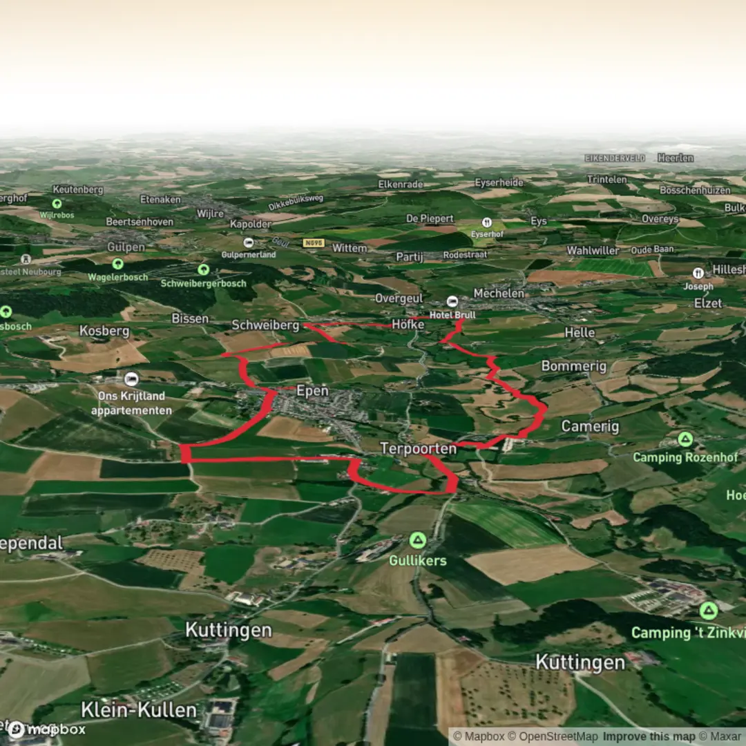
Starting from the picturesque village of Schweiberg, this loop hike covers approximately 8 km (about 5 miles) with a gentle elevation gain of around 100 metres (330 feet), making it accessible for most walkers. Schweiberg is nestled in the rolling hills of South Limburg, Netherlands, close to the Belgian border, and is easily reached by car via the N278 from Maastricht or Aachen. For those using public transport, buses from Maastricht or Heerlen stop at Mechelen, a short walk from Schweiberg.
Getting Oriented and Navigation
The route is well-marked, but carrying a digital map on HiiKER is highly recommended for real-time navigation and to explore points of interest along the way. The trailhead is near Schweibergerweg, a notable road running through the village, and parking is available nearby.
Trail Highlights and Landmarks
The hike begins by descending gently into the Goehl Valley (Goehltal), a lush, green corridor shaped by the meandering Goehl River. Early on, you’ll pass traditional half-timbered farmhouses and orchards, typical of the Limburg countryside. The valley is renowned for its biodiversity—look for kingfishers darting along the riverbanks and, in spring, carpets of wildflowers.
After about 2 km (1.2 miles), the path enters the Epen Bronnenland, an area famous for its natural springs and wetlands. This section is particularly rich in birdlife, with chances to spot herons, woodpeckers, and sometimes roe deer grazing at the forest edge. The wetlands are fed by mineral-rich springs, which have shaped the landscape for centuries and support rare plant species.
Cultural and Historical Features
As you approach the village of Epen, around the halfway point, you’ll notice the distinctive red-brick church tower rising above the rooftops. Epen is known for its preserved historic core, with several buildings dating back to the 18th century. The region’s history is deeply tied to agriculture and cross-border trade, and you may see remnants of old field boundaries and stone crosses along the route.
Return via Panoramic Meadows
The loop turns back toward Schweiberg through open meadows and gentle hills, offering panoramic views of the Geul Valley and, on clear days, glimpses into Belgium and Germany. This section is especially scenic in late summer when the fields are golden and dotted with grazing livestock. The final ascent is mild, bringing you back to Schweiberg with minimal effort.
Practical Considerations
The trail surface is a mix of gravel paths, grassy tracks, and quiet country lanes. Waterproof footwear is advisable, especially after rain, as some sections near the springs can be muddy. There are several benches and picnic spots along the way, particularly near Epen and the valley viewpoints. Public toilets and cafés can be found in both Schweiberg and Epen, making it easy to plan a rest stop.
For those interested in extending their walk or exploring nearby trails, HiiKER provides detailed maps and route options throughout the Limburg hills. The area is well-served by local bus routes, and bike rentals are available in nearby towns for those wishing to explore further after the hike.

Surfaces
Unknown
Asphalt
Sand
Gravel
Grass
Dirt
Ground
Concrete
Comments and Reviews
User comments, reviews and discussions about the Schweiberg via Goehltal Route and Epen Bronnenland Rood Loop, Netherlands.
average rating out of 5
0 rating(s)