Download
Preview
Add to list
More
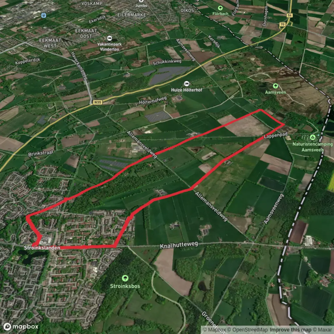
6.9 km
~1 hrs 23 min
7 m
Loop
“Wander through woodlands, meadows, and centuries-old castles on a trail where history and nature entwine.”
The Noaberpad and Verwoolds Weg Loop is a scenic and accessible hiking route that spans approximately 7 kilometers (4.3 miles) with minimal elevation change, making it suitable for hikers of all skill levels. This loop combines sections of the Noaberpad—a long-distance trail that traverses the Dutch-German border region—and the Verwoolds Weg, offering a unique blend of natural beauty and cultural heritage.
Trail Overview
Starting near the village of Vorden in the Gelderland province of the Netherlands, the trailhead is conveniently located close to the Vorden railway station, providing easy access for those traveling by public transport. For those arriving by car, parking is available near the station and in the village center.
Route Highlights
- Forested Paths and Open Fields: The trail meanders through a diverse landscape of dense woodlands and expansive meadows. The well-maintained paths are predominantly flat, ensuring a comfortable walking experience.
- Historical Landmarks: Along the route, hikers will encounter several notable sites, including the historic Vorden Castle (Kasteel Vorden), a medieval castle dating back to the 13th century. The castle's architecture and surrounding gardens provide a glimpse into the region's rich history.
- Cultural Significance: The Noaberpad, meaning "Neighbor's Path," symbolizes the close ties between the Netherlands and Germany. This trail has historically served as a route for cross-border interaction and trade, reflecting the shared heritage of the border communities.
Flora and Fauna
The loop offers opportunities to observe a variety of wildlife, including deer, foxes, and numerous bird species. The changing seasons bring different highlights: spring and summer showcase vibrant wildflowers, while autumn offers a tapestry of colorful foliage.
Navigation and Safety
The trail is well-marked with clear signage. For detailed maps and real-time navigation, hikers can utilize the HiiKER app, which provides comprehensive information on the route. It's advisable to wear sturdy footwear, as some sections may become muddy after rainfall.
Access and Transportation
- By Public Transport: Vorden railway station is served by regular trains from major Dutch cities, making it a convenient starting point for the hike.
- By Car: From Amsterdam, take the A1 motorway eastward, then transition to the N348 towards Zutphen, followed by the N319 to Vorden. The drive takes approximately 1.5 hours.
Additional Information
While the loop is relatively short, hikers may choose to extend their journey by exploring adjacent sections of the Noaberpad or visiting nearby attractions in Vorden. Local cafes and restaurants in the village offer a chance to experience regional cuisine and hospitality.
This hike provides a harmonious blend of natural landscapes and historical insights, offering a rewarding experience for those interested in the cultural tapestry of the Dutch-German border region.

Surfaces
Asphalt
Unknown
Dirt
Grass
Sand
Paved
Gravel
Unpaved
Comments and Reviews
User comments, reviews and discussions about the Noaberpad and Verwoolds Weg Loop, Netherlands.
average rating out of 5
0 rating(s)