Download
Preview
Add to list
More
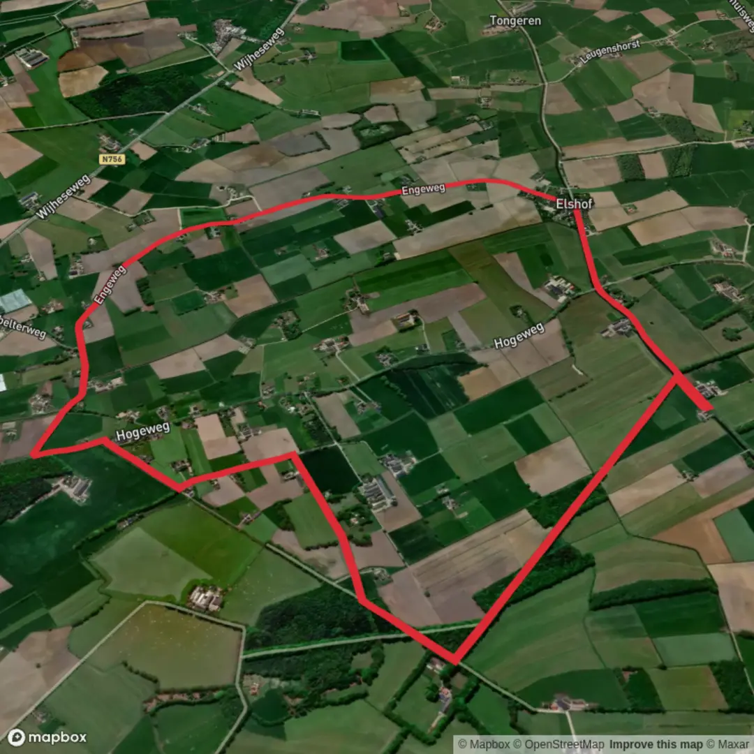
7.8 km
~1 hrs 33 min
0 m
Loop
“Step into a living Dutch canvas where medieval skylines, riverside meadows, and vibrant birdlife unfold in harmony.”
Starting from the outskirts of the historic Hanseatic city of Deventer, this 8 km (5 miles) loop along the Hanzestedenpad and Enge Weg offers a flat, leisurely walk through a landscape shaped by centuries of trade, agriculture, and river life. With virtually no elevation gain, this route is accessible to hikers of all abilities and is especially suitable for those seeking a relaxed day out immersed in Dutch history and nature.
Getting There
Deventer is well-connected by train, with frequent services from major cities like Amsterdam, Utrecht, and Zwolle. From Deventer’s central station, local buses or a short taxi ride will bring you to the trailhead near the IJssel riverbank, close to the Wilhelminabrug (Wilhelmina Bridge), a recognizable city landmark. For those arriving by car, parking is available near the riverfront or in the city center, with clear signage directing visitors to walking routes.
Trail Experience and Navigation
The route follows a section of the Hanzestedenpad, a long-distance path that traces the legacy of the Hanseatic League—an influential medieval trading network. The trail is well-marked, but for added confidence and real-time navigation, use the HiiKER app, which provides detailed maps and waypoints.
Historical and Cultural Highlights
As you set out, the skyline of Deventer with its medieval church towers and merchant houses sets the tone. The city was a major Hanseatic port, and remnants of its prosperous past are visible in the old warehouses and cobbled streets. The trail soon leaves the urban bustle, crossing the floodplains of the IJssel, where you’ll see traditional Dutch dikes and perhaps grazing sheep or cattle.
Nature and Wildlife
The floodplain meadows are a haven for birdlife, especially in spring and autumn when migratory species stop to rest. Look for storks, herons, and lapwings in the wetlands, and listen for the calls of reed warblers among the tall grasses. The Enge Weg section leads you through quiet woodland patches and open fields, with wildflowers blooming in late spring and summer.
Points of Interest
About halfway (4 km/2.5 miles), you’ll pass near the small hamlet of Diepenveen, known for its historic manor house and tranquil village atmosphere. The route loops back toward Deventer, offering views of the city’s skyline reflected in the IJssel, especially striking at sunset.
Trail Conditions and Preparation
The path is mostly on well-maintained dirt tracks and paved dike roads, suitable for walking shoes or lightweight hiking boots. There are benches and picnic spots along the way, but limited facilities, so bring water and snacks. The area is exposed to wind and weather, so pack a rain jacket and sun protection as needed.
Access and Safety
The entire route is flat, with no significant climbs or descents, making it accessible for families and those with limited mobility. The trail is popular with cyclists, so stay alert on shared sections. Public transport options make it easy to shorten or extend your walk, with bus stops near Diepenveen and Deventer.
For up-to-date trail conditions and navigation, consult HiiKER before setting out.

Surfaces
Asphalt
Unknown
Sand
Grass
Comments and Reviews
User comments, reviews and discussions about the Hanzestedenpad and Enge Weg, Netherlands.
average rating out of 5
0 rating(s)