Download
Preview
Add to list
More
6.1 km
~1 hrs 12 min
0 m
Loop
“Stroll through castle shadows, wildflower meadows, and riverside history on this enchanting Dutch loop.”
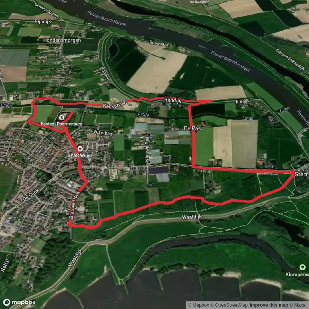
Starting from the picturesque village of Doornenburg in the eastern Netherlands, this loop trail covers approximately 6 km (about 3.7 miles) with virtually no elevation gain, making it accessible for hikers of all abilities. The trailhead is conveniently located near the historic Doornenburg Castle, a well-preserved medieval fortress that serves as both a landmark and a gateway to the region’s rich history.
Getting There Doornenburg is easily reached by public transport. Take a train to Arnhem or Nijmegen, then transfer to a local bus (such as Bus 33 or 35) that stops at Doornenburg, close to the castle. For those arriving by car, parking is available at the castle’s visitor lot, which is signposted from the main road into the village.
Historic Landmarks and Cultural Highlights The route begins at Doornenburg Castle, a striking 13th-century fortress surrounded by moats and lush meadows. The castle is one of the largest and best-preserved in the Netherlands, and its imposing walls and towers are visible from much of the trail. As you set off, you’ll pass through the castle’s outer bailey, where you can explore the grounds or visit the small museum before or after your hike.
Nature and Wildlife The loop meanders through the Gelderse Poort nature reserve, a landscape shaped by the Rhine and Waal rivers. Expect to see expansive floodplains, reed beds, and willow groves. This area is a haven for birdlife—look for storks, herons, and sometimes even wild Konik horses grazing in the meadows. In spring and summer, wildflowers line the dikes and embankments, adding vibrant color to the scenery.
Trail Navigation and Wayfinding The route is well-marked and mostly flat, following a combination of paved paths, grassy dikes, and quiet country lanes. Navigation is straightforward, but for added confidence, use the HiiKER app, which provides detailed maps and real-time GPS tracking for the entire loop.
Points of Interest Along the Route At around 2 km (1.2 miles), you’ll reach the banks of the Pannerdensch Kanaal, a major waterway that played a crucial role in the region’s defense and trade. Pause here to watch river traffic and enjoy panoramic views across the floodplains. Continuing along the dike, you’ll pass several WWII-era bunkers and pillboxes, remnants of the area’s strategic importance during the war.
The trail loops back toward Doornenburg, passing through tranquil farmland dotted with traditional Dutch farmhouses. Keep an eye out for grazing sheep and the occasional roe deer in the fields. The final stretch brings you back to the castle, where you can relax at the on-site café or explore the village’s charming streets.
With its blend of history, natural beauty, and easy terrain, this loop offers a rewarding day out for families, casual walkers, and anyone interested in the cultural heritage of the Dutch riverlands.

Surfaces
Unknown
Grass
Asphalt
Dirt
Gravel
Wood
Comments and Reviews
User comments, reviews and discussions about the Kasteel Route Doornenburg Loop, Netherlands.
average rating out of 5
0 rating(s)