Download
Preview
Add to list
More
26.9 km
~1 day 0 hrs
26 m
Loop
“Wander through woodlands, historic estates, and tranquil waters on a gentle loop bursting with Achterhoek charm.”
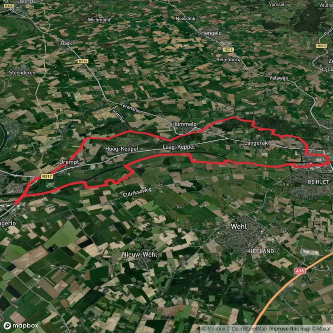
Starting from the outskirts of Vorden, a charming village in the Dutch province of Gelderland, this 27 km (about 16.8 miles) loop along the Graafschapspad offers a gentle, flat walk through the heart of the Achterhoek region. With virtually no elevation gain, this route is accessible to most walkers and is ideal for those seeking a long but easy day out in the countryside.Getting ThereVorden is well-connected by public transport, with a train station (Station Vorden) just a short walk from the trailhead. Trains from Zutphen and Winterswijk stop here regularly, making it easy to reach from larger cities. For those arriving by car, parking is available near the station and in the village center.Historic Estates and CastlesThe route quickly immerses you in the region’s rich history. Early on, you’ll pass near Huize Ulenpas, a stately manor house dating back to the 17th century. While the house itself is private, the surrounding estate is a highlight, with ancient oaks, manicured lanes, and glimpses of the manor through the trees. The area is dotted with other historic estates, reflecting the wealth and agricultural heritage of the Achterhoek.Woodlands, Heath, and WaterwaysAfter leaving the village, the trail meanders through mixed woodlands and open fields, typical of the Achterhoek’s bocage landscape. Around the 8 km (5 mile) mark, you’ll reach the Grote Ven, a tranquil pond surrounded by heathland and birch trees. This is a great spot for a break and some birdwatching—look for herons, grebes, and, in spring, the vibrant colors of wildflowers.Crossing the EnergiebrugAt roughly 15 km (9.3 miles), the route leads you to the Energiebrug, a modern bridge spanning the Twentekanaal. This crossing offers panoramic views of the canal and the surrounding farmland. The bridge is a symbol of the region’s blend of tradition and innovation, as it’s part of local efforts to integrate renewable energy infrastructure into the landscape.Wildlife and NatureThroughout the hike, keep an eye out for roe deer, foxes, and a variety of woodland birds. The hedgerows and small copses provide excellent habitat for wildlife, and the quiet, rural setting means you’re likely to encounter more animals than people, especially on weekdays.Navigation and WaymarkingThe Graafschapspad is a well-marked long-distance trail, but for added confidence and route details, use HiiKER for up-to-date maps and navigation. The app provides offline access and highlights points of interest along the way.Facilities and RefreshmentsThere are several opportunities to stop for refreshments in Vorden at the start and end of the hike, with cafés and bakeries near the station. Along the route, services are limited, so bring enough water and snacks for the day. Picnic spots are plentiful, especially near the Grote Ven and along the canal.Planning TipsWith a total distance of 27 km (16.8 miles) and no significant climbs, this hike is suitable for most walkers with a reasonable level of fitness. Good walking shoes are recommended, as some sections can be muddy after rain. The route is enjoyable year-round, but spring and early autumn offer the most vibrant scenery.

Surfaces
Unknown
Asphalt
Ground
Sand
Dirt
Concrete
Comments and Reviews
User comments, reviews and discussions about the Huize Ulenpas, Grote Ven and Energiebrug via Graafschapspad, Netherlands.
average rating out of 5
0 rating(s)