Download
Preview
Add to list
More
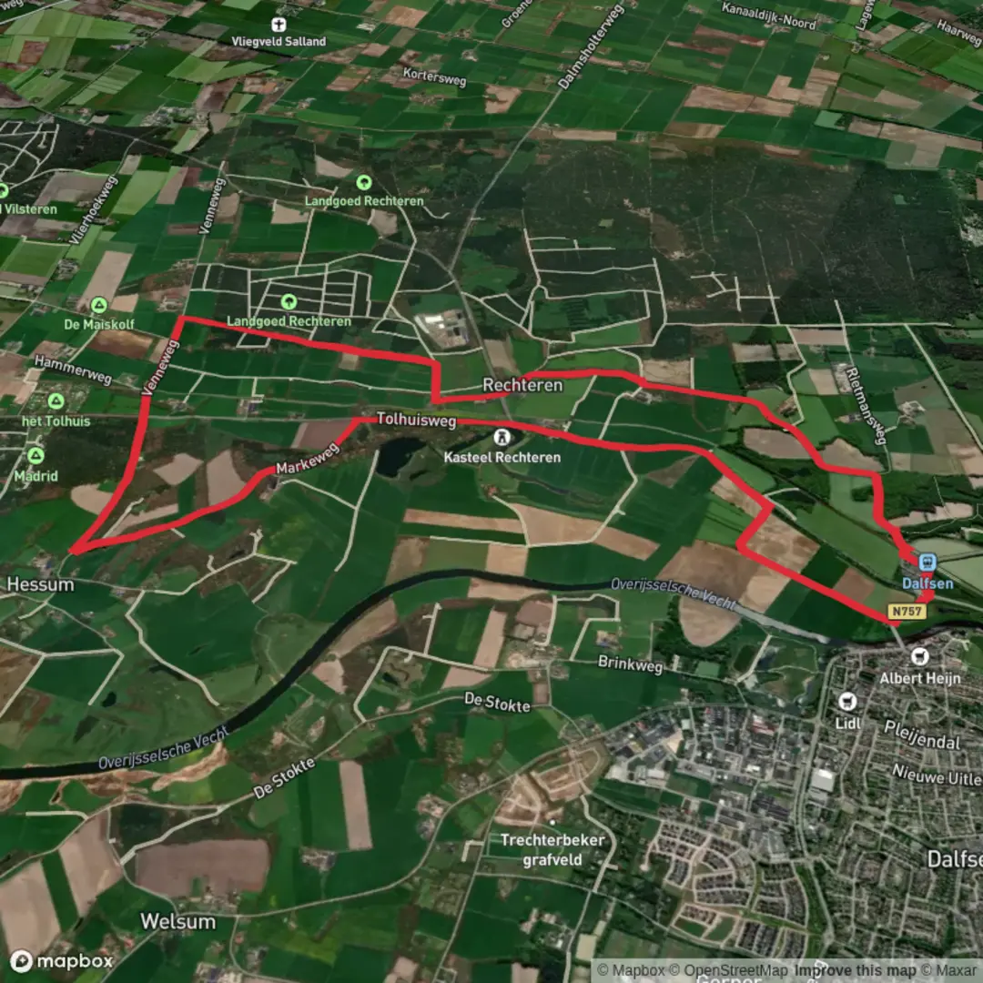
11.7 km
~2 hrs 20 min
6 m
Loop
“Wander through blooming meadows, noble estates, and tranquil lanes, where history and nature quietly entwine.”
Starting from the vicinity of Rechterensedijk, just outside the charming village of Dalfsen in the Overijssel province of the Netherlands, this 12 km (about 7.5 miles) circular walk offers a gentle, flat route with virtually no elevation gain, making it accessible for hikers of all abilities. The trailhead is easily reached by car, with parking available near Landgoed Rechteren, or by taking a train to Dalfsen station and walking or cycling a short distance to the start.
Getting Oriented and Navigation
The route follows quiet country lanes and well-marked paths, weaving through a landscape shaped by centuries of agricultural use and noble estates. For navigation, HiiKER provides reliable, up-to-date mapping and route guidance, ensuring you stay on track throughout the walk.
Landmarks and Points of Interest
Shortly after setting out, you’ll skirt the edge of Landgoed Rechteren, a historic estate dominated by the imposing Rechteren Castle. While the castle itself is not open to the public, its moated silhouette and centuries-old trees are visible from the path, offering a glimpse into the region’s feudal past. The estate’s origins date back to the 14th century, and it remains one of the few privately owned castles in the Netherlands.
Continuing along Rechterensedijk, the route passes through a patchwork of meadows, woodlands, and hedgerows. In spring and summer, the fields are alive with wildflowers and the air is filled with birdsong. Look out for storks, buzzards, and the occasional roe deer in the quieter stretches. The area is also known for its ancient oak and beech trees, some of which line the dike and provide welcome shade.
Markeweg and Rural Scenery
Turning onto Markeweg, the landscape opens up to reveal traditional Dutch farmsteads and grazing livestock. This section, roughly halfway through the hike, is particularly tranquil, with wide views across the Salland countryside. The route here follows old parish boundaries, known locally as “marken,” which historically defined communal land use and village organization. These boundaries are still visible in the landscape, marked by rows of pollarded willows and drainage ditches.
Practical Considerations
The entire loop is on well-maintained paths and quiet roads, with no significant climbs or descents. The total elevation gain is negligible—less than a meter (about 3 feet)—making it ideal for families, casual walkers, and those seeking a relaxed day outdoors. There are several benches and picnic spots along the way, especially near the wooded sections and at scenic viewpoints.
Refreshments and facilities can be found in Dalfsen, where you’ll find cafés, bakeries, and shops. Public toilets are available at the train station and in the village center.
Wildlife and Seasonal Highlights
Depending on the season, the route offers a variety of natural highlights. In early spring, wood anemones and bluebells carpet the forest floor, while autumn brings vibrant foliage and the chance to spot mushrooms and fungi. The area is managed with conservation in mind, supporting a rich diversity of birdlife and small mammals.
For those interested in local history, interpretive signs along the route provide insights into the region’s agricultural heritage and the significance of the Rechteren estate. The combination of natural beauty, historical context, and easy access makes this walk a rewarding outing for anyone exploring the Dutch countryside.

Surfaces
Unknown
Asphalt
Concrete
Sand
Ground
Comments and Reviews
User comments, reviews and discussions about the Rechterensedijk and Markeweg, Netherlands.
average rating out of 5
0 rating(s)