Download
Preview
Add to list
More
11.0 km
~2 hrs 11 min
0 m
Loop
“Wander through blooming fields, riverside vistas, and centuries-old history on this scenic Dutch adventure.”
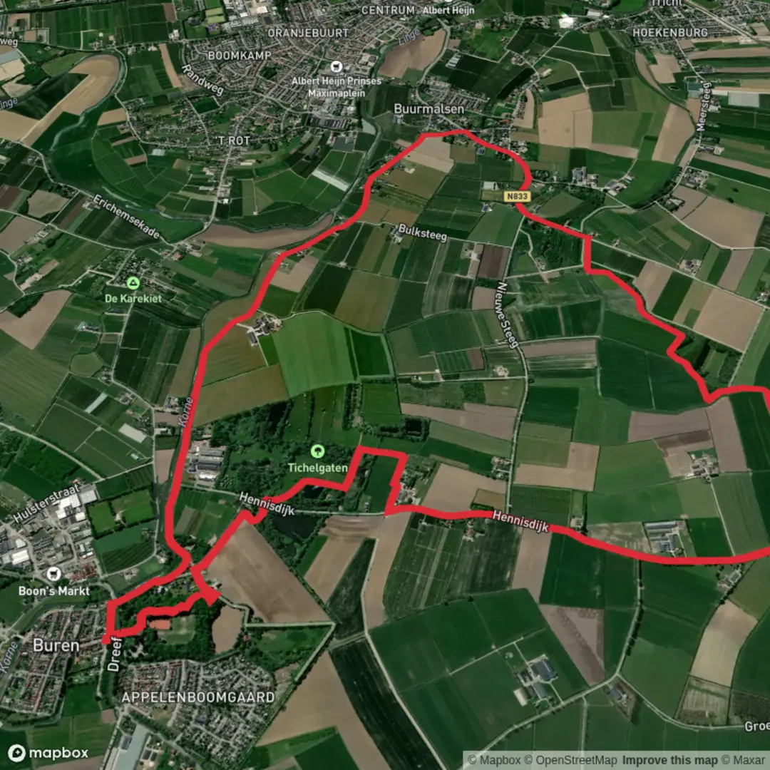
The Gemeente and Buren Loop is an approximately 11-kilometer (6.8-mile) trail with minimal elevation gain, offering an easy and enjoyable hiking experience. The trailhead is conveniently located near the town of Buren in the Gelderland province of the Netherlands.
Getting There
For those traveling by car, Buren is accessible via the A15 motorway, taking the exit toward Tiel and following signs to Buren. Parking is available near the town center, particularly around the Markt area. If using public transport, you can take a train to Tiel Station and then a bus to Buren; check local schedules for the most current routes and times.
Trail Overview
The loop begins in the historic center of Buren, known for its well-preserved medieval architecture. As you set out, you'll pass by the 14th-century St. Lambertus Church, a notable landmark with its striking tower. The trail then leads you through picturesque Dutch countryside, characterized by flat, open fields and traditional windmills.
Key Landmarks and Points of Interest
- Buren Castle Ruins: Approximately 2 kilometers (1.2 miles) into the hike, you'll encounter the remnants of Buren Castle. Built in the 13th century, the castle played a significant role in the region's history. Informational plaques provide insights into its past.
- Linge River: Around the 5-kilometer (3.1-mile) mark, the trail runs alongside the Linge River, the longest river entirely within the Netherlands. This section offers serene views and opportunities to spot waterfowl such as herons and kingfishers.
Flora and Fauna
The trail is lined with poplar and willow trees, common in the Dutch landscape. In spring and summer, wildflowers like tulips and daffodils bloom along the path. Wildlife enthusiasts may observe hares in the fields and a variety of bird species, including storks and swallows.
Historical Significance
Buren is often referred to as the "Oranje Stad" (Orange City) due to its connection with the Dutch royal family. In the 16th century, William of Orange married Anna van Egmond, Countess of Buren, linking the town to the House of Orange-Nassau. As you walk through Buren, you'll notice several monuments and museums dedicated to this royal heritage.
Trail Conditions and Safety
The path is well-maintained and predominantly flat, making it suitable for hikers of all ages and skill levels. However, sections along the river can be muddy after rain, so appropriate footwear is recommended. It's advisable to carry water and snacks, as amenities along the trail are limited.
Navigation
While the trail is well-marked, using a reliable navigation tool like HiiKER can enhance your hiking experience by providing detailed maps and real-time updates.
By the time you complete the loop and return to Buren, you'll have experienced a blend of natural beauty, wildlife, and rich historical context, making this hike a memorable journey through the heart of the Netherlands.

Surfaces
Asphalt
Grass
Unknown
Ground
Wood
Gravel
Comments and Reviews
User comments, reviews and discussions about the Gemeente and Buren Loop, Netherlands.
average rating out of 5
0 rating(s)