Download
Preview
Add to list
More
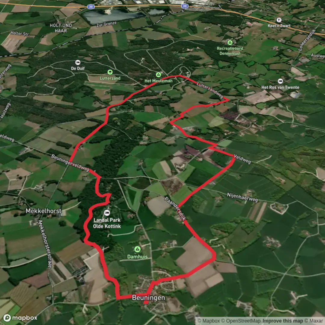
10.6 km
~2 hrs 8 min
15 m
Loop
“Wander through wildflower meadows, ancient forests, and sandy riverbanks on this peaceful Dutch borderland loop.”
Starting near the picturesque village of Denekamp in the eastern Netherlands, this 11 km (about 6.8 miles) loop trail offers a gentle, flat walk with virtually no elevation gain, making it accessible for hikers of all abilities. The trailhead is conveniently located close to the historic St. Nicholas Church in Denekamp, a recognizable landmark that also serves as a good meeting point. For those arriving by public transport, Denekamp is accessible via bus from Oldenzaal train station, with regular services connecting to the village center. If traveling by car, parking is available near the church and in the village center.
Through the Dinkel Valley and Lutterzand
The route follows the meandering Dinkel River, a serene waterway that shapes the landscape and supports a rich diversity of flora and fauna. Early on, the trail leads you through the lush meadows and woodlands of the Dinkel valley, where you may spot herons, kingfishers, and, in spring and summer, a vibrant array of wildflowers. The path is well-marked and mostly consists of compacted earth and gravel, suitable for walking shoes or lightweight boots.
After approximately 3 km (1.9 miles), you enter the Lutterzand nature reserve, a highlight of the hike. This area is renowned for its sandy banks, ancient pine forests, and the striking erosion cliffs along the Dinkel. The Lutterzand is a protected landscape, home to rare plant species and a variety of woodland birds. Keep an eye out for woodpeckers and, if you’re lucky, deer grazing in the early morning or late afternoon.
Tweetepad and Historical Context
Continuing along the Tweetepad, the trail passes through a mix of heathland and forest. This section is particularly tranquil, with the soft crunch of pine needles underfoot and the scent of heather in the air. The region has a long history of human settlement, with archaeological finds indicating habitation dating back to prehistoric times. The nearby village of De Lutte, just a short detour from the route, is known for its traditional Saxon farmhouses and offers a glimpse into the rural heritage of Twente.
Navigation and Amenities
Navigation is straightforward, with clear signage throughout the route. For detailed mapping and real-time navigation, HiiKER provides comprehensive trail data and offline maps, ensuring you stay on track even in the more secluded stretches. There are several benches and picnic spots along the way, particularly in Lutterzand, where you can pause to enjoy the peaceful surroundings. Public toilets and a café can be found near the Lutterzand visitor center, about halfway through the hike.
The trail loops back toward Denekamp, following the river and passing through open fields dotted with grazing cattle and horses. The gentle terrain and well-maintained paths make this an ideal walk for families, casual hikers, and anyone seeking a relaxing day outdoors immersed in the natural beauty and quiet history of the Dutch-German borderlands.

Surfaces
Asphalt
Unknown
Ground
Concrete
Sand
Gravel
Comments and Reviews
User comments, reviews and discussions about the Dinkel via Tweetepad and Lutterzand Weg, Netherlands.
average rating out of 5
0 rating(s)