Download
Preview
Add to list
More
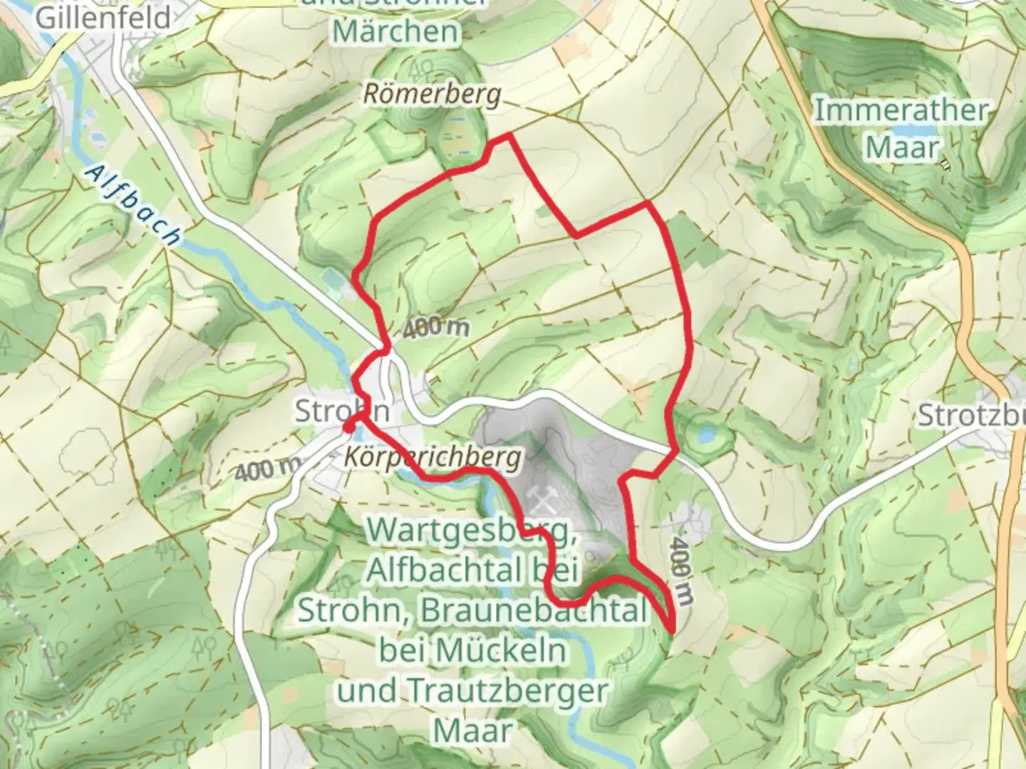
7.9 km
~1 hrs 47 min
121 m
Loop
“Explore the Maeaerchenweg trail for stunning volcanic landscapes, historical insights, and diverse wildlife.”
Starting near the picturesque region of Vulkaneifel in Germany, this 8 km (approximately 5 miles) loop trail offers a delightful mix of natural beauty and historical intrigue. With an elevation gain of around 100 meters (328 feet), the Maeaerchenweg trail is estimated to be of medium difficulty, making it accessible for most hikers with a moderate level of fitness.
Getting There To reach the trailhead, you can either drive or use public transport. If driving, set your GPS to the Vulkaneifel region, specifically near the town of Daun, which is a well-known landmark in the area. For those using public transport, take a train to the Daun station and then a local bus or taxi to the trailhead.
Trail Highlights The trail begins in a lush, forested area, immediately immersing you in the serene beauty of the Vulkaneifel region. As you start your hike, you'll notice the dense canopy of trees providing ample shade, making it a pleasant experience even on warmer days.
#### Natural Beauty Around the 2 km (1.2 miles) mark, you'll come across a small, tranquil lake known as Gemündener Maar. This is one of the many volcanic craters filled with water, characteristic of the Eifel region. The lake is surrounded by a variety of flora, including wildflowers and ancient trees, making it a perfect spot for a short break and some nature photography.
Continuing on, the trail meanders through rolling hills and open meadows. At approximately 4 km (2.5 miles), you'll reach the highest point of the trail, offering panoramic views of the surrounding landscape. This is a great spot to pause and take in the breathtaking scenery.
#### Historical Significance The Vulkaneifel region is rich in geological history, and the Maeaerchenweg trail is no exception. As you hike, you'll encounter several information boards detailing the volcanic activity that shaped this unique landscape millions of years ago. These boards provide fascinating insights into the region's past, making your hike both educational and enjoyable.
Wildlife Keep an eye out for local wildlife, including deer, foxes, and a variety of bird species. The diverse habitats along the trail support a rich array of fauna, making it a rewarding experience for wildlife enthusiasts.
Navigation For navigation, it's highly recommended to use the HiiKER app, which provides detailed maps and real-time updates to ensure you stay on track. The trail is well-marked, but having a reliable navigation tool can enhance your hiking experience and provide peace of mind.
Final Stretch As you near the end of the loop, the trail descends gently back towards the starting point. The final 2 km (1.2 miles) take you through a charming forested area, where you can enjoy the sounds of birds chirping and leaves rustling in the wind.
This 8 km loop trail near Vulkaneifel offers a perfect blend of natural beauty, historical significance, and moderate physical challenge, making it an ideal choice for a day hike.

Comments and Reviews
User comments, reviews and discussions about the Maeaerchenweg, Germany.
5.0
average rating out of 5
1 rating(s)