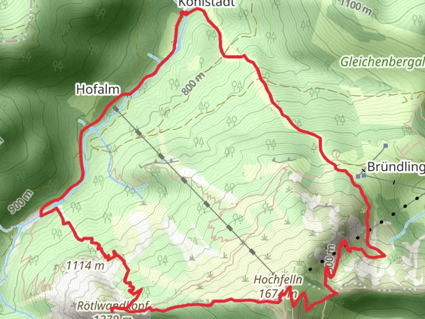
Rötlwandkopf and Hochfelln via Hochfelln von Kohlstatt
Download
Preview
Add to list
More
8.4 km
~3 hrs 25 min
1044 m
Loop
“Embark on a breathtaking alpine adventure, conquering rugged peaks and reveling in Bavarian natural beauty.”
Nestled in the Bavarian Alps near Traunstein, Germany, the Rötlwandkopf and Hochfelln via Hochfelln von Kohlstatt trail offers a challenging yet rewarding adventure for seasoned hikers. This loop trail spans approximately 8 kilometers (about 5 miles) with an elevation gain of around 1000 meters (approximately 3280 feet), making it an extra difficult trek that demands preparation and respect for the mountain environment.
Getting There
The trailhead is conveniently located near Traunstein, a charming town that serves as a gateway to the Bavarian Alps. For those traveling by car, Traunstein is accessible via the A8 motorway, with ample parking available near the trailhead. If you prefer public transport, Traunstein is well-connected by train, with regular services from Munich and Salzburg. From Traunstein, local buses or a short taxi ride can take you to the starting point of the hike.
Trail Overview
The journey begins with a steep ascent through dense forest, where the trail is well-marked but demands attention due to its rugged terrain. As you climb, the forest gradually gives way to alpine meadows, offering breathtaking views of the surrounding peaks. The first significant landmark is the Rötlwandkopf, a striking rock formation that provides a perfect spot for a brief rest and photo opportunity.
Nature and Wildlife
The trail is a haven for nature enthusiasts, with diverse flora and fauna. In the spring and summer months, the meadows burst into color with wildflowers, while the forests are home to deer, foxes, and a variety of bird species. Keep an eye out for the elusive golden eagle soaring above the peaks, a majestic sight that adds to the trail's allure.
Historical Significance
The region is steeped in history, with the Hochfelln summit offering more than just panoramic views. The area has been a site of human activity for centuries, with archaeological finds suggesting that it was used as a lookout point in ancient times. The summit is marked by a cross and a small chapel, both of which are significant landmarks that reflect the cultural heritage of the region.
Reaching the Summit
As you approach the Hochfelln summit, the trail becomes more challenging, with rocky sections that require careful navigation. The use of a reliable navigation tool like HiiKER is recommended to ensure you stay on track. Upon reaching the summit, hikers are rewarded with sweeping views of the Chiemgau Alps and, on clear days, the distant peaks of the Austrian Alps.
Descent and Return
The descent follows a different path, completing the loop and offering new perspectives of the landscape. The trail winds through picturesque valleys and past traditional Bavarian huts, where you might encounter local shepherds tending to their flocks. The return to the trailhead is a gentle reminder of the diverse beauty and cultural richness of the Bavarian Alps.
This trail is a true test of endurance and skill, offering an unforgettable experience for those prepared to tackle its challenges.

Comments and Reviews
User comments, reviews and discussions about the Rötlwandkopf and Hochfelln via Hochfelln von Kohlstatt, Germany.
4.75
average rating out of 5
4 rating(s)