Download
Preview
Add to list
More
15.8 km
~4 hrs 41 min
917 m
Loop
“Explore Bavaria's diverse landscapes and history on the scenic Altofing Loop via Mitterberg hike.”
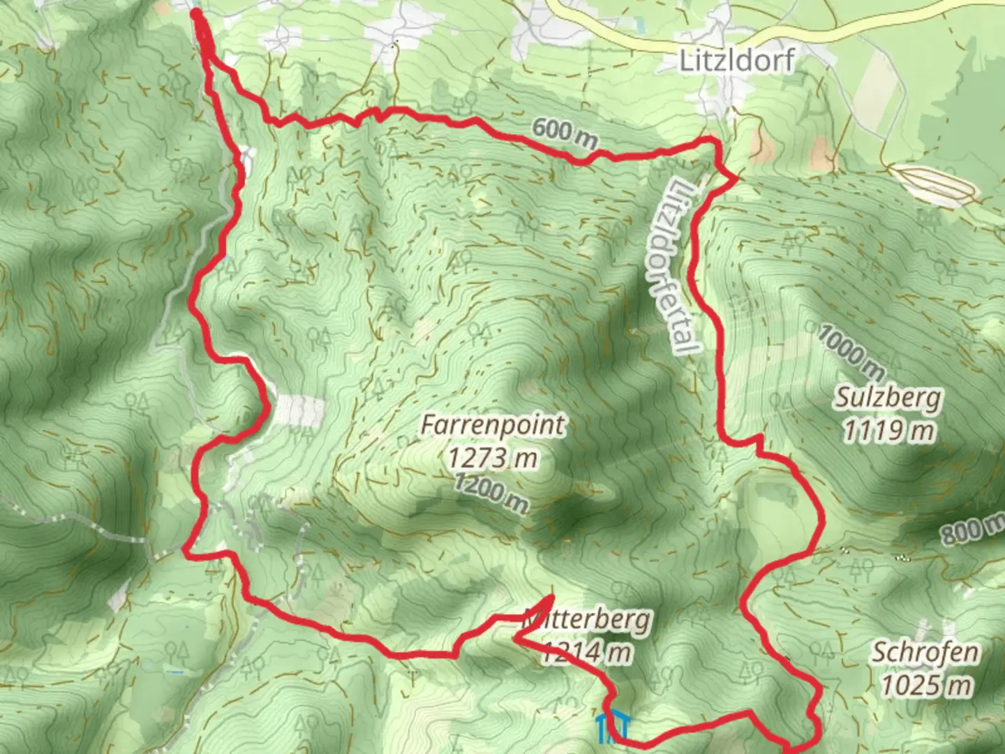
Nestled near the charming town of Rosenheim in Germany, the Altofing Loop via Mitterberg offers a delightful hiking experience through the Bavarian landscape. This 16 km (approximately 10 miles) loop trail is perfect for those seeking a moderate challenge, with an elevation gain of around 900 meters (about 2,950 feet). The trailhead is conveniently located near Rosenheim, making it accessible for both locals and visitors.### Getting ThereTo reach the trailhead, you can drive or use public transportation. If you're driving, head towards Rosenheim and follow signs to the nearby village of Altofing, where parking is available. For those using public transport, take a train to Rosenheim station, and from there, a local bus or taxi can take you to the starting point near Altofing.### Trail HighlightsThe Altofing Loop via Mitterberg is a journey through lush forests, open meadows, and offers stunning panoramic views of the surrounding Bavarian Alps. As you embark on this trail, you'll first encounter gentle inclines through dense woodlands, where the scent of pine fills the air. Keep an eye out for local wildlife, including deer and various bird species that inhabit this region.### Mitterberg AscentAs you approach the Mitterberg section, the trail becomes steeper, offering a rewarding challenge for hikers. This part of the trail provides breathtaking views of the Inn Valley and the distant peaks of the Alps. The ascent is approximately 450 meters (1,475 feet) over a distance of 8 km (5 miles), making it a perfect spot to pause and take in the scenery.### Historical SignificanceThe region around Rosenheim has a rich history, with settlements dating back to Roman times. As you hike, you may come across remnants of ancient pathways and stone markers that hint at the area's historical significance. The Mitterberg itself has been a strategic lookout point throughout history, offering commanding views of the surrounding landscape.### Navigating the TrailFor navigation, it's recommended to use the HiiKER app, which provides detailed maps and real-time updates to ensure you stay on track. The trail is well-marked, but having a reliable navigation tool can enhance your hiking experience.### Descending Back to AltofingThe descent back to Altofing is a gentle one, winding through picturesque meadows and past traditional Bavarian farmhouses. This section of the trail is particularly beautiful in the spring and summer months when wildflowers are in full bloom. The final stretch is a leisurely walk back to the trailhead, where you can reflect on the day's adventure.Whether you're a seasoned hiker or someone looking to explore the natural beauty of Bavaria, the Altofing Loop via Mitterberg offers a memorable experience with its diverse landscapes and historical charm.

Comments and Reviews
User comments, reviews and discussions about the Altofing Loop via Mitterberg, Germany.
average rating out of 5
0 rating(s)